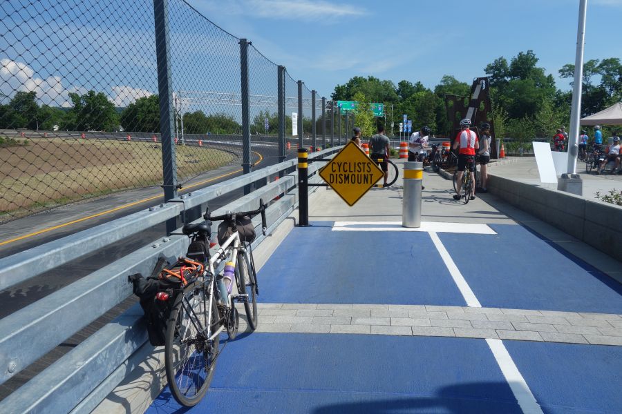
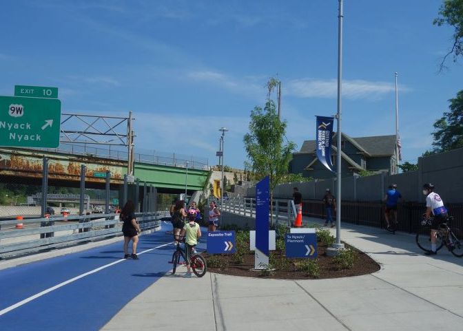
Ocean Parkway Coastal Greenway (Jones Beach Bike Path)

Jones Beach bike path
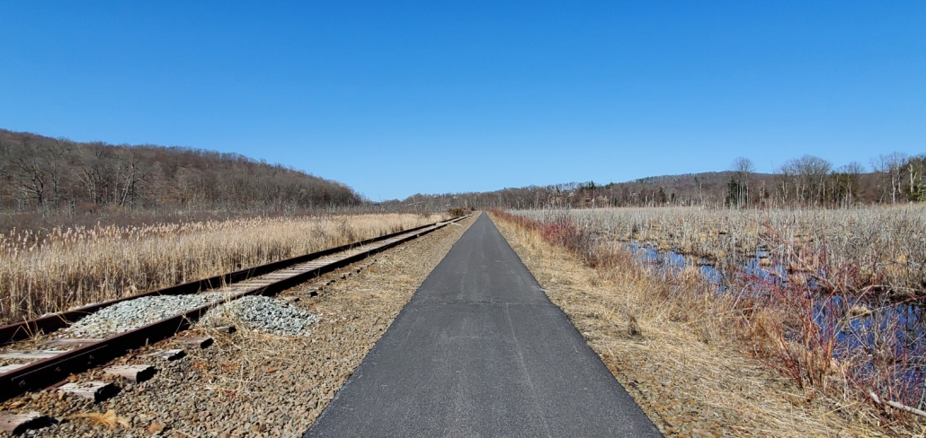
One of the most spectacular bike paths in the New York Metro Region is the Ocean Parkway Coastal Greenway (or Jones Beach Bike Path) on Long Island which traverses almost the entire length of Jones Beach Island. A major segment of this path was opened this year, and it’s now a continuous 20-mile path between Cedar Creek County Park in Wantagh and Captree State Park in Babylon. This bike path has it all: waterfront views, convenient restrooms and parking areas, beach access, restaurants and the chance to spot wildlife.  But it can also be a challenging ride because of wind, bugs and the remoteness of certain areas. So you need to come prepared! Read on to find out more!

Jones Beach bike path map

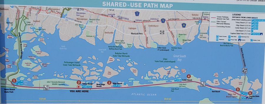
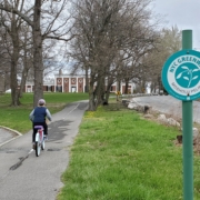
If you do the entire 20-mile ride, you will actually be riding on a series of bike paths with different names that go along the highways that Robert Moses constructed to provide access to Jones Beach State Park as well as Captree State Park and Robert Moses State Park. The western portion of this trail system is the Ellen Ferrant Memorial Bicycle Path which runs in a north-south direction along the Wantagh State Parkway between Cedar Creek County Park and Jones Beach State Park for about 5 miles. Once you arrive at Jones Beach, the trail turns east and you are riding on an older section of the Ocean Parkway Coastal Greenway which goes between Jones Beach State Park and Tobay Beach, which is Town beach run by the Town of Oyster Bay. East of Tobay Beach is the newest segment of the trail, which is about 10 miles long and passes through Gilgo Beach before reaching Captree State Park where the trail ends.

Captree State Park

Captree State Park is a beautiful spot. You can enjoy a view of the Robert Moses Causeway from a picnic area, but you cannot ride a bike over it. The bike path ends (or starts) here with no bikeable connections to other roadways.

Planning your ride

While the entire bike path system is about 20 miles, any ride you do on this trailway will need to be “out-and-back” unless you have someone picking you up at one of the parking areas along the trail. So to ride the whole path, you will actually need to ride 40 miles if you are parking at one of the trail’s endpoints at either Cedar Creek County Park or Captree State Park because it’s one-way out and one-way back.  There is no way to do this trail as a loop.  While the Ellen Ferrant Memorial Bicycle Path will get you across the bay on the west end of the path, you would need to ride your bike on the Robert Moses Causeway on the east end of the path to close the loop, and bikes are not allowed on that road.  So unfortunately, when the bike path reaches Captree State Park, the trail is a “dead-end” and you have to go back. Or you could make Captree State Park your starting point and ride west before turning around.

Ellen Ferrant Bikeway

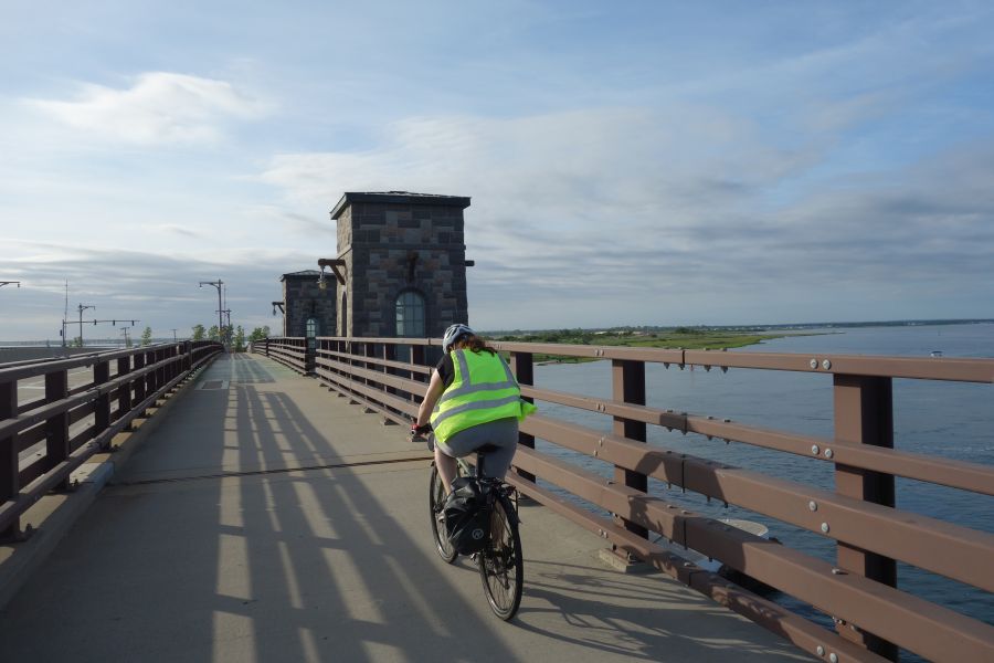
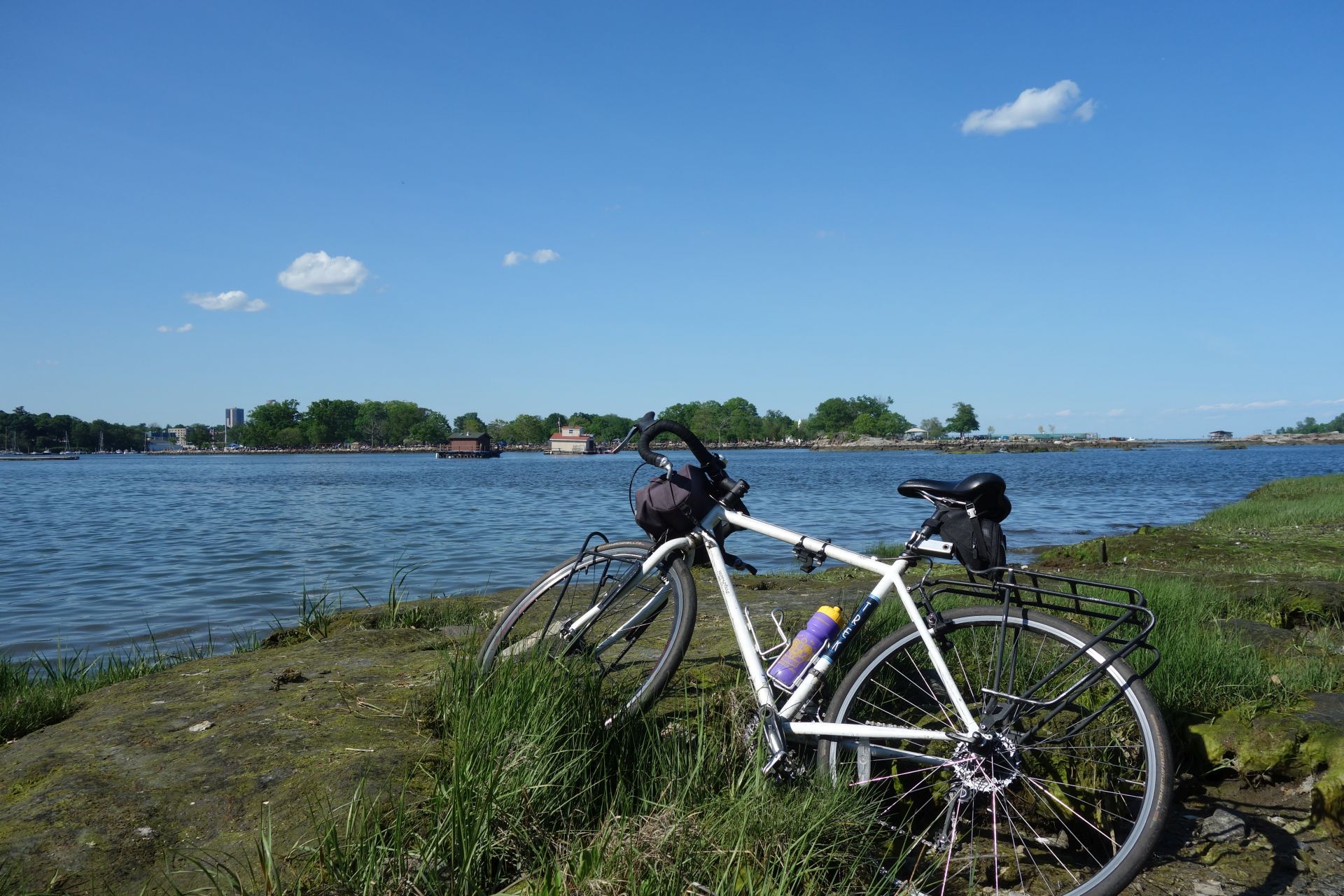
The Ellen Ferrant Memorial Bikeway crosses the bay on a series of bridges with beautiful views.

If you want to take public transit to the Jones Beach bike path you can do that too. The Wantagh station for Long Island Railroad is a short distance away from Cedar Creek County Park and its easy to hop on the bike path from there. However, whatever distance you ride in the eastern direction, you’ll need to turn around to get back.

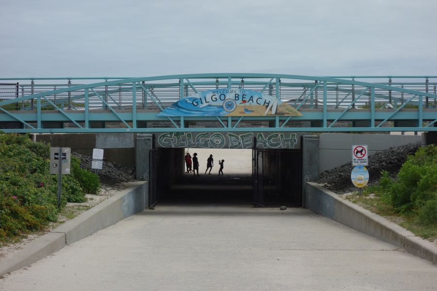
If you are driving to the bike path in a car, you have several choices of where to park, based on how much you want to ride.  The only place where you can park for free is Cedar Creek County Park. If you park at either Jones Beach State Park or Captree State Park, you will need to pay the parking fees associated with those State parks, which is usually around $8-10 unless you have an Empire Pass.  It is also possible to park in the middle of Jones Beach Island at either Tobay Beach, Gilgo Beach or Cedar Beach. However, these beaches are Town-controlled and have higher parking fees (unless you are a Town resident).  For example, parking at Gilgo Beach costs $40 on a Friday, Saturday, Sunday or holiday and $20 on all other days. Residents of the Town of Babylon can park for free.  You can also park for free if you arrive later in the day after the payment booth is closed. Parking is also free off-season, but check with the Town before you go to make sure they are not charging.

Gilgo Beach

Go for a swim at one of the many public beaches you will pass. Each beach has bike parking, restroom access and a food concession.

Experiencing the trail

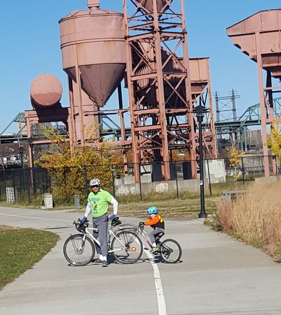
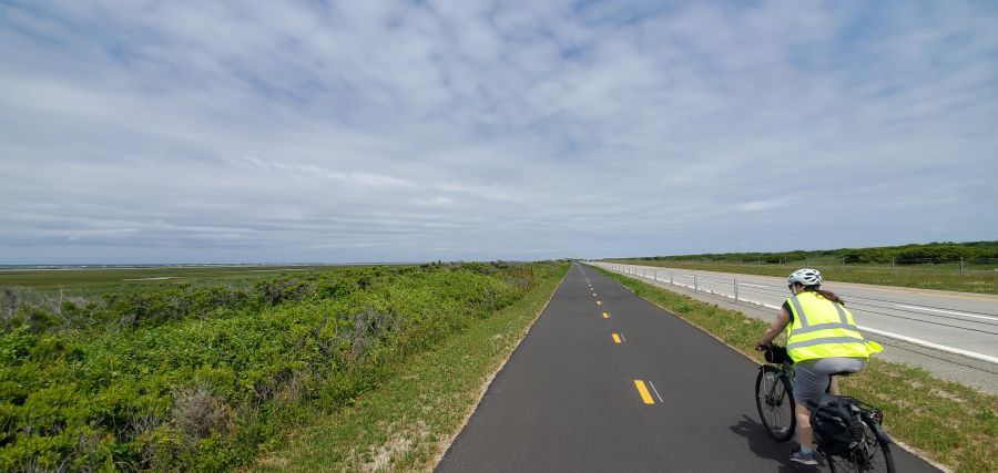
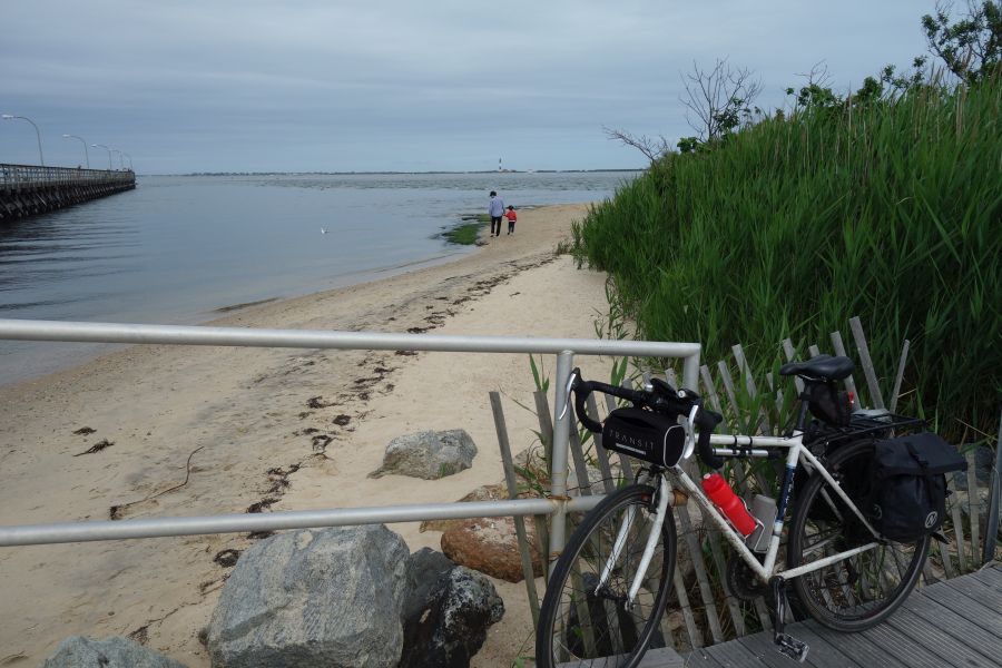
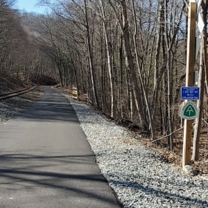
No matter where you ride along the Jones Beach bike path, it is a great experience.  You are right along the water for the entire time with great views of the bay between Jones Beach Island and the main part of Long Island.  As we mentioned earlier, the trail goes through a number of areas with services and beach access, and helpful signage along the trail informs you about what services are available in which places. There are restrooms and places to eat at Jones Beach, Tobay Beach, Gilgo Beach and Cedar Beach.  You can also lock up your bike at any of these locations and go for a swim on the ocean side of the island by using underpasses that go underneath Ocean Parkway.  If you are arriving by bicycle you won’t have to pay the beach access fees.

Rabbit along trail

We saw scores of baby bunnies along the trail. But be warned….when we stopped to take this picture, we were almost eaten alive by biting flies!

Wildlife also abounds along the pathway. On the day we were riding there, we saw scores of rabbits along the trail popping in and out of the brush. Unfortunately insects are also a major force in this area as well, so depending on the day, you will want to have bug spray available. For example, just stopping to take a picture of a bunny can invite a swarm of biting flies that will leave welt-like bikes all over any exposed skin. So in these areas you will need to keep moving so that the flies cannot land on you.  Or bring bug spray.

Wind is also a major consideration to think about when doing this ride.  Since Jones Beach Island is a barrier island, it can receive a lot of wind. So depending on the day, and the fact that the trail requires you to ride “out-and-back”, you will likely have the wind at your back in one direction….and the wind in your face in the other.  So definitely think this through before you start riding!

Captree State Park

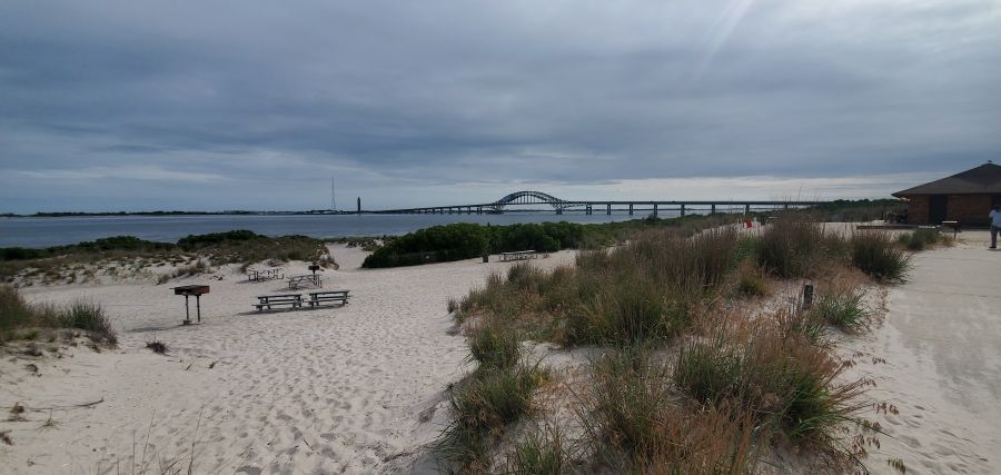
Captree State Park is a great ending for this bike path. You can walk along the shore and see the Fire Island Lighthouse off in the distance.

Also keep in mind that while there are services are available at the different beaches along the route, there is nothing in between those hubs along the bike path but open road. So make sure you know the distances between the various amenities before you set out on your ride.

Riding the Maybrook Trailway

The Maybrook Trailway is the newest rail trail in the lower Hudson Valley and it is also the very eagerly-awaited “missing link” of trail between the former Putnam Division Railroad trailway system (also known as the Putnam Trailway, North County Trailway, South County Trailway and Putnam Greenway depending on where you are) and the trail system centered around the Walkway-Over-the-Hudson (which is comprised of the walkway itself, the Dutchess Rail Trail, the Hudson Valley Rail Trail and the Wallkill Valley Rail Trail). With the construction of the Maybrook Trail, it is now possible to ride continuously on a bike path (with no cars) between New York City and Kingston – almost 100 miles! All of this is part of the new Empire State Trail which goes across the entire state (although not all of the Empire State Trail is bike paths).

The Maybrook Trailway travels between Brewster and Hopewell Junction for 24 miles. There are no services available or restrooms.

The Maybrook Trailway has been a long time coming. Instead of being a “rail trail’ the Maybrook is actually a “rail with trail” traveling alongside the Maybrook Line owned by Metro-North Railroad. The trailway itself is also owned by Metro-North, which makes it one of the only bike paths to our knowledge to be owned and operated by a commuter railroad. The uniqueness of this arrangement also makes for a very unique trail experience, as you travel through very remote areas that are only accessible by this rail line. Far from development and traffic, the Maybrook Trail offers a quiet experience with the sounds of birds and wildlife as a soothing soundtrack in the background. In fact, the Maybrook Trailway is probably one of the most scenic bike paths in our entire region.

Wide open and quiet, with only the sounds of nature surrounding you.

The Maybrook was a mountain railroad, crossing the Appalachian Trail.

However, this sense of solace comes at the expense of convenient services. There are no easily accessible services anywhere along the trail and there are no restrooms along its entire 24 mile length. So you need to go into this ride prepared, or you could consider one of our tour packages where we provide rest stops and services to our riders. There are also no places to sit along this trail except for the stone boulders placed near road crossings. This is a shame since there are so many pretty views that would be nice to sit and enjoy.

As you would expect from a transit agency, the Maybrook Trailway has lots of clear signage. Most of this involves telling you what you can’t do: don’t go on the tracks, stay off of private property, don’t swim in this lake, etc. But there are also lots of great informational panels telling 

Although there are no services or restrooms along the Maybrook Trail, when you reach the end in Hopewell Junction, there are restrooms and vending machines.

you about railroad history and the many settlements that you pass.  Also, because the Maybrook Trailway goes along train tracks that connect to the Brewster rail yards, you can easily take Metro-North railroad from NYC with your bike to get to the trail. It’s also possible to ride the 44 miles to Poughkeepsie (via the Dutchess Rail Trail) and then take the train back to the city via the Hudson Line while you watch the sun set over the Hudson River. Discount rail fare is available for this excursion with our tour package.


New York Metro Area Bike Paths That Are Great for Cross Country Skiing

Cross Country Skiing New YorkThere’s nothing quite like getting outside on cross country skis after a fresh snowfall. When you can’t get out for a bike tour, cross country skiing is a great form of exercise, since you work both your upper and lower body at the same time. Plus it’s beautiful to ski through a winter wonderland where snow is sticking to tree branches. Unlike downhill skiing, cross country skiing can perhaps best be described as a faster version of hiking where you glide along a trail using your own power to move. But of course those downhills are always a fun part of any day out. The New York area has many biking and hiking paths that offer a wide range of cross country skiing experiences from easy to difficult. There are also a few paths that follow train lines that allow you to ski one way and take the train back to where you started.

In most cases, to ski any of these trails you will need to have your own cross country skis. While this may seem like a major purchase, XC skis cost much less than downhill skis and they will last you many years. Major retailers that sell them include REI and L.L. Bean. There are also a few local retailers who sell them, including Pawling Cycle & Sport and Rock & Snow, both in the mid-Hudson Valley. Rock & Snow also offers rentals if you aren’t ready to buy yet. 

Fahnestock Winter Park

Fahnestock Winter Park is perhaps the best choice for New Yorkers who are looking to try cross country skiing for the first time, or if you don’t have equipment. Every winter, the beach area, campground, and hiking trails in Fahnstock State Park are transformed into a nordic skiing center whenever we get a big snowfall. Groomed trails range from easy to difficult and they have rental skis and lessons available. This is the closest nordic skiing center to NYC, so it can get a little crowded. But it is also super easy to get to since it is right off the Taconic State Parkway. You can also get here by public transit by taking the Metro-North Railroad to Cold Spring and then cabbing it over. 

Bronx River Pathway

If you are looking to just get out for a short ski trip, you can’t beat the Bronx River Pathway in Westchester County for convenience. This bike path parallels the Metro-North Harlem Line and the Bronx River Parkway so it’s easy to get to by car or train. Plus it offers the advantage of a one-way trip where you can use the train to get to a starting point and then ski back. The scenery is super nice as you pass through dense woods. The nicest segment for skiing is between Hartsdale and White Plains since it has a fair amount of up-and-down and there are no road crossings. If you are looking for a flatter section, try the area between Bronxville and Scarsdale.

XC skiing on the Bronx River Pathway

The section of the greenway just south of White Plains is great for cross-country skiing when it snows.

Old Croton Aqueduct

With the leaves off the trees, you get a near constant view of the Hudson River and the Palisades from the Old Croton Aqueduct bike trail through Westchester’s river towns. This trail is consistently flat and, since it parallels the Metro-North Hudson Line, it is also very easy to get to by train or do a one-way ski. You also pass through many town centers, which make it easy to stop for lunch. 

Rockefeller State Park Preserve

Another regional hot spot for cross country skiers is Rockefeller Preserve in between Pleasantville and Tarrytown in Westchester. This park features a large network of carriage trails that are primarily used by hikers and horseback riders. But after a snowfall it becomes a prime local destination for cross country skiers who ply its ungroomed trails. Probably one of the most scenic parks in our region, this is a great place to check out. You could also get here by train to Tarrytown or Pleasantville in combination with a cab ride. 

Ward Pound Ridge

Similar to Rockefeller Preserve, but further north, is Ward Pound Ridge Reservation, which also has a large network of carriage trails that are perfect for cross country skiing. The park isn’t far from the Katonah Metro-North Station, which also has taxi service.

Westchester County Golf Courses

If skiing across open landscapes instead of wooded trails is more appealing to you, all six of Westchester County’s golf courses are open to XC skiing and sledding. These golf courses offer a mix of terrain from steep hills to flat fairways, so there is something for every ability. Plus the parking lots are always plowed and you can even take Bee-Line buses to the Dunwoodie and Saxon Woods Golf Courses. (For Saxon Woods, your best bet is to take the bus to the pool parking area where you can access the parks hiking trails which are also good for skiing). 

High Point Cross Country Ski Center

Finally, if you are looking for another large nordic center, but you are willing to travel a little further, High Point Cross Country Ski Center in New Jersey is another place where ski rentals (and even snowmaking and night skiing!) is available. 

Resources to find out more

If you want more guidance in figuring out where to go or where the best conditions are, there are a couple of great resources for cross country skiers in our area. Check out Ski the Northeast which is a comprehensive website for skiers from the New York Metro area. Another great resource, particularly if you are interested in updates about ski conditions and other general information, is this fantastic email forum from the New York/North Jersey Chapter of the Appalachian Mountain Club. It’s a great group to learn more about skiing and ask questions. 

Riding the Old Croton Aqueduct Trail

The growth of New York City into the place we all know today has always been linked to the ability to bring fresh water to an urban environment surrounded by salt water estuaries. In the early 19th century, this was a major problem as the city began to push north from its original settlement at the southern tip of Manhattan. At that time water was obtained from wells, many of which were contaminated. This lack of clean water was responsible for both yellow fever and cholera epidemics. Water was also needed for fire suppression. By 1833 it was time for the City to begin work on a new fresh water supply. Nine years later the project would be complete, connecting the Croton Reservoir to the growing city. Today, although the aqueduct is no longer in use, most of its infrastructure is still there. Much of the aqueduct is now a State park (or NYC Park), and the land above it is a fascinating trailway that you can ride your bike on with great views of the Hudson River. The Old Croton Aqueduct Trail (OCA) goes across the Highbridge – one of the nicest car-free bridges in our region. The OCA is also a great way to get to the new Mario M. Cuomo Bridge Bike Path.

Old Croton Aqueduct trail conditions

The OCA trail is unpaved for most of its length. This is one of the wider (and smoother) parts. You should ride this with a hybrid or mountain bike.

While the initial aqueduct was 41 miles long going between the Croton Reservoir in Westchester County and the Croton Distributing Reservoir (now the site of the New York Public Library on 5th Avenue and 42nd Street) the 26-mile portion in Westchester County is the part we will be discussing below. This is the most contiguous part of the trail that offers the best riding.  While portions of the OCA trail in New York City are spectacular (like the Highbridge) the route isn’t contiguous or clear. 

No matter which portion of the OCA Trail you want to ride, we highly recommend purchasing a map from the Friends of the Old Croton Aqueduct for $5. This map will show you the exact route, which can be confusing and hard to follow for the uninitiated. But once you’ve ridden it, you’ll see why it was worth the effort. 

OCA sign

The OCA trail can be narrow at times and you will have to follow small signs to stay on the route.  We definitely recommend buying a map for $5.

The Westchester portion of the OCA Trail is almost entirely unpaved. You will need to watch out for bumps, roots, rocks, mud and debris. Some portions are wider than others, and the route is almost entirely shaded. Peek through the trees and you’ll see great views of the Hudson River and the Palisades throughout most of your ride. You’ll also see many, many remnants of the aqueduct, like ventilation towers, weirs and more. But make no mistake, the trail can be rough. So do not attempt this trail with a road bike. Hybrid or mountain bikes are a must!

Hudson Palisades view

One of the many views you’ll get of the Hudson River or the Palisades while riding the OCA trail.

There are numerous access points to the OCA Trail from its many street crossings. The OCA once flowed through every riverfront village or town in Westchester between Yonkers and Croton-on-Hudson. This means that the trail offers direct access to downtown areas in Hastings-on-Hudson, Dobbs Ferry, Irvington, Tarrytown, Sleepy Hollow and Ossining and it is also very close to downtown Yonkers and downtown Croton-on-Hudson. All of these areas have Metro-North train stations, so you can easily do a ride that starts in one place and ends at another. And that also makes this trail easy to get to from the city.

Downtown Irvington

The OCA Trail goes directly through a number of downtown areas. So you are never far from services or train stations.

If you want to start your ride at the south end, a good place to start is at Glenwood Avenue, particularly if you are taking the train. This trail access point is very close to the Glenwood train station, but beware, you will have to go up a big hill to get to the trail.

Heading north the trail is continuous, but you will need to pay attention to your map or to signs (where available) to get you through tricky spots where the route gets confusing. In most downtown places the trail is shared with roadways or parking lots. Try your best to follow along. In some cases, it may even feel as if you are riding through somebody’s front or back yard.  It’s OK – you are still on the trail. 

OCA trail next to a house

Hey, am I riding through someones yard? Yes you are…but it’s also the trail!

As you approach Tarrytown you will pass by some beautiful properties including Lyndhurst Castle. These were once Hudson River estates for the wealthy. Lyndhurst, in particular, offers tours. However, once you pass Lyndhurst, you will get to your first major interruption in the trail, since it is here that the aqueduct was obliterated by the construction of I-287 and the Tappan Zee Bridge. So you will have to ride along Route 9 for a while until you get to downtown Tarrytown where the OCA trail picks up again. This is a busy road, so it isn’t the greatest for cycling. But you could always ride on the sidewalk if you did not feel safe. It is here that you will also pass the entrance for the Mario M. Cuomo Bridge bike path

weir building

The OCA trail goes past many remnants of the aqueducts infrastructure, such as this weir building.

If you want to ride north of Tarrytown, the OCA trail offers some nice interrupted stretches. But there are also major gaps in the trail that you will need to get around. Once again, having a map will really help you figure this out. The biggest obstacles are Sleepy Hollow High School (which was built right over the aqueduct), a missing piece of trail in Scarborough, and passing through downtown Ossining, where you will need to use local streets (and stairs) to follow along the path. The last major interruption in the trail is where Route 9A was constructed across the aqueduct (another highway obliteration…). Here you will need to skirt around the fence of a training and conference center owned by GE, so again you will need to pay attention to signs (and your map). But the last couple of miles are spectacular, as you move away from the Hudson River into the Croton River gorge. The trail ends at the Croton Dam, which is a site to behold.  You can bike across the top of the dam, or go down to the gorge below, which is a County park.  If you are taking the train back, just reverse your course back a few miles and you can access the Croton-Harmon Metro-North station relatively easily.

Tappan Zee bike path

Riding the Mario M. Cuomo (Tappan Zee) Bridge Bike Path

Tappan Zee bike path

The replacement of the old Tappan Zee Bridge with the new Mario M. Cuomo Bridge has been a long time coming. Everyone hated that old bridge…especially cyclists and pedestrians, because that bridge had never been built with them in mind. How could such a critical link in the Hudson Valley not include bicycles and pedestrians? Finally, the bridge was torn down and replaced. And the last phase of that replacement is now open: the Governor Mario M. Cuomo Bridge Path! (Or to some, the new Tappan Zee bike path).

While it’s annoying that the bike path was the last phase of the bridge to open, everyone is glad it is finally here. This past weekend was its first weekend of operation, and it was packed with visitors! Here’s what you can expect if you ride the new Tappan Zee bike path. 

Tappan Zee Bike Path sign

Manage your expectations

If you had the ability to design a brand-new, state of the art, bike path from scratch on a brand new bridge, you’d do something amazing, right?  Well that’s not what the Tappan Zee bike path is. It is more or less just a 12-foot car lane repurposed into a multi-use path with a white stripe going down the middle. Pedestrians on one side, bikes on the other.  Cross the line at your peril!  If you’ve been on a bike path on almost any other local bridge, this is more or less the same deal.  You’ve got cyclists of all abilities, all competing for the same space…right next to pedestrians.  It is absolutely essential to keep your wits about you.  But it’s a great path if you take your time and go slow. But at the same time, it’s also a really good idea to ride this path with a mirror so you can be ready for the packs of lycra-clad riders who come blowing through in a paceline, perilously close to young mothers riding with toddlers on the backs of their bikes.

Blocked view from Tappan Zee Bridge

You told me there would be river views! Not here, as opaque panels shield your eyes from something you are not meant to see.

Besides, why not take your time and enjoy the view? It’s fantastic! But if you start out on the Westchester side, you’ll need to wait a bit.  For some reason, they put opaque panels blocking your view for the first part of the ride.  But then things open up, and there are 6 little rest areas you can stop at to enjoy the view.  These rest stops have whimsical names like “Fish and Ships”, but they are mostly just bland seating areas adorned with touchscreen monitors that will inform you about a different Hudson River topic. 

Tappan Zee Belvedere

It’s time for some “fish and ships” at one of the seating areas along the bridge. Always a nice view. There’s also a touch screen for you to look at and touch.

The seating areas also offer some artistic flair for the bridge along with other public art installations that you can look at. The art is a great distraction from the sounds of 18-wheelers and buses roaring past you. Don’t forget, this bridge carries the NYS Thruway. But at least in the seating areas, the mesh suicide-proof fence between you and the traffic is replaced by glass paneling to attenuate the vehicular noise while you browse those touchscreen panels.

Public art Tappan Zee bridge

Get lost in public art installations along the bike path.

The Rockland side of the bridge approaches the shore at a much lower elevation than the Westchester side, and dispenses you amidst the tangle of Interchange 10.  The space here is tight and narrow-feeling thanks to the concrete sound-barrier walls. But at least you will be in the shade on a hot summer day.

Crowded Tappan Zee bike path

Approaching the Rockland side is “easy-squeezy” as the crowd is shunted between sound barrier walls and the suicide fence next to the traffic.

The bike path has great amenities on both landings of the bridge.  Each landing has a clean restroom near the parking lot, although there are few places to lock up your bike while you go inside. Each landing also has at least one food truck and a small area to consume the items you purchase. 

Tappan Zee food truck

Grab a bite from a food truck and eat it on a metal picnic table with absolutely no shade. Public art provides a visual contrast to the pavement that surrounds you.

Getting there

The Mario M. Cuomo Bridge is unique, compared to other bridges with bike paths, in that it has free parking for people to drive to the bridge and then ride or walk across it. But the bridge is also connected to other bike paths on both sides of the river, so you can also ride your bike to it.  On the Westchester side, the bridge is very close to the Old Croton Aqueduct Trail and the Westchester RiverWalk trail. It is easy to ride from these trails to the bridge by riding on the sidewalk of Route 9 between the trail and the bridge. You can also ride in the road if you want to.  

Cyclist dismount sign

This severe-looking design was clearly invented by the highway engineers. Welcome to the parking area.

On the Rockland side, the bridge connects directly to the Esposito Trail, which in turn will take you directly to downtown Nyack.  Nyack is probably the easiest community to visit when you are riding the bridge’s bike path. On the Westchester side, you can also visit Tarrytown, but you’ll have to ride down busy Route 9 to get there.  You could also go the other way and ride to Irvington, using the Old Croton Aqueduct or RiverWalk trails. 

Tappan Zee bike path signs

The bridge’s bike path connects to other trails. Clear signage ensures you will not get lost.

Another way to get to the bridge’s bike path is to use the Hudson Link bus.  These buses ply the I-287 corridor and offer stops near the bike path during certain times of the day.  The buses all have bike racks that hold up to 3 bikes.  So you can ride or walk the bridge one way, then take the bus back. 

Tappan Zee Bridge sign

Hey! Don’t forget that the current governor named the bridge after his father, a previous governor. These signs ensure you don’t forget.

O&W Trail

Riding the O&W Rail Trail

The City of Kingston sits right next to the Catskill Mountains along the Hudson River. But it also sits at the end of two river valleys that run south to north. These two waterways: the Roundout Creek and the Wallkill River, have their confluence just south of Kingston.  From that point north, the Roundout Creek becomes a navigable waterway which leads to the small harbor that made Kingston a hub of industrial activity in the Mid-Hudson Valley.

The Roundout Valley has long been a transportation corridor.  First it was the Delaware and Hudson Canal that once transported coal between northeast Pennsylvania and the Hudson River.  Later the canal was replaced by the New York, Ontario and Western Railway (the O&W). And now that railroad alignment is another great bike path for you to explore. Riding this trail can be a great component of any of our Hudson Valley bike tours.  You could also combine it with our Catskill Scenic Trail tour and make a weekend out of it. 

The O&W is a quiet, peaceful ride. But it is still a work in progress in many ways.  There are a number of gaps in the trail, and some parts of the ride are kind of rough.  So you will definitely want to ride a hybrid bike or a mountain bike if you want to experience any of the rough parts.  There is a good map showing the different segments (and gaps) on the trail’s official website. The map also shows a number of parking areas as well. You can also take public transit to parts of the O&W trail by using Route EU of the Ulster County Area Transit bus system.  These buses are equipped with bike racks and can help you ride this route one-way, and take the bus back to your start point. 

Perhaps the roughest section of the trail is in Kingston where the O&W met the other lines that made Kingson a regional rail hub.  The trail begins in the parking lot of the Super 8 hotel where  the O&W once joined the tracks that are still in use by the Catskill Mountain Railroad.  Riding the trail in this area is basically riding on bumpy grass, and it can be tough at times. If you want to skip this area, you can start instead at the parking lot just off of Route 209 in Hurley.  From here south, the trail conditions begin to get better and it is a nice quiet ride through beautiful woods with great scenery. Although there are a couple of rough spots on the trail here and there. Once you reach High Falls, you will begin to ride along the Roundout Creek where you can see remnants of both the D&H Canal as well as the O&W Railroad. 

O&W Rail Trail conditions

Typical trail conditions on the O&W Rail Trail

There aren’t a lot of services or stores immediately next to the trail.  So you’ll want to pack some food to bring with you.  If you need to stop for supplies, your options are basically in Hurley, near the parking lot at the north end, and at Big E’s deli where the trail crosses Cottekill Road.  There are also some shops in High Falls if you get off the trail and cross the Roundout Creek.

This section of trail is more or less continuous until you reach the hamlet of Accord, where the trail peters out in a lumberyard.  From here you will need to continue along Lucas Turnpike and Route 209 if you want to keep going. These roads can be kind of busy and aren’t the greatest for riding, but more advanced riders should be OK.  

Shawangunk Ridge

A view of the Shawangunk Ridge from the O&W Trail

When you reach the center of Accord, you will need to go through town and cross the Roundout Creek.  There aren’t that many stores or services here, despite it being the center of town.  You will need find your way over to Rochester Town Park by taking County Road 27 to get to the next segment of trail.  But you may have to ride through the park for a while until you can figure out where the trail is.  Just look for the dump trucks and the trail should be behind them.  The trail is kind of rough here again, and it only goes for 4.3 miles until the next gap in the trail in Kerhonkson.  But you will ride along the Roundout Creek the entire time with great views of the Shawangunk Ridge. 

In Kerhonkson, if you want to keep riding, you’ll need to use Berme Road for 3.4 miles and it will take you to one last piece of trail – 1.2 miles in Ellenville. But it’s still a nice ride!  Kerhonskon also has a couple of restaurants, a brewery and a resort hotel making it a nice place to end your ride as well.

Sussex Branch Trail Lake

Riding the Sussex Branch Trail

Beaver lodge along Sussex Branch Trail

A beaver lodge on a reflective lake: one of many nature scenes on the Sussex Branch Trail

If you are looking to ride your bike on a rail trail that offers a great deal of solitude, check out the Sussex Branch Trail, which as the name suggests, is located in Sussex County, New Jersey. This trail is 18 miles long, unpaved, and goes through many quiet areas where you can easily spot wildlife. This trail is also a great feature of our New Jersey End-to-End bike tour. 

While the Sussex Branch trail is generally flat, thanks to the fact that it was once the Sussex Branch line of the former Erie Lackawana Railroad, it has its “ups and downs” in terms of conditions and maintenance. The trail is not paved, and can have lots of puddles, mud and flooding if it has recently rained. In autumn, this trail is a spectacular tunnel of color, but that also means that there are leaves on the trail obscuring rocks. No matter when you go, make sure you show up with a mountain bike or a hybrid bike. Take your time and go slow. There’s no need for speed and it’s better to relax and enjoy the quiet solitude. The generally tough conditions of this trail help keep it quiet, and you may go long distances without seeing another cyclist. 

Sussex Branch Trail conditions

One of the smoother sections of trail.

The Sussex Branch trail generally runs north-south between the Borough of Branchville and Allamuchy Mountain State Park at the southern end of Byram Township, right at the border of Morris County and Mount Olive Township. Mount Olive has a train station that is located about a mile away from the trailhead in Allamuchy Mountain State Park, so the NJ Transit Morris and Essex Line train is your only option if you are seeking to access the Sussex Branch Trail by train with your bike  Be advised that the train serves the Mount Olive station on weekdays only and you will have to switch trains in Dover if you are coming from NYC. 

If you are driving, the clearest parking area is at the southern end in Allamuchy Mountain State Park.  Just off Waterloo Road (County Road 604) is a sizable parking lot with a port-a-potty. This is also the closest parking area to Interstate 80. But there are also other parking areas available along the route, mostly just roadside pull-offs.  Consult this map produced by the Sussex County tourism organization for parking locations and other info about accommodations, and things to do near the trail. 

Sussex Branch Trail Lake

One of the many viewpoints of quiet lakes along the trail.

Starting at the south parking lot, you immediately get to travel north through Allamuchy Mountain State Park which has two beautiful lakes that you can stop and enjoy. Unfortunately, the first lake has you riding close to its dam and this area can severely flood under the wrong conditions. (We’re not kidding – check out this video!)  Allamuchy State park used to have quarries and you can see the remnants of those as smaller ponds along the route.  Eventually you will reach Cranberry Lake and you will get to ride along its shore.  The trail enters a small commercial area here with a deli and then goes along Route 206, more or less through parking lots, and then as a dirt path on the side of the road. Eventually the road rises up above you and you are down lower, which means poor drainage after a rain.  The good news is that Route 206 has wide shoulders here, so you can hop off and so some road riding if you want a break from the trail conditions. 

Quarry pond

You can see these quarry ponds adjacent to the trail in Allamuchy Mountain State Park

At Whitehall Hill Road, there is a gap in the trail, but instead of riding along Route 206, you can ride along the much quieter Whitehall Hill Road, which parallels Route 206. At the junction of Whitehall Hill Road, Whitehall Road and Morris and Sussex Turnpike look for a little dirt path off to the right.  That is where the trail picks up again. This time you are higher up, above Route 206.  No flooding here, but it is bumpy. Take your time and push through. You’ll be rewarded by going over an old stone bridge. Shortly after you’ll arrive in Andover, which has a few restaurants and bunch of antique shops. 

Old stone bridge

The trail goes over this stone bridge

North of Andover, the trail gets very quiet again as you veer away from Route 206 and head back into the woods. You will skirt along the east side of Newtown (another opportunity to access stores and restaurants) and you will need to ride on Hicks Avenue for a short distance to cover a break in the trail.  After that, it is very quiet as you bike through the woods next to several streams. One interesting site you will see is the crossing of the Paulinskill Valley Trail high above you.  This is another rail trail that was built on a line of the former New York, Susquehanna and Western Railroad.  It is an uncommon sight to see two rail trail bike paths cross each other like this!

Paulinskill Valley Trail

The Paulinskill Valley Trail passes high above you.

Soon after this crossing you will approach Lafayette Township where the trail starts going along Route 15. Fortunately, you are far enough away from the road to not be distracted by a lot of car noise. Also, at this point you are biking along the Paulins Kill, a rushing stream whose flowing water adds to the sounds you will hear. But you are never far from Route 15 which has restaurants and stores along it, particularly if you need a restroom. 

sculpture garden

A quirky trail-side sculpture garden welcomes you to Lafayette Township

The bike path flows in the same direction as the streams you will pass, which in a few miles takes you to Branchville where the Sussex Branch Trail ends.  The trail ends unceremoniously on Mill Street and then it’s just a quick bike ride to the borough’s historic business district where shops and restaurants are available.

Sussex Branch Trail farm scene

This bucolic farm scene is not very far from services located along Route 15 and the end of the trail in Branchville.

Bronx River Greenway

Bronx River Waterfall

The Bronx River Valley has been a corridor for transportation and industry throughout New York’s history. As the only fresh-water river in NYC it played an important role in industry, with many mills set up along its banks, the remnants of which can be seen in the many “waterfalls” you see along the river flowing over dams that date back to the 19th century. The Bronx River Valley has also been an important transportation corridor dating back to the 1840’s when the New York and Harlem Railroad was constructed (now the the Metro-North Harlem Line) and the construction of the Bronx River Parkway in 1907 as the first parkway to be constructed in the United States.

One of the innovations of parkway construction at the dawn of the automobile era was the preservation of lands along each side of the roadway as dedicated parkland.  This parkland has allowed for the development of one of the region’s best bicycle paths.  While not fully complete, you can ride 25 miles between the source of the Bronx River in Valhalla to and the mouth of the river at Claisson Point in the Bronx by using existing trail segments and roads that fill in the gaps.  Eventually, both the City of New York, with the help of the Bronx River Alliance, and Westchester County are committed to constructing a trailway along the river’s entire length.  But for now, you can ride the whole river mostly on bike paths, so long as you are OK with detours onto nearby streets.

One of the nicest attributes about the Bronx River Greenway is that it connects many downtown areas with restaurants, services, train stations and parking. So you are never far from services and this is an ideal ride to do one-way and take the train back, since the bike path follows the Metro-North Harlem Line closely.  So whether you want to ride a little, or a lot, the Bronx River Greenway is a great choice for a day out on a bike that is close to home.  During spring and autumn you can also combine your ride with Bicycle Sundays which involve the closure of the Bronx River Parkway for bikes and pedestrians between Yonkers and White Plains.  

Concrete Plant Park

In the Bronx, the Greenway takes you though a series of smaller parks, such as Concrete Plant Park.

Let’s take a look at the route from south to north.  For an overview of the route in both the Bronx and Westchester, click here. Use this map to guide you as you read, since your ride will take you through many different park areas and then on streets in between. But this map is not a recommended route. Please consult the various other maps we call your attention to later in this article. To start with, you may also want to check out the maps and cue sheets on this webpage

Classon Point is at the south end. There is a dock here that gets regular NYC Ferry service which is a great way to arrive with your bike if you are coming from Brooklyn, Queens or Manhattan. Parking here is also relatively easy to find. From here you will ride through a series of parks with a little on-street riding in between each. Head directly out on a bike path which takes you through Soundview Park along the tidal flats of the mouth of the Bronx River. Then with a little knowledge of local streets from a map, you can get across the Bruckner Expressway to Concrete Plant Park. From here the route is well put together, with signage and a protected bike lane along the decommissioned Sheridan Expressway (now Sheridan Boulevard) which leads to Starlight Park.

Starlight Park Bronx

Cheering on riders in Starlight Park during the Tour de Bronx in October

North of here, the park land is interrupted as you go through the bustling West Farms neighborhood. This is a major transit hub for subways and buses, so it’s a good starting point if you want to take the subway to get to the ride. You can also try your luck with parking here since there is good highway access at this particular spot. Again a map is helpful getting you through the neighborhood streets.  Watch out for cars!

The good news is that it’s only a half mile of on-street riding and then you are back on a nice bike path starting at 180th Street. At this point you are going to be on a path for a while as you go through Bronx Park, so relax and enjoy. If you are interested in an odd piece of New York history, take a very small detour to the East 180th Street subway station, which used to be a train terminal for the now-defunct New York, Boston and Westchester Railroad. Both the 2 and 5 trains stop here and the 5 continues on along the old NY,B &W route to Dyre Avenue.

Bronx River Pathway

The Bronx River Greenway in Shoelace Park is wide and straight.

Once you are on this bike path, everything is straightforward and well marked almost until you reach the northern border of NYC. There are also plenty of restrooms and water fountains (usually found at playgrounds) along the way. The only challenging section is where you need to cross Pelham Parkway. This is a busy street that is difficult to cross.  So take your time and use the pedestrian signals.  Or check out the neighborhood and get a snack or lunch while you are there. 

After about 4.3 miles of riding on this path, you will reach Woodlawn Heights, which is where NYC ends and Westchester County begins. The bike path here continues north of 233 Street, but it is a dead-end bike path that goes to Muskrat Cove, a quiet little spot along the Bronx River in between the parkway and the railroad. So if you want to check it out, you’ll have to go back to 233 Street again. Be aware of homeless encampments if you go on this bike path.  From 233 Street you are looking at 4 miles of on-road riding to get to the next trail segment. So you may want to take a break here and grab lunch while you figure out the best route for you to ride. The Woodlawn Heights neighborhood is famous for Irish restaurants. Or you can head up Bronx Boulevard and get great jerk chicken and BBQ from the Cookmaster who sets up shop most days in the summer on the sidewalk in front of a self-storage facility.

Muskrat Cove

The ride to Muskrat Cove goes under the looming Nereid Avenue Bridge.

There is a lot of debate about the best on-road route to connect the Bronx and Westchester segments of this trail. On our map we use a jumble of streets in southeast Yonkers that takes you to Kimball Avenue, which is a relatively wide 2-lane road. It’s a mystery why the City of Yonkers doesn’t stripe this road with bike lanes. If you go this way, you will need to be careful riding past Cross County Shopping Center because there are a lot of cars here.  But north of the mall you’ll ride through Sarah Lawrence College, which is a nice change. Right after Sarah Lawrence the bike path starts up again. Another route is offered on these cue sheets. You should decide the best route for you. 

This 4 mile gap will probably be the least pleasant part of your ride, since there are no signs to guide you and you will be on streets with cars. Rest assured, Westchester County will eventually construct a bike path for this segment, but it has been hard to engineer using the available land.  If you don’t want to ride this part, you can also ride Metro-North railroad with your bike between the Woodlawn Station and the Bronxville station.  Trains run every 30 minutes on weekends and you can bring your bike on board for this 8 minute ride. 

Bicycle Sunday Bronx River Parkway

On Sundays during spring and autumn, the Bronx River Parkway is closed to cars.

Once you are in Bronxville, the final 11 miles of your ride are going to be pretty nice as you ride a bike path through the Bronx River Reservation. While there are few directional signs here, the bike path is (mostly) intuitive. The path also closely follows the Metro-North Harlem Line with direct access to several train stations which is perfect for getting to the trail and then back home again.  There is also free parking at many of these stations on weekends if you want to drive to the trail. Westchester County Parks has also produced a nice map of this trail showing access points and parking.   

Once you are north of Scarsdale Road in Yonkers, the bike path parallels the section of the Bronx River Parkway that is closed on Sundays in the spring and fall for “Bicycle Sundays”. So if you are doing your ride on a  Sunday, you can choose to ride on the bike path or on the parkway itself. Either way, you’ll go directly through the center of a number of downtowns offering places to get lunch. Restrooms, however, are harder to find. Once you are north of Scarsdale Road, the path is continuous until the end. 

XC skiing on the Bronx River Pathway

The section just south of White Plains is great for cross-country skiing when it snows.

When you get to White Plains the bike path goes under two roadway bridges. Ring your bell if you have one as you approach the bridges because there are sometimes homeless people under them and you’ll want to give them a heads up. They won’t bother you. White Plains is a busy place, but if you are tempted to get off the trail and explore, be aware that the streets in White Plains are very inhospitable to bikes and, unless you like brutalist architecture, there aren’t a lot of places worth checking out unless you ride several blocks into the core of downtown. There is, however, a hot dog stand right next to the trail that is popular with local cyclists. 

After the bridges and the hot dog stand, the bike path goes through a large parking lot associated with the Westchester County Center. They have restrooms here, but you’ll have to cross the parkway using a pedestrian signal to get to them. You can also park here, but you have to pay a fee. 

Kensico Dam

Kensico Dam Plaza is a bold visual finish to your ride.

The final 3 miles of the pathway between White Plains and Kensico Dam Plaza is a relaxing finish to the ride. There is plenty to explore at Kensico Dam, including a hike to the top of the dam. On weekends there are also a number of cultural festivals that are held here. From the dam you are a short bike ride to downtown Valhalla which has several nice restaurants which are perfect for the end of your ride.  There is also a Metro-North station here if you want to get back to the city. Parking at Kensico Dam Plaza is free, so you could also start here and ride this bike path in the reverse order if you wanted to. 

The Bronx Greenway Mosholu / Pelham System

Bronx Greenway Mosholu Pelham System

One of the best bicycle path networks in the New York Metro Region is located in the Bronx. While many counties and cities in our region have great bicycle paths, a common issue among many of them is connectivity. Perhaps they run a few miles and stop. Or perhaps one trail is unable to connect to another thanks to a missing piece. The Bronx is fortunate in this regard in that a number of bike paths connect together into a system that stretches almost entirely across the borough.  As shown on the excerpt of the NYC Bike Map below, the Mosholu-Pelham Greenway System is the spine of a large network of trails that connects cyclists to attractions such as Orchard Beach, City Island, the Bronx Zoo, the New York Botanical Gardens as well as many local neighborhoods, great restaurants, employment sites, universities, swimming pools, golf courses (including mini-golf courses) and more. 

NYC Bike Map

This trail of networks is the showpiece of the Tour de Bronx bike tour that is held every October. But it’s also a system that can be easily used by residents and visitors alike, with many access points, parking areas and transit connections. So it’s perfect place to go for a day-long outing. It also connects to other regional trail systems such as the North-South County Trailway in Westchester and the multi-state East Coast Greenway.

East Coast Greenway

This trail system is part of the larger East Coast Greenway.

While this trail system generally runs east-west, there are a number of connections that will also take you north or south. The west end of this system is Van Cortlandt Park, which is home to many sports fields, a pool, a golf course, and the historic Van Cortlandt House Museum. It is in Van Cortlandt Park that this system connects to Westchester’s South County Trailway, which will take you more than 50 miles north up to Brewster in Putnam County. Trailside parking is available at the Van Cortlandt Golf Course and you can also easily get to the park by subway. Leaving Van Cortlandt Park, the bike path system goes along Mosholu Parkway where it connects with the New York Botanical Gardens.  There is bike parking at the garden entrance here.

Moving east, the Mosholu/Pelham system merges into the Bronx River Greenway, a longer north-south route that generally follows the length of the Bronx River between Kensico Dam in Valhalla to Soundview where the Bronx River empties into the East River. It is here that you can access the Bronx Zoo or a number of Metro-North train stations. There is also on-street parking on most of the side streets here. 

Bronx River Pathway

The Bronx River Greenway is a (mostly completed) bike path between Kensico Dam and the East River

At Pelham Parkway, the Mosholu/Pelham system breaks away from the Bronx River and heads east again as a bike path within the large median of Pelham Parkway. A quick side trip to the south brings you to the Morris Park neighborhood, with many great Italian restaurants. If you just want to stop for a quick lunch there are many options including the famous Emilio’s pizza which has a one-of-a-kind recipe for chicken vodka sauce slices. You could also park within this neighborhood or take the subway here with your bike. 

Pelham Bay Park

Ride through Pelham Bay Park, next to an equestrian trail and a historic mansion.

As the bike network crosses highway interchanges for both the Hutchinson River Parkway and I-95, you will need to cross many exit and entrance ramps here, so be careful. Most of these are well marked with signs and crosswalks, but always watch out for speeding cars. You can also gain access to the Hutchinson River Greenway here, which is another great north-south route that follows the Hutchinson River Parkway. 

Once you cross I-95 you are in Pelham Bay Park, which is New York City’s largest park. This park includes Orchard Beach, Split Rock Golf Course, the Bartow-Pell Mansion Historic Site, Turtle Cove batting cages and mini-golf, and a stable for horseback riding. All of these attractions are right on the bike path which takes you as far east as City Island or north to the Village of Pelham Manor, where the trail dumps you out on a residential street that continues as part of the East Coast Greenway. City Island also features a number of great restaurants and it is a very interesting community to visit. Riding your bike to City Island also lets you not have to think about traffic or parking. Isn’t that great?

Orchard Beach & City Island

Relax by the water on City Island or at Orchard Beach