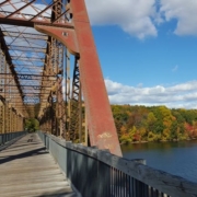

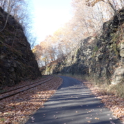
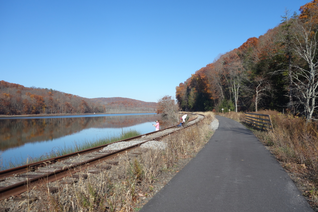
The Maybrook Trailway is the newest rail trail in the lower Hudson Valley and it is also the very eagerly-awaited “missing link” of trail between the former Putnam Division Railroad trailway system (also known as the Putnam Trailway, North County Trailway, South County Trailway and Putnam Greenway depending on where you are) and the trail system centered around the Walkway-Over-the-Hudson (which is comprised of the walkway itself, the Dutchess Rail Trail, the Hudson Valley Rail Trail and the Wallkill Valley Rail Trail). With the construction of the Maybrook Trail, it is now possible to ride continuously on a bike path (with no cars) between New York City and Kingston – almost 100 miles! All of this is part of the new Empire State Trail which goes across the entire state (although not all of the Empire State Trail is bike paths).
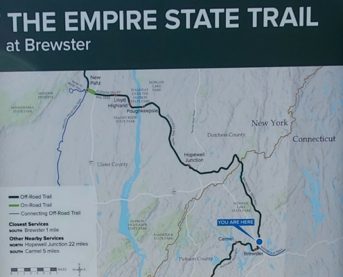
The Maybrook Trailway travels between Brewster and Hopewell Junction for 24 miles. There are no services available or restrooms.
The Maybrook Trailway has been a long time coming. Instead of being a “rail trail’ the Maybrook is actually a “rail with trail” traveling alongside the Maybrook Line owned by Metro-North Railroad. The trailway itself is also owned by Metro-North, which makes it one of the only bike paths to our knowledge to be owned and operated by a commuter railroad. The uniqueness of this arrangement also makes for a very unique trail experience, as you travel through very remote areas that are only accessible by this rail line. Far from development and traffic, the Maybrook Trail offers a quiet experience with the sounds of birds and wildlife as a soothing soundtrack in the background. In fact, the Maybrook Trailway is probably one of the most scenic bike paths in our entire region.
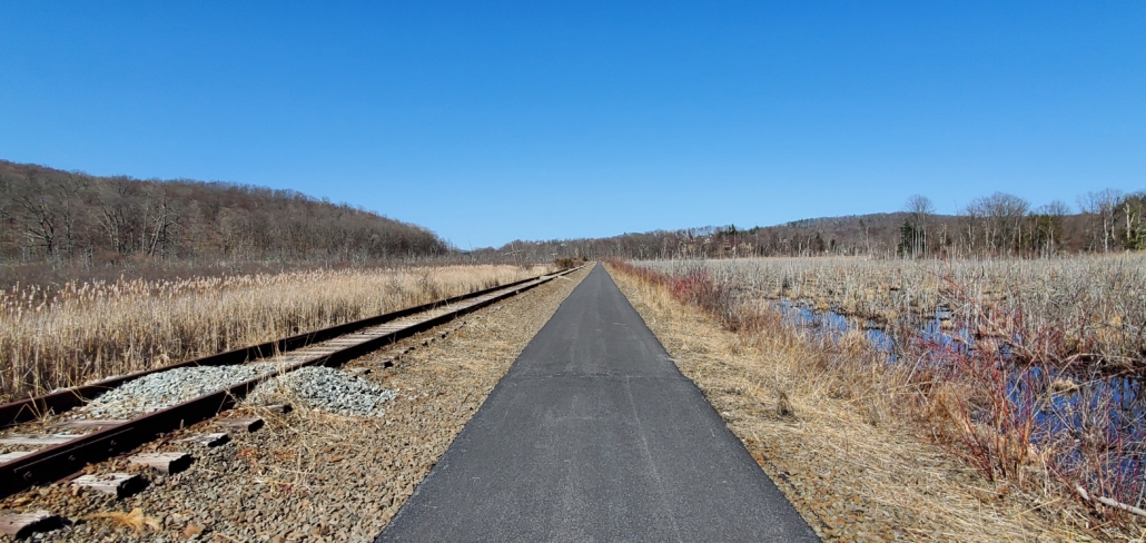
Wide open and quiet, with only the sounds of nature surrounding you.
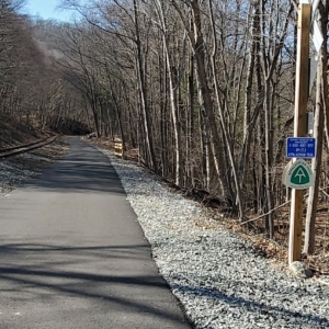
The Maybrook was a mountain railroad, crossing the Appalachian Trail.
However, this sense of solace comes at the expense of convenient services. There are no easily accessible services anywhere along the trail and there are no restrooms along its entire 24 mile length. So you need to go into this ride prepared, or you could consider one of our tour packages where we provide rest stops and services to our riders. There are also no places to sit along this trail except for the stone boulders placed near road crossings. This is a shame since there are so many pretty views that would be nice to sit and enjoy.
As you would expect from a transit agency, the Maybrook Trailway has lots of clear signage. Most of this involves telling you what you can’t do: don’t go on the tracks, stay off of private property, don’t swim in this lake, etc. But there are also lots of great informational panels telling
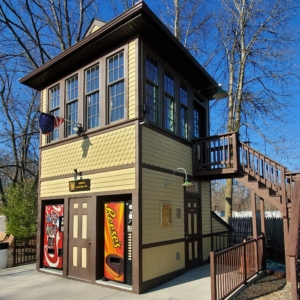
Although there are no services or restrooms along the Maybrook Trail, when you reach the end in Hopewell Junction, there are restrooms and vending machines.
you about railroad history and the many settlements that you pass. Also, because the Maybrook Trailway goes along train tracks that connect to the Brewster rail yards, you can easily take Metro-North railroad from NYC with your bike to get to the trail. It’s also possible to ride the 44 miles to Poughkeepsie (via the Dutchess Rail Trail) and then take the train back to the city via the Hudson Line while you watch the sun set over the Hudson River. Discount rail fare is available for this excursion with our tour package.
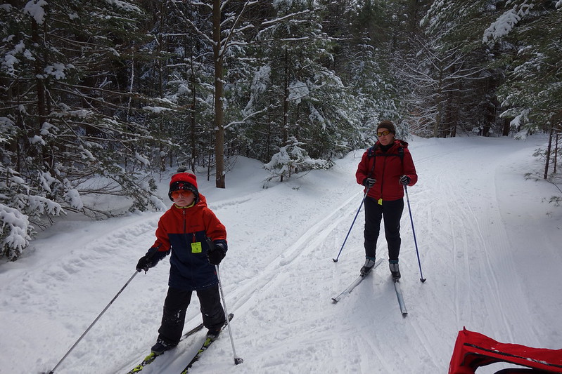 There’s nothing quite like getting outside on cross country skis after a fresh snowfall. When you can’t get out for a bike tour, cross country skiing is a great form of exercise, since you work both your upper and lower body at the same time. Plus it’s beautiful to ski through a winter wonderland where snow is sticking to tree branches. Unlike downhill skiing, cross country skiing can perhaps best be described as a faster version of hiking where you glide along a trail using your own power to move. But of course those downhills are always a fun part of any day out. The New York area has many biking and hiking paths that offer a wide range of cross country skiing experiences from easy to difficult. There are also a few paths that follow train lines that allow you to ski one way and take the train back to where you started.
In most cases, to ski any of these trails you will need to have your own cross country skis. While this may seem like a major purchase, XC skis cost much less than downhill skis and they will last you many years. Major retailers that sell them include REI and L.L. Bean. There are also a few local retailers who sell them, including Pawling Cycle & Sport and Rock & Snow, both in the mid-Hudson Valley. Rock & Snow also offers rentals if you aren’t ready to buy yet.
Fahnestock Winter Park is perhaps the best choice for New Yorkers who are looking to try cross country skiing for the first time, or if you don’t have equipment. Every winter, the beach area, campground, and hiking trails in Fahnstock State Park are transformed into a nordic skiing center whenever we get a big snowfall. Groomed trails range from easy to difficult and they have rental skis and lessons available. This is the closest nordic skiing center to NYC, so it can get a little crowded. But it is also super easy to get to since it is right off the Taconic State Parkway. You can also get here by public transit by taking the Metro-North Railroad to Cold Spring and then cabbing it over.
If you are looking to just get out for a short ski trip, you can’t beat the Bronx River Pathway in Westchester County for convenience. This bike path parallels the Metro-North Harlem Line and the Bronx River Parkway so it’s easy to get to by car or train. Plus it offers the advantage of a one-way trip where you can use the train to get to a starting point and then ski back. The scenery is super nice as you pass through dense woods. The nicest segment for skiing is between Hartsdale and White Plains since it has a fair amount of up-and-down and there are no road crossings. If you are looking for a flatter section, try the area between Bronxville and Scarsdale.
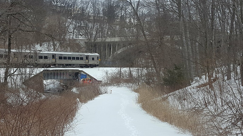
The section of the greenway just south of White Plains is great for cross-country skiing when it snows.
With the leaves off the trees, you get a near constant view of the Hudson River and the Palisades from the Old Croton Aqueduct bike trail through Westchester’s river towns. This trail is consistently flat and, since it parallels the Metro-North Hudson Line, it is also very easy to get to by train or do a one-way ski. You also pass through many town centers, which make it easy to stop for lunch.
Another regional hot spot for cross country skiers is Rockefeller Preserve in between Pleasantville and Tarrytown in Westchester. This park features a large network of carriage trails that are primarily used by hikers and horseback riders. But after a snowfall it becomes a prime local destination for cross country skiers who ply its ungroomed trails. Probably one of the most scenic parks in our region, this is a great place to check out. You could also get here by train to Tarrytown or Pleasantville in combination with a cab ride.
Similar to Rockefeller Preserve, but further north, is Ward Pound Ridge Reservation, which also has a large network of carriage trails that are perfect for cross country skiing. The park isn’t far from the Katonah Metro-North Station, which also has taxi service.
If skiing across open landscapes instead of wooded trails is more appealing to you, all six of Westchester County’s golf courses are open to XC skiing and sledding. These golf courses offer a mix of terrain from steep hills to flat fairways, so there is something for every ability. Plus the parking lots are always plowed and you can even take Bee-Line buses to the Dunwoodie and Saxon Woods Golf Courses. (For Saxon Woods, your best bet is to take the bus to the pool parking area where you can access the parks hiking trails which are also good for skiing).
Finally, if you are looking for another large nordic center, but you are willing to travel a little further, High Point Cross Country Ski Center in New Jersey is another place where ski rentals (and even snowmaking and night skiing!) is available.
If you want more guidance in figuring out where to go or where the best conditions are, there are a couple of great resources for cross country skiers in our area. Check out Ski the Northeast which is a comprehensive website for skiers from the New York Metro area. Another great resource, particularly if you are interested in updates about ski conditions and other general information, is this fantastic email forum from the New York/North Jersey Chapter of the Appalachian Mountain Club. It’s a great group to learn more about skiing and ask questions.
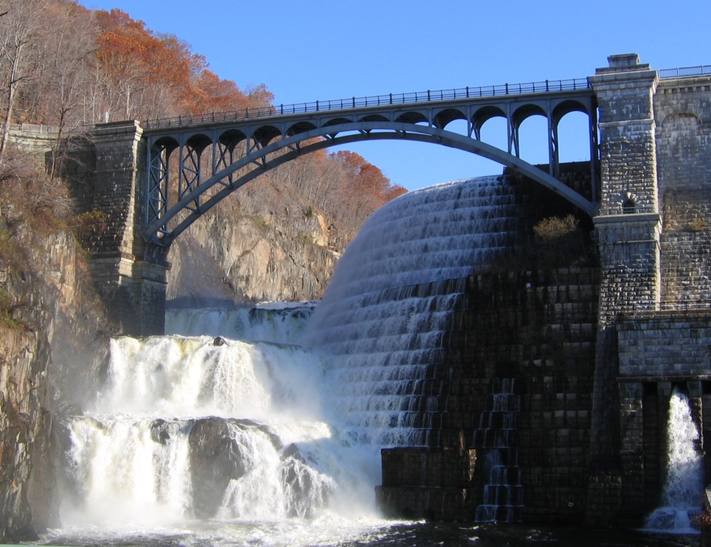
The growth of New York City into the place we all know today has always been linked to the ability to bring fresh water to an urban environment surrounded by salt water estuaries. In the early 19th century, this was a major problem as the city began to push north from its original settlement at the southern tip of Manhattan. At that time water was obtained from wells, many of which were contaminated. This lack of clean water was responsible for both yellow fever and cholera epidemics. Water was also needed for fire suppression. By 1833 it was time for the City to begin work on a new fresh water supply. Nine years later the project would be complete, connecting the Croton Reservoir to the growing city. Today, although the aqueduct is no longer in use, most of its infrastructure is still there. Much of the aqueduct is now a State park (or NYC Park), and the land above it is a fascinating trailway that you can ride your bike on with great views of the Hudson River. The Old Croton Aqueduct Trail (OCA) goes across the Highbridge – one of the nicest car-free bridges in our region. The OCA is also a great way to get to the new Mario M. Cuomo Bridge Bike Path.
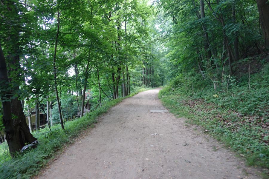
The OCA trail is unpaved for most of its length. This is one of the wider (and smoother) parts. You should ride this with a hybrid or mountain bike.
While the initial aqueduct was 41 miles long going between the Croton Reservoir in Westchester County and the Croton Distributing Reservoir (now the site of the New York Public Library on 5th Avenue and 42nd Street) the 26-mile portion in Westchester County is the part we will be discussing below. This is the most contiguous part of the trail that offers the best riding. While portions of the OCA trail in New York City are spectacular (like the Highbridge) the route isn’t contiguous or clear.
No matter which portion of the OCA Trail you want to ride, we highly recommend purchasing a map from the Friends of the Old Croton Aqueduct for $5. This map will show you the exact route, which can be confusing and hard to follow for the uninitiated. But once you’ve ridden it, you’ll see why it was worth the effort.
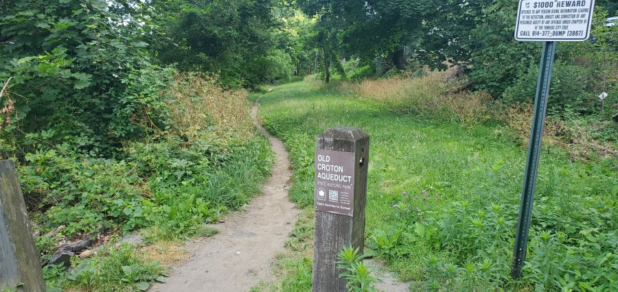
The OCA trail can be narrow at times and you will have to follow small signs to stay on the route. We definitely recommend buying a map for $5.
The Westchester portion of the OCA Trail is almost entirely unpaved. You will need to watch out for bumps, roots, rocks, mud and debris. Some portions are wider than others, and the route is almost entirely shaded. Peek through the trees and you’ll see great views of the Hudson River and the Palisades throughout most of your ride. You’ll also see many, many remnants of the aqueduct, like ventilation towers, weirs and more. But make no mistake, the trail can be rough. So do not attempt this trail with a road bike. Hybrid or mountain bikes are a must!
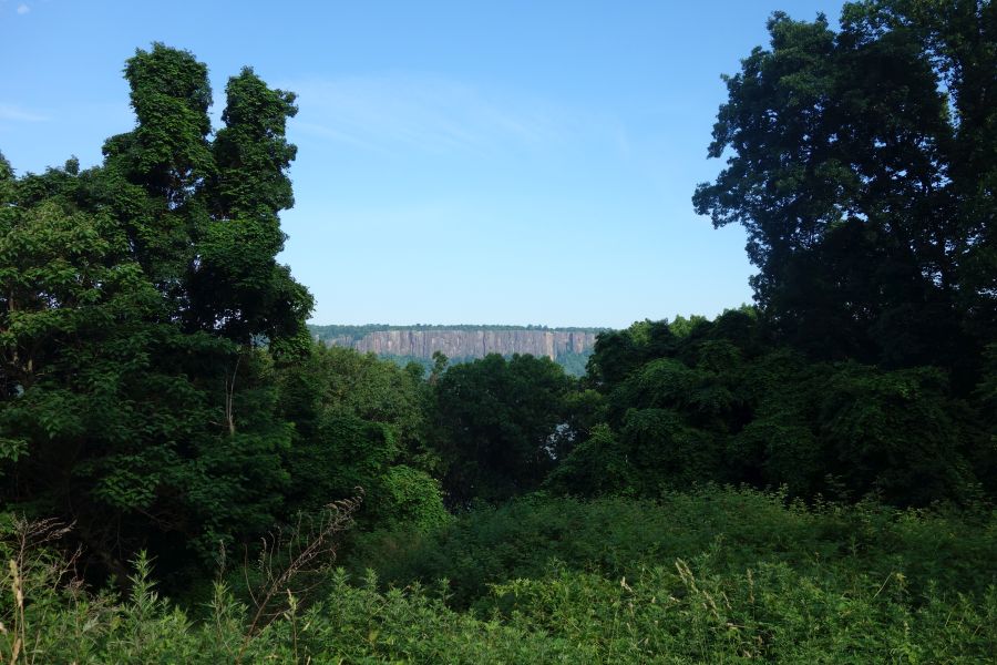
One of the many views you’ll get of the Hudson River or the Palisades while riding the OCA trail.
There are numerous access points to the OCA Trail from its many street crossings. The OCA once flowed through every riverfront village or town in Westchester between Yonkers and Croton-on-Hudson. This means that the trail offers direct access to downtown areas in Hastings-on-Hudson, Dobbs Ferry, Irvington, Tarrytown, Sleepy Hollow and Ossining and it is also very close to downtown Yonkers and downtown Croton-on-Hudson. All of these areas have Metro-North train stations, so you can easily do a ride that starts in one place and ends at another. And that also makes this trail easy to get to from the city.
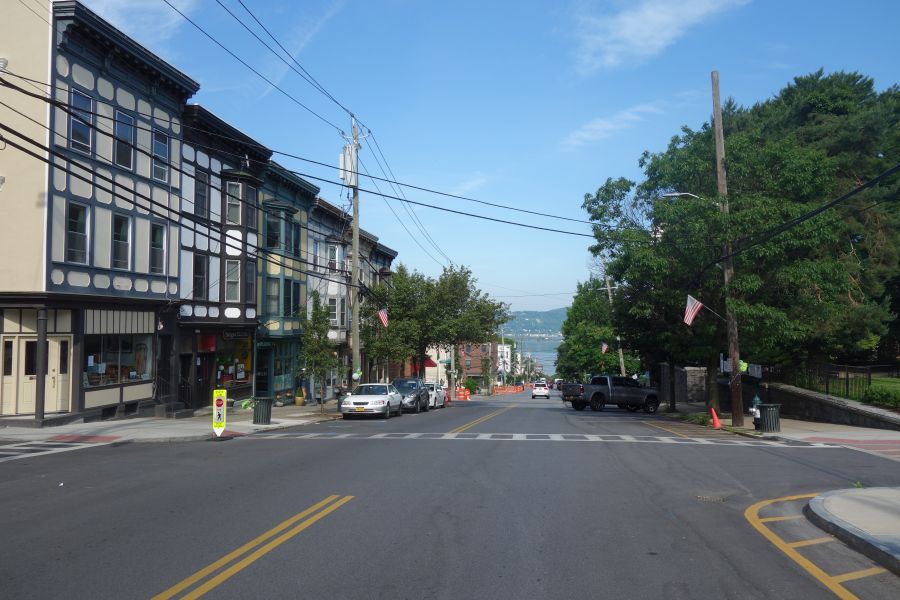
The OCA Trail goes directly through a number of downtown areas. So you are never far from services or train stations.
If you want to start your ride at the south end, a good place to start is at Glenwood Avenue, particularly if you are taking the train. This trail access point is very close to the Glenwood train station, but beware, you will have to go up a big hill to get to the trail.
Heading north the trail is continuous, but you will need to pay attention to your map or to signs (where available) to get you through tricky spots where the route gets confusing. In most downtown places the trail is shared with roadways or parking lots. Try your best to follow along. In some cases, it may even feel as if you are riding through somebody’s front or back yard. It’s OK – you are still on the trail.
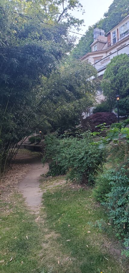
Hey, am I riding through someones yard? Yes you are…but it’s also the trail!
As you approach Tarrytown you will pass by some beautiful properties including Lyndhurst Castle. These were once Hudson River estates for the wealthy. Lyndhurst, in particular, offers tours. However, once you pass Lyndhurst, you will get to your first major interruption in the trail, since it is here that the aqueduct was obliterated by the construction of I-287 and the Tappan Zee Bridge. So you will have to ride along Route 9 for a while until you get to downtown Tarrytown where the OCA trail picks up again. This is a busy road, so it isn’t the greatest for cycling. But you could always ride on the sidewalk if you did not feel safe. It is here that you will also pass the entrance for the Mario M. Cuomo Bridge bike path.
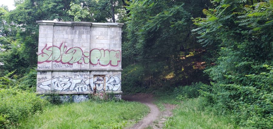
The OCA trail goes past many remnants of the aqueducts infrastructure, such as this weir building.
If you want to ride north of Tarrytown, the OCA trail offers some nice interrupted stretches. But there are also major gaps in the trail that you will need to get around. Once again, having a map will really help you figure this out. The biggest obstacles are Sleepy Hollow High School (which was built right over the aqueduct), a missing piece of trail in Scarborough, and passing through downtown Ossining, where you will need to use local streets (and stairs) to follow along the path. The last major interruption in the trail is where Route 9A was constructed across the aqueduct (another highway obliteration…). Here you will need to skirt around the fence of a training and conference center owned by GE, so again you will need to pay attention to signs (and your map). But the last couple of miles are spectacular, as you move away from the Hudson River into the Croton River gorge. The trail ends at the Croton Dam, which is a site to behold. You can bike across the top of the dam, or go down to the gorge below, which is a County park. If you are taking the train back, just reverse your course back a few miles and you can access the Croton-Harmon Metro-North station relatively easily.
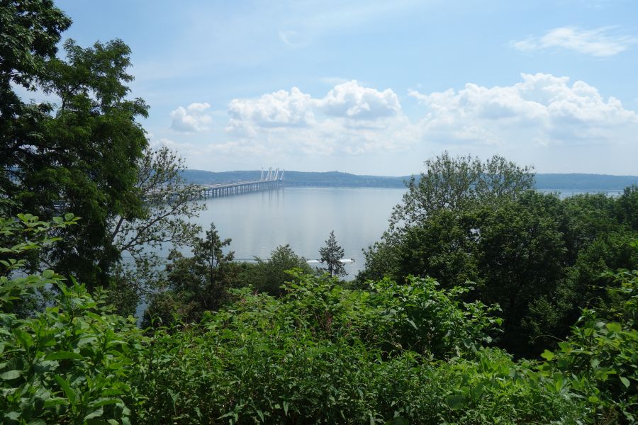
A view of the Mario Cuomo Bridge from the Esposito Trail.
If you are planning to ride across the new Tappan Zee Bridge (or Mario M. Cuomo Bridge) bike path, you are probably wondering “what other trails connect to this bike path”? Well, look no further than the Raymond G. Esposito Memorial Trail. The Esposito Trail is a great way to connect from the bridge to the Villages of Nyack, South Nyack and Piermont. This trail will also connect you to the Joseph B. Clarke Rail Trail in Sparkill via its extension called the Old Erie Path
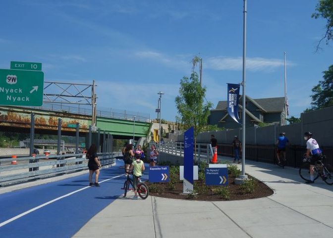
Clear signage takes you from the Tappan Zee Bridge bike path to the Esposito Trail.
The new Tappan Zee Bridge bike path is a great new amenity for cyclists in the Hudson Valley. The Esposito trail connects almost seamlessly with the bridge bike path to take you directly to South Nyack and Nyack where there are plenty of stores, restaurants, and services. These bike-friendly villages are a great place to head to after riding over the Mario M. Cuomo Bridge.
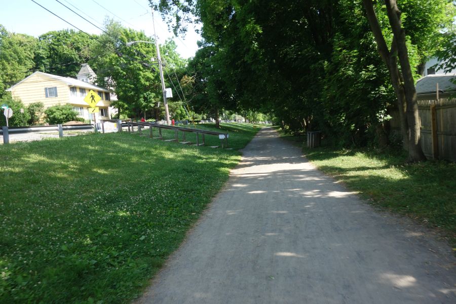
The Esposito Trail is wide and easy to ride in between the bridge and Nyack.
You can also head south on the Esposito Trail, which eventually becomes the Old Erie Path. This trail follows the alignment of the former Northern Railroad of New Jersey, which once ran passenger trains between Jersey City and Nyack. Passenger service ended in 1966, and today it’s another great rail trail for cyclists. The surface is a combination of dirt and gravel, so make sure you ride this with either a hybrid bike or a mountain bike. Sturdier road bikes should also do okay.
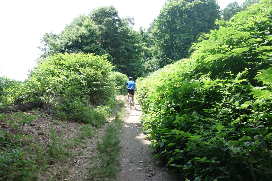
Watch out for narrow sections like this one. One way only!
While the trail is generally wide and smooth north of the bridge, as you move south, it gets bumpier and narrow. There are a couple of spots where the trail becomes very narrow and it’s one-way at time, so be aware of people coming in the opposite direction!
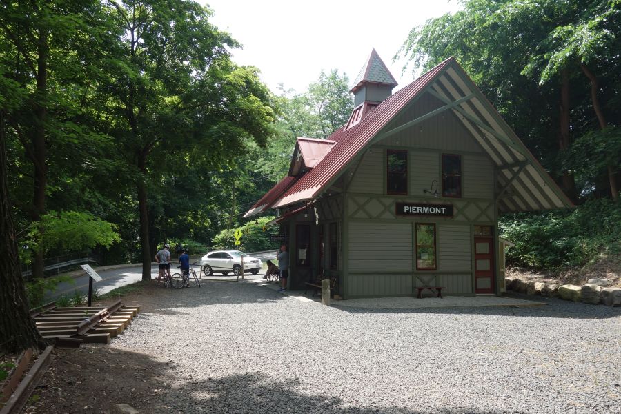
Check out the beautifully restored Piermont Station.
When you reach Piermont you will see a beautifully restored station. Keep riding south and you will eventually get to the hamlet of Sparkill where you can easily pick up NYS Bike Route 9 which takes you to the George Washington Bridge. Sparkill once had a major junction of railroads in its center….which is now a major junction of bike paths. From here, you can get on the Joseph B. Clarke Rail Trail and ride further. Or you can stop and get lunch here at one of several restaurants. With the connection to Bike Route 9, the Esposito Trail can be a great part of a circular route that features the Old Croton Aqueduct, the Mario M. Cuomo Bridge and Bike Route 9 back to Manhattan via the George Washington Bridge.
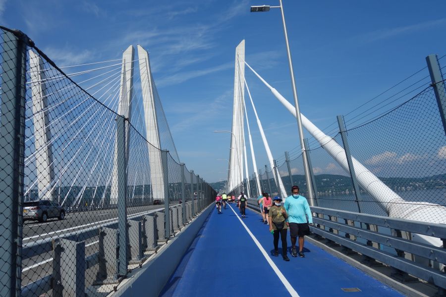
The replacement of the old Tappan Zee Bridge with the new Mario M. Cuomo Bridge has been a long time coming. Everyone hated that old bridge…especially cyclists and pedestrians, because that bridge had never been built with them in mind. How could such a critical link in the Hudson Valley not include bicycles and pedestrians? Finally, the bridge was torn down and replaced. And the last phase of that replacement is now open: the Governor Mario M. Cuomo Bridge Path! (Or to some, the new Tappan Zee bike path).
While it’s annoying that the bike path was the last phase of the bridge to open, everyone is glad it is finally here. This past weekend was its first weekend of operation, and it was packed with visitors! Here’s what you can expect if you ride the new Tappan Zee bike path.
If you had the ability to design a brand-new, state of the art, bike path from scratch on a brand new bridge, you’d do something amazing, right? Well that’s not what the Tappan Zee bike path is. It is more or less just a 12-foot car lane repurposed into a multi-use path with a white stripe going down the middle. Pedestrians on one side, bikes on the other. Cross the line at your peril! If you’ve been on a bike path on almost any other local bridge, this is more or less the same deal. You’ve got cyclists of all abilities, all competing for the same space…right next to pedestrians. It is absolutely essential to keep your wits about you. But it’s a great path if you take your time and go slow. But at the same time, it’s also a really good idea to ride this path with a mirror so you can be ready for the packs of lycra-clad riders who come blowing through in a paceline, perilously close to young mothers riding with toddlers on the backs of their bikes.
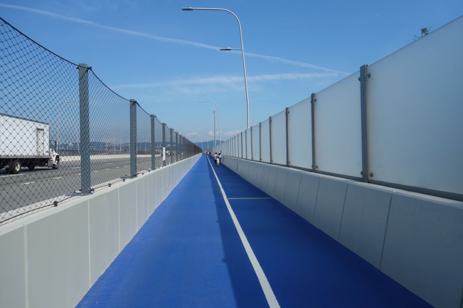
You told me there would be river views! Not here, as opaque panels shield your eyes from something you are not meant to see.
Besides, why not take your time and enjoy the view? It’s fantastic! But if you start out on the Westchester side, you’ll need to wait a bit. For some reason, they put opaque panels blocking your view for the first part of the ride. But then things open up, and there are 6 little rest areas you can stop at to enjoy the view. These rest stops have whimsical names like “Fish and Ships”, but they are mostly just bland seating areas adorned with touchscreen monitors that will inform you about a different Hudson River topic.
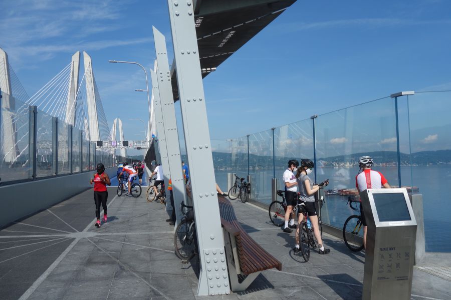
It’s time for some “fish and ships” at one of the seating areas along the bridge. Always a nice view. There’s also a touch screen for you to look at and touch.
The seating areas also offer some artistic flair for the bridge along with other public art installations that you can look at. The art is a great distraction from the sounds of 18-wheelers and buses roaring past you. Don’t forget, this bridge carries the NYS Thruway. But at least in the seating areas, the mesh suicide-proof fence between you and the traffic is replaced by glass paneling to attenuate the vehicular noise while you browse those touchscreen panels.
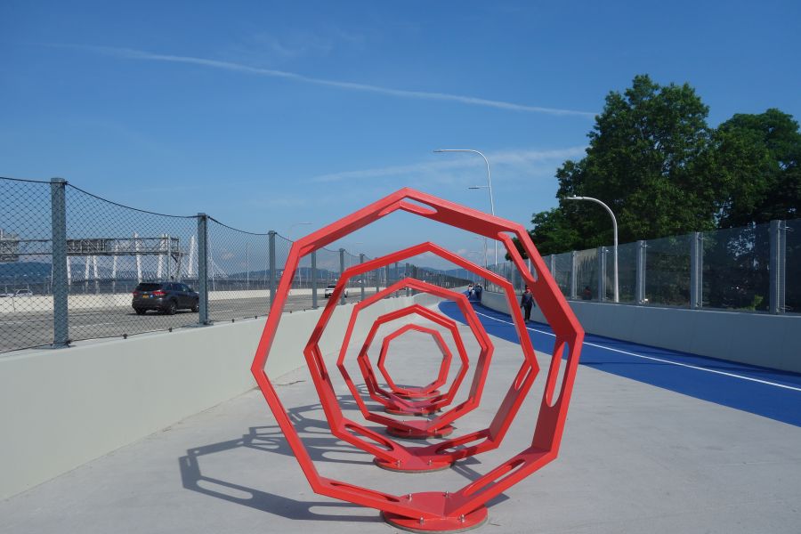
Get lost in public art installations along the bike path.
The Rockland side of the bridge approaches the shore at a much lower elevation than the Westchester side, and dispenses you amidst the tangle of Interchange 10. The space here is tight and narrow-feeling thanks to the concrete sound-barrier walls. But at least you will be in the shade on a hot summer day.
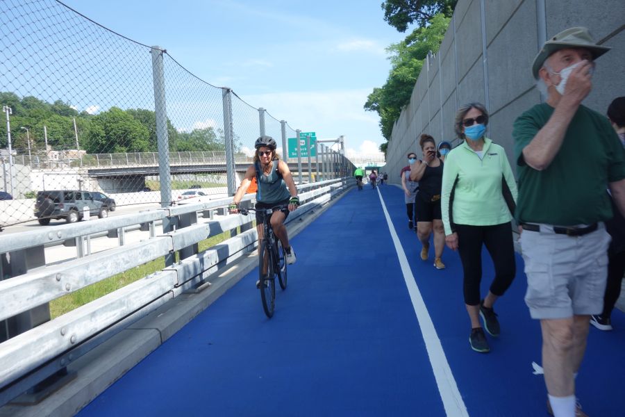
Approaching the Rockland side is “easy-squeezy” as the crowd is shunted between sound barrier walls and the suicide fence next to the traffic.
The bike path has great amenities on both landings of the bridge. Each landing has a clean restroom near the parking lot, although there are few places to lock up your bike while you go inside. Each landing also has at least one food truck and a small area to consume the items you purchase.
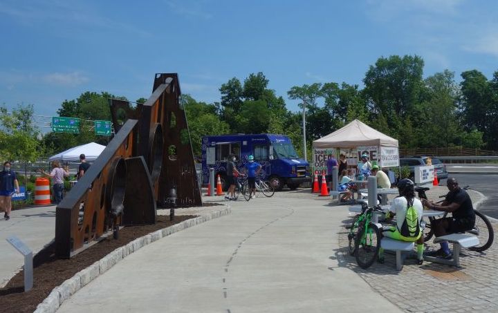
Grab a bite from a food truck and eat it on a metal picnic table with absolutely no shade. Public art provides a visual contrast to the pavement that surrounds you.
The Mario M. Cuomo Bridge is unique, compared to other bridges with bike paths, in that it has free parking for people to drive to the bridge and then ride or walk across it. But the bridge is also connected to other bike paths on both sides of the river, so you can also ride your bike to it. On the Westchester side, the bridge is very close to the Old Croton Aqueduct Trail and the Westchester RiverWalk trail. It is easy to ride from these trails to the bridge by riding on the sidewalk of Route 9 between the trail and the bridge. You can also ride in the road if you want to.
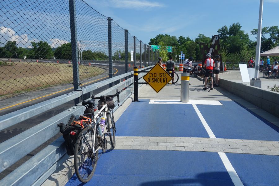
This severe-looking design was clearly invented by the highway engineers. Welcome to the parking area.
On the Rockland side, the bridge connects directly to the Esposito Trail, which in turn will take you directly to downtown Nyack. Nyack is probably the easiest community to visit when you are riding the bridge’s bike path. On the Westchester side, you can also visit Tarrytown, but you’ll have to ride down busy Route 9 to get there. You could also go the other way and ride to Irvington, using the Old Croton Aqueduct or RiverWalk trails.
The bridge’s bike path connects to other trails. Clear signage ensures you will not get lost.
Another way to get to the bridge’s bike path is to use the Hudson Link bus. These buses ply the I-287 corridor and offer stops near the bike path during certain times of the day. The buses all have bike racks that hold up to 3 bikes. So you can ride or walk the bridge one way, then take the bus back.
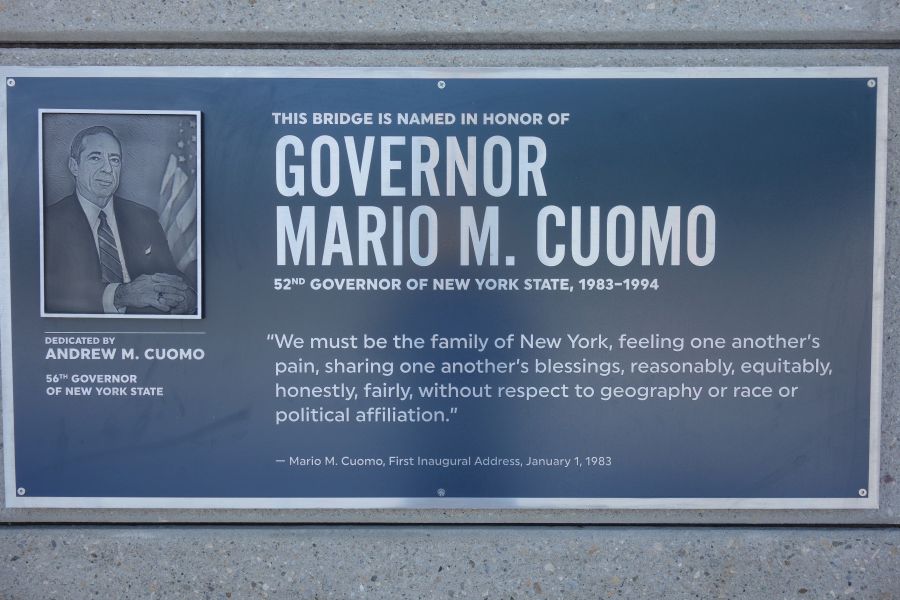
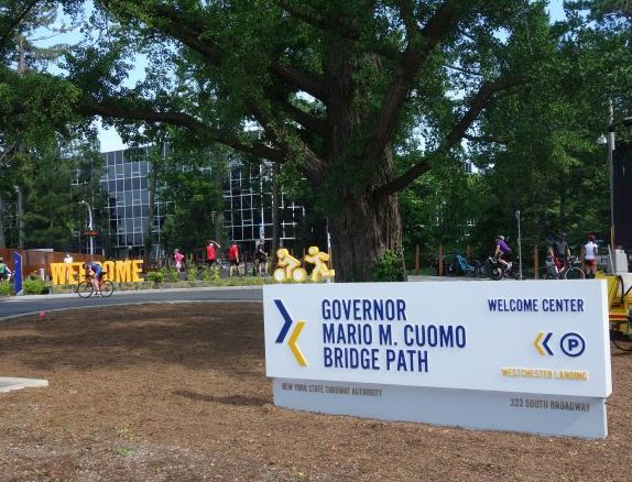
Hey! Don’t forget that the current governor named the bridge after his father, a previous governor. These signs ensure you don’t forget.
The City of Kingston sits right next to the Catskill Mountains along the Hudson River. But it also sits at the end of two river valleys that run south to north. These two waterways: the Roundout Creek and the Wallkill River, have their confluence just south of Kingston. From that point north, the Roundout Creek becomes a navigable waterway which leads to the small harbor that made Kingston a hub of industrial activity in the Mid-Hudson Valley.
The Roundout Valley has long been a transportation corridor. First it was the Delaware and Hudson Canal that once transported coal between northeast Pennsylvania and the Hudson River. Later the canal was replaced by the New York, Ontario and Western Railway (the O&W). And now that railroad alignment is another great bike path for you to explore. Riding this trail can be a great component of any of our Hudson Valley bike tours. You could also combine it with our Catskill Scenic Trail tour and make a weekend out of it.
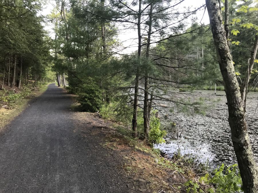
The O&W is a quiet, peaceful ride. But it is still a work in progress in many ways. There are a number of gaps in the trail, and some parts of the ride are kind of rough. So you will definitely want to ride a hybrid bike or a mountain bike if you want to experience any of the rough parts. There is a good map showing the different segments (and gaps) on the trail’s official website. The map also shows a number of parking areas as well. You can also take public transit to parts of the O&W trail by using Route EU of the Ulster County Area Transit bus system. These buses are equipped with bike racks and can help you ride this route one-way, and take the bus back to your start point.
Perhaps the roughest section of the trail is in Kingston where the O&W met the other lines that made Kingson a regional rail hub. The trail begins in the parking lot of the Super 8 hotel where the O&W once joined the tracks that are still in use by the Catskill Mountain Railroad. Riding the trail in this area is basically riding on bumpy grass, and it can be tough at times. If you want to skip this area, you can start instead at the parking lot just off of Route 209 in Hurley. From here south, the trail conditions begin to get better and it is a nice quiet ride through beautiful woods with great scenery. Although there are a couple of rough spots on the trail here and there. Once you reach High Falls, you will begin to ride along the Roundout Creek where you can see remnants of both the D&H Canal as well as the O&W Railroad.
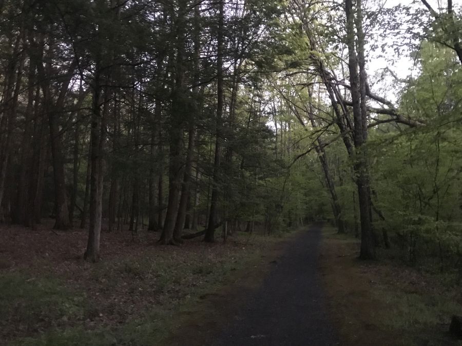
Typical trail conditions on the O&W Rail Trail
There aren’t a lot of services or stores immediately next to the trail. So you’ll want to pack some food to bring with you. If you need to stop for supplies, your options are basically in Hurley, near the parking lot at the north end, and at Big E’s deli where the trail crosses Cottekill Road. There are also some shops in High Falls if you get off the trail and cross the Roundout Creek.
This section of trail is more or less continuous until you reach the hamlet of Accord, where the trail peters out in a lumberyard. From here you will need to continue along Lucas Turnpike and Route 209 if you want to keep going. These roads can be kind of busy and aren’t the greatest for riding, but more advanced riders should be OK.
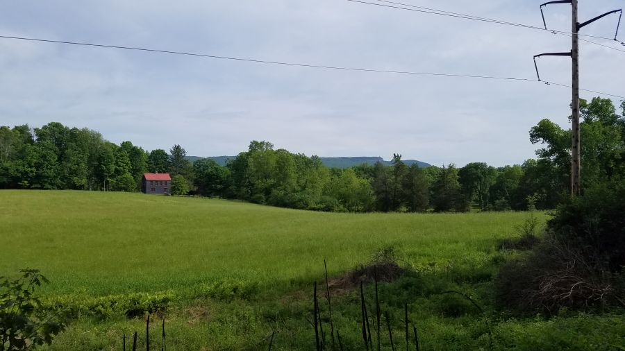
A view of the Shawangunk Ridge from the O&W Trail
When you reach the center of Accord, you will need to go through town and cross the Roundout Creek. There aren’t that many stores or services here, despite it being the center of town. You will need find your way over to Rochester Town Park by taking County Road 27 to get to the next segment of trail. But you may have to ride through the park for a while until you can figure out where the trail is. Just look for the dump trucks and the trail should be behind them. The trail is kind of rough here again, and it only goes for 4.3 miles until the next gap in the trail in Kerhonkson. But you will ride along the Roundout Creek the entire time with great views of the Shawangunk Ridge.
In Kerhonkson, if you want to keep riding, you’ll need to use Berme Road for 3.4 miles and it will take you to one last piece of trail – 1.2 miles in Ellenville. But it’s still a nice ride! Kerhonskon also has a couple of restaurants, a brewery and a resort hotel making it a nice place to end your ride as well.
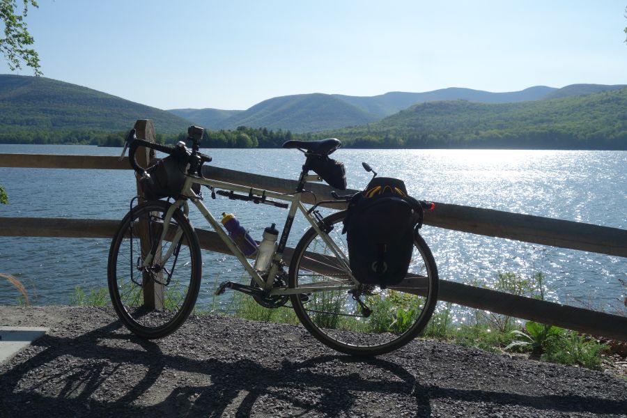
If you are looking for one of the most glorious 10- to 20-mile bike rides you can do in the Hudson Valley, look no further than the Ashokan Rail Trail. This trail was recently opened in the fall of 2019 and is one of the region’s newest and best constructed trail facilities. While the trail is unpaved, the surface is a smooth crushed stone that is suitable for most bikes. The trail is also very wide, ranging from 10 to 12 feet in width, which is a lot wider than most bike paths in our region. The result is a beautiful trail experience that feels uncrowded. It’s also a great trail to do over a weekend, for example, by combining it with the Catskill Scenic Trail.
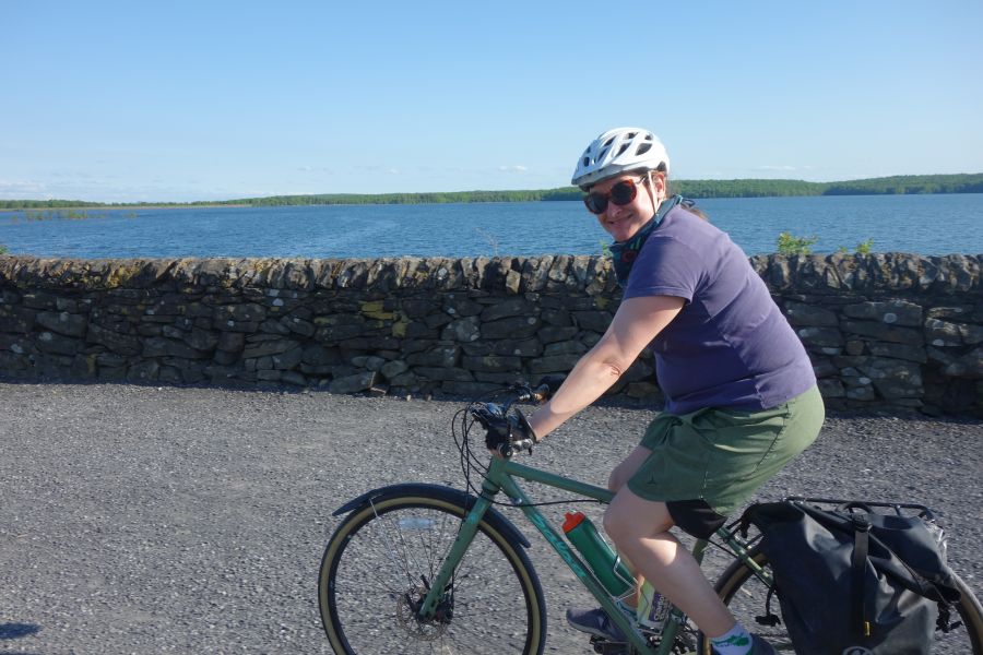
Perhaps the best part of the Ashokan Rail Trail is its views of the Ashokan Reservoir. The Ashokan is one of the largest reservoirs in the NYC water supply system. However, access to the water is very limited, with only a few roads and pathways going up to the water’s edge. This trail has several stunning viewpoints of the reservoir, often with the Catskill Mountains in the background. There are many places to stop and enjoy the view. In between the lakeside viewpoints, the trail is mostly shaded by surrounding woods. This makes the Ashokan Rail Trail a nice place to ride in summer. And of course in autumn, the trail is an explosion of fall color!
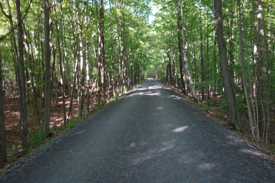
The Ashokan Rail Trail is 10-12 feet wide and paved with crushed stone. Many sections are wooded, offering shade and lots of color in autumn.
The Ashokan Rail Trail has a very good website that explains all aspects of the trail along with providing a map of the trail. The map is very useful in guiding you towards the three parking lots along the trail, which runs east to west. The Boiceville Bridge Trailhead parking is at the west end while the Woodstock Dike Trailhead is at the east end. Both trailheads have scenic viewpoints near them and all parking lots have portable toilets. A third parking lot is located in the center of the trail in Shokan. When you park, be aware that some of the spaces in the lot are reserved for anglers. Many of the creeks which feed the Ashokan Reservoir, including the Esopus Creek, have excellent fishing. All parking lots have excellent signage directing you to them from NYS Route 28, which is the main corridor route through this part of the Catskills, connecting Kingston to Belleayre.
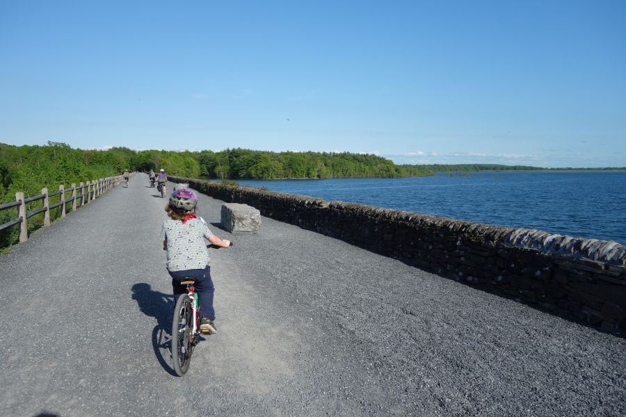
Riding across the Glenford Dike offers great views of the Ashokan reservoir.
Despite its rural location, the Ashokan Rail Trail is also served by public transit, since the trail follows the general alignment of Route 28. Ulster County Area Transit Route Z provides this service, and the bus has bike racks for you to use. In addition, you can also take Pine Hill/Adirondack Trailways buses to this trail on any route that travels down Route 28. However, you would need to put your bicycle in some kind of box to do this.
If you aren’t lured to the Ashokan Rail Trail simply for its magnificent views or great riding conditions, the fascinating history of this area is another reason to visit. The trail is built on top of the rail alignment for the Ulster and Delaware Railroad. This railroad, which initially began construction in the 1820’s with the intention of connecting the Delaware and Hudson Canal in Kingston with Oswego along Lake Ontario, was ultimately scaled back to travel between Kingston and Oneonta. As the only railroad that went entirely through the Catskills, the Ulster and Delaware played a crucial role in transporting agricultural products, timber, bluestone and coal. It also offered robust passenger service for tourists vacationing in the Catskill Mountains. While the final train ran in 1976, there are still portions of the line that are used by scenic railroads, such as the Catskill Mountain Railroad which operates in Kingston, and the Delaware & Ulster Railroad which operates in Arkville. The Trolley Museum of New York also maintains and operates trains on the easternmost portion of the line along the Kingston waterfront. In between where these railroads operate, there are sections of the railroad that have been converted into bike paths, such as the Ashokan Rail Trail, the Catskill Scenic Trail and the Kingston Greenline. The Catskill Rail Explorers also offers unique pedal-powered rail cars on a section of track as well. Along most of the line you can still see many railroad artifacts as well as some station buildings which have either been abandoned or repurposed, such as the Empire State Railway Museum.
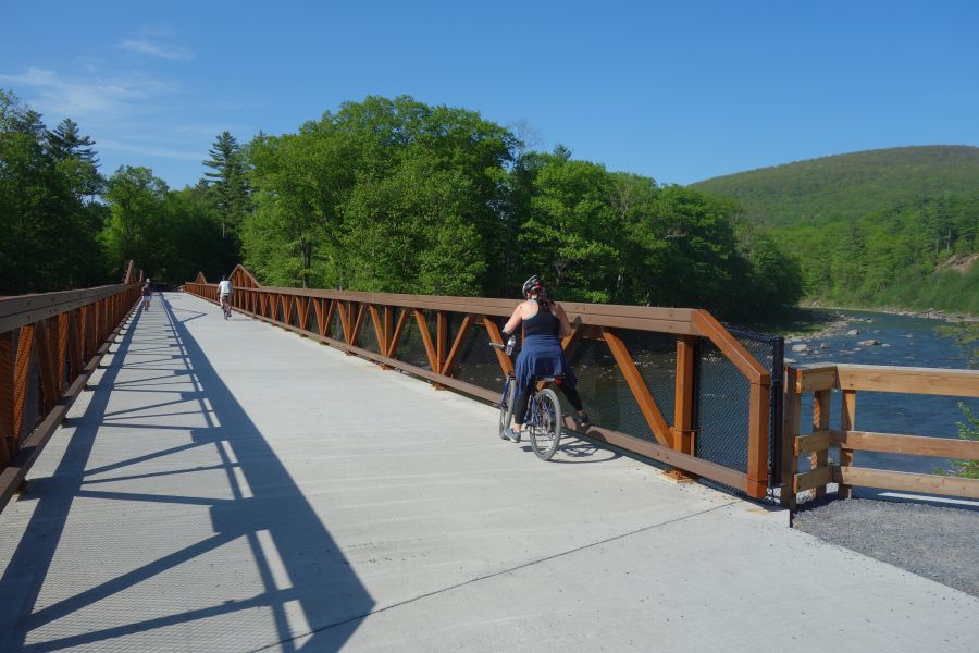
The Boiceville Trestle crosses the Esopus Creek and was reconstructed to accommodate the trail.
In addition to railroad history, the Ashokan Rail Trail also offers insight into the history and construction of the Ashokan Reservoir, which was constructed between 1907 and 1915, and displaced twelve communities containing 2,000 residents. While some of these communities were relocated to upland locations, you can still see the foundations of some of the buildings from the original communities in the reservoir when the water levels are low.
The Ashokan Rail Trail has several interpretive panels along the length of the trail that tells the history of both the railroad, the reservoir and the surrounding area. You can view the panels before you make your trip on the website.
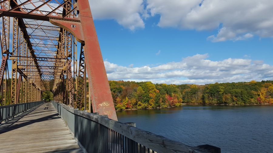
If there is one bike path that most closely resembles a trunk-line, main artery for bikes in the Hudson Valley region, it is the South and North County Trailway in Westchester County. This trail, which runs continuously from Bronx/Yonkers border for almost 50 miles to the Village of Brewster in Putnam County, is the centerpiece of Westchester’s trail network and one of the most popular parks in this part of the region. It also features prominently in our Hudson Valley Craft Brewery Bike Tour, which is our most popular tour.
Although this trailway is typically viewed as one long bike path, it is technically made up of four separate trailways with different names (and different maps). The South County Trailway runs between Van Cortlandt Park at the Bronx/Yonkers border to Old Saw Mill River Road, which is the border between the Towns of Greenburgh and Mount Pleasant. North of Old Saw Mill River Road, the path is the North County Trailway until you get to the border between Putnam and Westchester Counties where the path becomes the Putnam Trailway. The southernmost segment of the trail, which goes through Van Cortlandt Park in the Bronx, is named the Putnam Greenway.
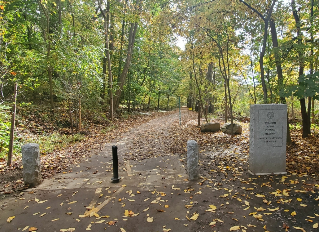
A stone marker lets you know you are crossing into New York City on the Putnam Greenway.
Although the name changes four times, and you need four different maps for it, the trailway is basically the same throughout. This was once a train line, known as the Putnam Division of the New York Central Railroad. It was first constructed as the New York City & Northern Railroad in 1881 when mining operations were abundant in Putnam County. Passenger service continued until 1958, but it was never as successful as the Harlem or Hudson lines (both of which continue as Metro-North train lines today) probably because riders needed to transfer in the Bronx to continue their trips to Manhattan. After passenger service ended, freight service continued until 1982 at which point the right-of-way was transferred to the New York State Department of Transportation. Then Westchester County and Putnam County both constructed trailways on the alignment as county parks. The New York City portion of the right-of-way remained a dirt path until it was finally paved in 2020.
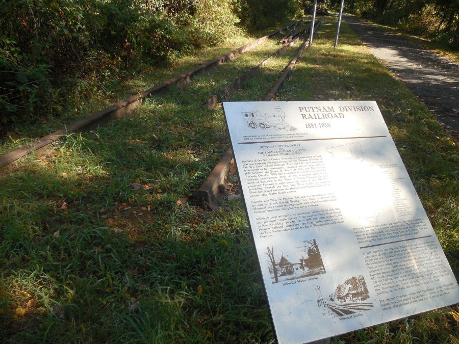
Historic panels along the trailway tell you about long lost train stations.
This trailway corridor has been constructed piece-meal over several decades. The first segments were constructed by Westchester County in the 1990’s. The last piece was opened in 2017. What this now means is that there are sections that are relatively new, and in great shape….and there area also old sections that are in very rough shape. The conditions can change dramatically as you ride. The good news is that some of the older sections are now being reconstructed and are better than ever. The bad news is that this construction will take many years to reach all of the spots that need it, so some of the segments will stay rough and bumpy for a while longer. You’ll also have to deal with interruptions in the trail due to construction.
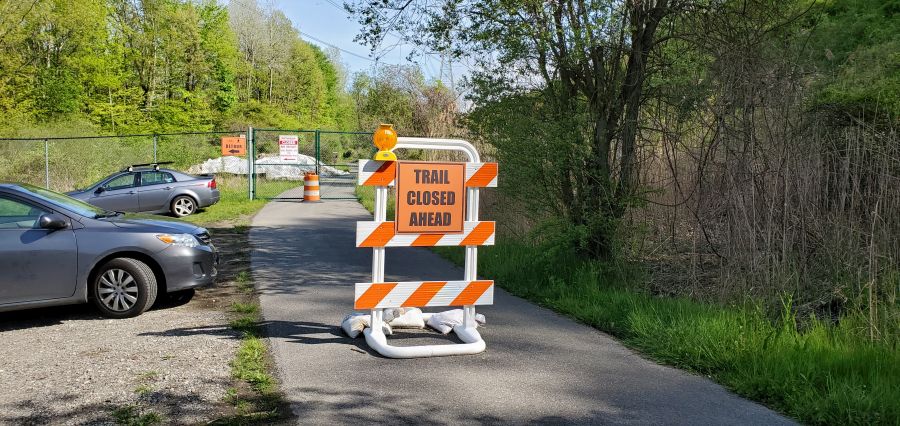
Uh oh…a surprise construction closure means you get to make a detour. At least this part of trail will be brand new the next time you come back.
If you are looking to ride the trail, the good news is that there are many parking lots along the path. Parking lots are shown on the various maps for the trail. Biking to the trailway from somewhere else can be hit-or-miss, depending on where you are. Many of the roads that cross the trail are busy and have no shoulders on them, since this trail goes right through the heart of car-oriented suburbia. The only nearby public transit options are at the south end (the #1 subway at Van Cortlandt Park) or the north end (the Brewster Metro-North station). So transit works well if you want to do a 50+ mile ride. If not, you’ll probably end up riding “out and back” from wherever you parked your car. The only way to do a shorter distance as a one-way ride using transit is to do our Hudson Valley Craft Brewery Bike Tour, where we shuttle you back to the train after riding 35 miles.
When riding this trail, you will also need to carefully think about services, since there are long stretches with no restrooms, stores or restaurants. So you may need to pack a lunch or at least plan where you may want to buy it as well as think about bathroom breaks. This trail is busy, and often times there is little room on each side of the path, so sneaking into the woods to pee isn’t always an option. (Again, another advantage of our bike tour…we tell you where the restrooms are and we arrange a picnic lunch for you.)
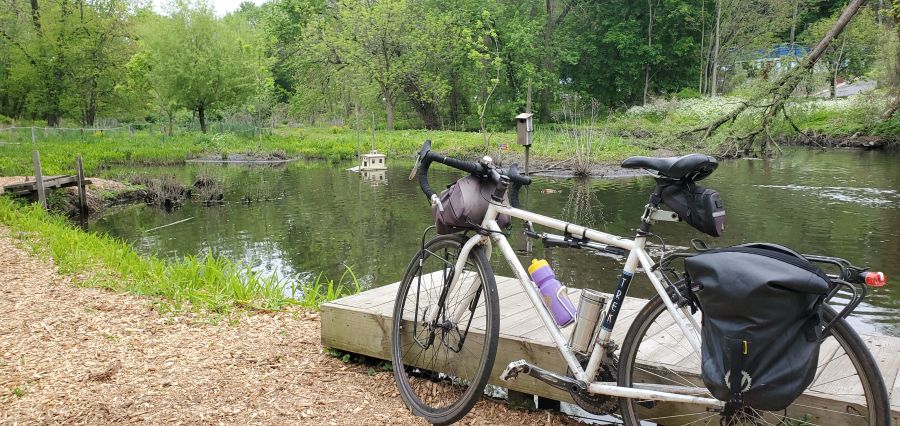
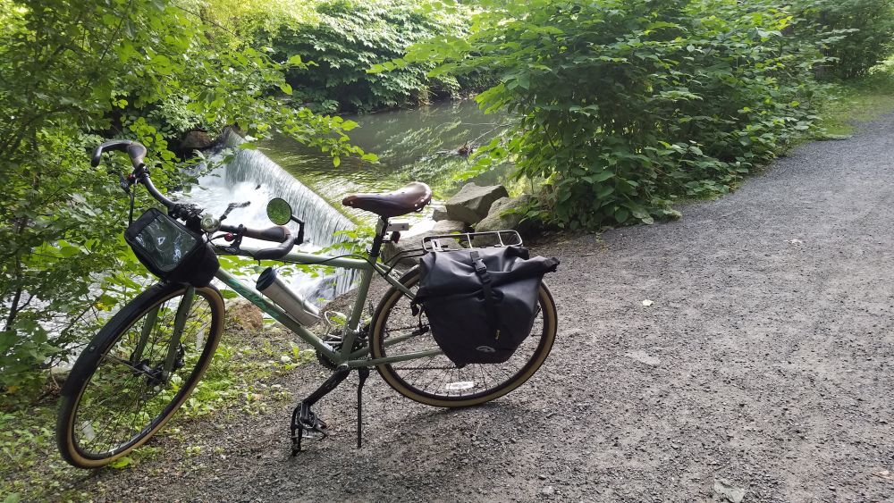
A beautiful spot to take a break along the Saw Mill River and observe wildlife.
This trailway also has an interesting relationship with the towns it goes through. Most of the South County Trailway is along the Saw Mill River, often squeezed between the river itself and the Saw Mill Parkway. So these were industrial areas, not downtown areas. Most of the factories are now gone, having left decades of pollution in the muck of the Saw Mill River next to empty brownfield sites, some of which have been redeveloped. One site was redeveloped with a shopping center with a variety of restaurants and a Starbucks. So that makes a good break stop, although you will have to get across the Saw Mill Parkway at a traffic signal.
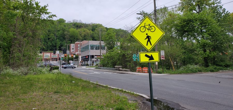
A shopping center is located on the other side of the parkway from the trail. Cross at the light to get there.
While the South County Trailway goes directly through the downtowns of two villages (Ardsley and Elmsford) the immediate areas surrounding the trailway are still industrial and you’ll need to ride around (on busy roads with no shoulders) to find that Dunkin Donuts with the bathroom or that pizza shop for lunch. Ardsley is particularly tricky since the only access point to the Village is through a school bus depot and it’s a tangle of roads to get to the main part of town.
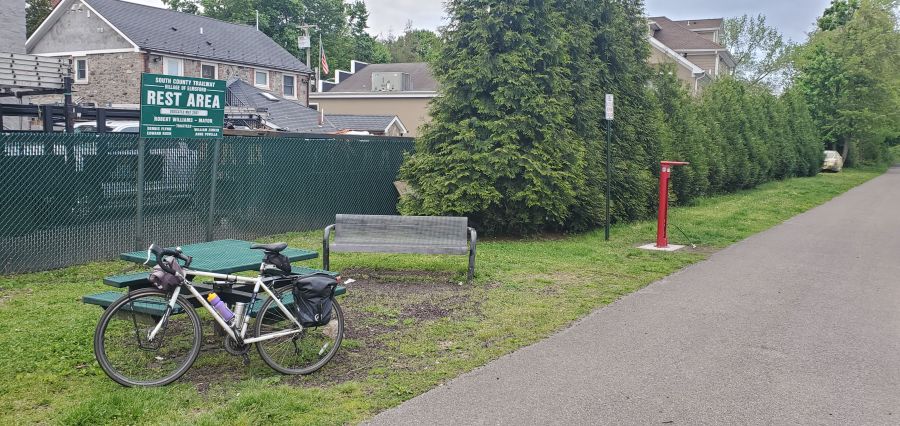
The Village of Elmsford welcomes you with this picnic area and bike repair station. There is no restroom here.
The North County Trailway does a little better in terms of taking you through downtown areas with restrooms and lunch places. The old Briarcliff Manor train station was converted into a library, and it is a great stop for a bathroom break (but there are no stores). Further up the line, Millwood has convenience stores, a deli and a supermarket. But perhaps the easiest towns for services are Yorktown Heights and Mahopac since the trail goes right through the center of those places. Yorktown Heights is one of the few places left where an old train station building remains. The local chamber of commerce has also placed maps of the town along the trail to help you find nearby services while also telling you about Yorktown’s other attractions. While there are many choices here, it helps to know where to go since the town is mostly a cluster of suburban shopping centers, many of which have substantial vacancies. Finding a restroom here is also tricky. Mahopac also has a lot of choices as well as another library right along the trail (another great restroom stop). Food choices in both towns are good, particularly if you like pizza. You get pizza that’s the real deal in these towns, although no pizza shops are directly along the trail.
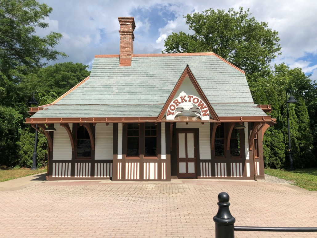
The historic Yorktown train station is currently being restored to its former glory…but it will not have a restroom for you to use.
From Mahopac and north you are on the Putnam Trailway. Although the entire corridor is a relatively flat rail trail, the Putnam Trailway has some of the steeper grades. But you will be rewarded by going through some very densely wooded areas with tall trees that burst into color in the fall. You will also get to experience a number of tall bridges as well as a causeway that goes across a reservoir. North of Mahopac you’ll go through Carmel, more or less through the center of town, but not always super close to businesses. And again, there are no restrooms along the trail.
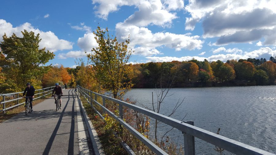
The crossing of the West Branch reservoir is another highlight of this great bike path.
The trailway ends unceremoniously in the Village of Brewster across from Miggins Screw Products and the entrance to the Metro-North rail yard for the Harlem Line. To get to downtown Brewster (and the train station) you will have to ride over a steep hill and then on a busy road to reach the center of the village. There are a number of restaurants and stores here. The Brewster train station also has a restroom, but it is often out of order, so don’t count on it.
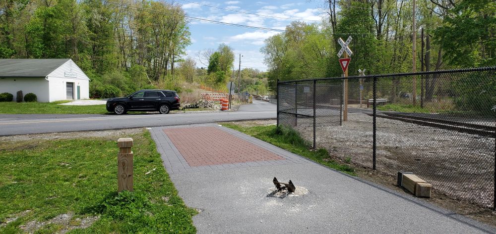
The trail ends unceremoniously across from Miggins Screw Products, next to the Metro-North rail yard.
The Bronx River Valley has been a corridor for transportation and industry throughout New York’s history. As the only fresh-water river in NYC it played an important role in industry, with many mills set up along its banks, the remnants of which can be seen in the many “waterfalls” you see along the river flowing over dams that date back to the 19th century. The Bronx River Valley has also been an important transportation corridor dating back to the 1840’s when the New York and Harlem Railroad was constructed (now the the Metro-North Harlem Line) and the construction of the Bronx River Parkway in 1907 as the first parkway to be constructed in the United States.
One of the innovations of parkway construction at the dawn of the automobile era was the preservation of lands along each side of the roadway as dedicated parkland. This parkland has allowed for the development of one of the region’s best bicycle paths. While not fully complete, you can ride 25 miles between the source of the Bronx River in Valhalla to and the mouth of the river at Claisson Point in the Bronx by using existing trail segments and roads that fill in the gaps. Eventually, both the City of New York, with the help of the Bronx River Alliance, and Westchester County are committed to constructing a trailway along the river’s entire length. But for now, you can ride the whole river mostly on bike paths, so long as you are OK with detours onto nearby streets.
One of the nicest attributes about the Bronx River Greenway is that it connects many downtown areas with restaurants, services, train stations and parking. So you are never far from services and this is an ideal ride to do one-way and take the train back, since the bike path follows the Metro-North Harlem Line closely. So whether you want to ride a little, or a lot, the Bronx River Greenway is a great choice for a day out on a bike that is close to home. During spring and autumn you can also combine your ride with Bicycle Sundays which involve the closure of the Bronx River Parkway for bikes and pedestrians between Yonkers and White Plains.
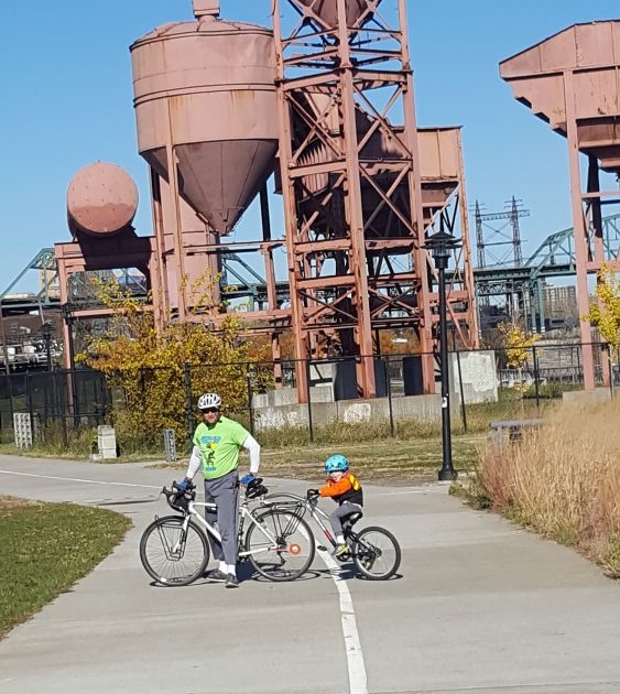
In the Bronx, the Greenway takes you though a series of smaller parks, such as Concrete Plant Park.
Let’s take a look at the route from south to north. For an overview of the route in both the Bronx and Westchester, click here. Use this map to guide you as you read, since your ride will take you through many different park areas and then on streets in between. But this map is not a recommended route. Please consult the various other maps we call your attention to later in this article. To start with, you may also want to check out the maps and cue sheets on this webpage.
Classon Point is at the south end. There is a dock here that gets regular NYC Ferry service which is a great way to arrive with your bike if you are coming from Brooklyn, Queens or Manhattan. Parking here is also relatively easy to find. From here you will ride through a series of parks with a little on-street riding in between each. Head directly out on a bike path which takes you through Soundview Park along the tidal flats of the mouth of the Bronx River. Then with a little knowledge of local streets from a map, you can get across the Bruckner Expressway to Concrete Plant Park. From here the route is well put together, with signage and a protected bike lane along the decommissioned Sheridan Expressway (now Sheridan Boulevard) which leads to Starlight Park.
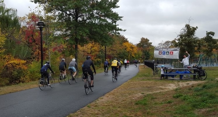
Cheering on riders in Starlight Park during the Tour de Bronx in October
North of here, the park land is interrupted as you go through the bustling West Farms neighborhood. This is a major transit hub for subways and buses, so it’s a good starting point if you want to take the subway to get to the ride. You can also try your luck with parking here since there is good highway access at this particular spot. Again a map is helpful getting you through the neighborhood streets. Watch out for cars!
The good news is that it’s only a half mile of on-street riding and then you are back on a nice bike path starting at 180th Street. At this point you are going to be on a path for a while as you go through Bronx Park, so relax and enjoy. If you are interested in an odd piece of New York history, take a very small detour to the East 180th Street subway station, which used to be a train terminal for the now-defunct New York, Boston and Westchester Railroad. Both the 2 and 5 trains stop here and the 5 continues on along the old NY,B &W route to Dyre Avenue.
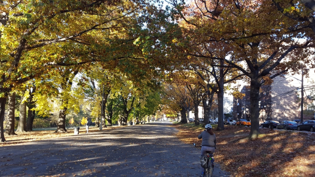
The Bronx River Greenway in Shoelace Park is wide and straight.
Once you are on this bike path, everything is straightforward and well marked almost until you reach the northern border of NYC. There are also plenty of restrooms and water fountains (usually found at playgrounds) along the way. The only challenging section is where you need to cross Pelham Parkway. This is a busy street that is difficult to cross. So take your time and use the pedestrian signals. Or check out the neighborhood and get a snack or lunch while you are there.
After about 4.3 miles of riding on this path, you will reach Woodlawn Heights, which is where NYC ends and Westchester County begins. The bike path here continues north of 233 Street, but it is a dead-end bike path that goes to Muskrat Cove, a quiet little spot along the Bronx River in between the parkway and the railroad. So if you want to check it out, you’ll have to go back to 233 Street again. Be aware of homeless encampments if you go on this bike path. From 233 Street you are looking at 4 miles of on-road riding to get to the next trail segment. So you may want to take a break here and grab lunch while you figure out the best route for you to ride. The Woodlawn Heights neighborhood is famous for Irish restaurants. Or you can head up Bronx Boulevard and get great jerk chicken and BBQ from the Cookmaster who sets up shop most days in the summer on the sidewalk in front of a self-storage facility.
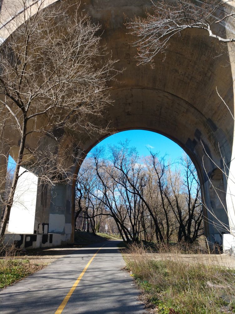
The ride to Muskrat Cove goes under the looming Nereid Avenue Bridge.
There is a lot of debate about the best on-road route to connect the Bronx and Westchester segments of this trail. On our map we use a jumble of streets in southeast Yonkers that takes you to Kimball Avenue, which is a relatively wide 2-lane road. It’s a mystery why the City of Yonkers doesn’t stripe this road with bike lanes. If you go this way, you will need to be careful riding past Cross County Shopping Center because there are a lot of cars here. But north of the mall you’ll ride through Sarah Lawrence College, which is a nice change. Right after Sarah Lawrence the bike path starts up again. Another route is offered on these cue sheets. You should decide the best route for you.
This 4 mile gap will probably be the least pleasant part of your ride, since there are no signs to guide you and you will be on streets with cars. Rest assured, Westchester County will eventually construct a bike path for this segment, but it has been hard to engineer using the available land. If you don’t want to ride this part, you can also ride Metro-North railroad with your bike between the Woodlawn Station and the Bronxville station. Trains run every 30 minutes on weekends and you can bring your bike on board for this 8 minute ride.
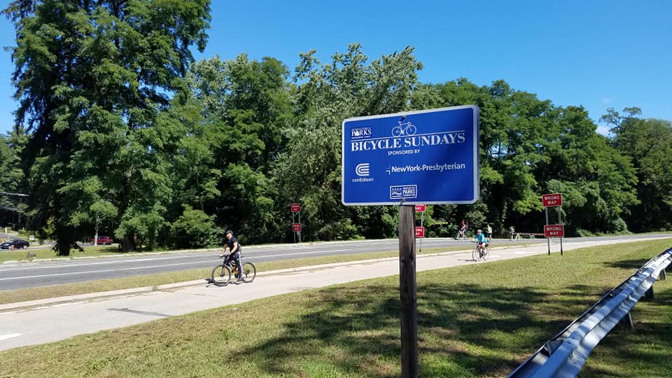
On Sundays during spring and autumn, the Bronx River Parkway is closed to cars.
Once you are in Bronxville, the final 11 miles of your ride are going to be pretty nice as you ride a bike path through the Bronx River Reservation. While there are few directional signs here, the bike path is (mostly) intuitive. The path also closely follows the Metro-North Harlem Line with direct access to several train stations which is perfect for getting to the trail and then back home again. There is also free parking at many of these stations on weekends if you want to drive to the trail. Westchester County Parks has also produced a nice map of this trail showing access points and parking.
Once you are north of Scarsdale Road in Yonkers, the bike path parallels the section of the Bronx River Parkway that is closed on Sundays in the spring and fall for “Bicycle Sundays”. So if you are doing your ride on a Sunday, you can choose to ride on the bike path or on the parkway itself. Either way, you’ll go directly through the center of a number of downtowns offering places to get lunch. Restrooms, however, are harder to find. Once you are north of Scarsdale Road, the path is continuous until the end.
The section just south of White Plains is great for cross-country skiing when it snows.
When you get to White Plains the bike path goes under two roadway bridges. Ring your bell if you have one as you approach the bridges because there are sometimes homeless people under them and you’ll want to give them a heads up. They won’t bother you. White Plains is a busy place, but if you are tempted to get off the trail and explore, be aware that the streets in White Plains are very inhospitable to bikes and, unless you like brutalist architecture, there aren’t a lot of places worth checking out unless you ride several blocks into the core of downtown. There is, however, a hot dog stand right next to the trail that is popular with local cyclists.
After the bridges and the hot dog stand, the bike path goes through a large parking lot associated with the Westchester County Center. They have restrooms here, but you’ll have to cross the parkway using a pedestrian signal to get to them. You can also park here, but you have to pay a fee.
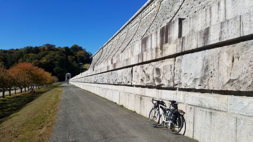
Kensico Dam Plaza is a bold visual finish to your ride.
The final 3 miles of the pathway between White Plains and Kensico Dam Plaza is a relaxing finish to the ride. There is plenty to explore at Kensico Dam, including a hike to the top of the dam. On weekends there are also a number of cultural festivals that are held here. From the dam you are a short bike ride to downtown Valhalla which has several nice restaurants which are perfect for the end of your ride. There is also a Metro-North station here if you want to get back to the city. Parking at Kensico Dam Plaza is free, so you could also start here and ride this bike path in the reverse order if you wanted to.
Now that it’s April, many cyclists are dusting off their bikes and heading out for their first ride of the season. And off-road bicycle paths are often the first places cyclists look to for those early season warm-up rides. The good news is that there are a lot of exciting bike path improvement projects heading to our region for 2019. Check out our updates below. And if you know of any other bike path improvement projects in the pipeline for this year, email us and we’ll update this posting again with the new information.
Don’t forget that there are great websites out there that catalog all the bike paths and bike routes in our region. These websites are great resources if you are looking to ride someplace new. Here are a few to check out:
https://www.facebook.com/njbikemap/
OK, on to the updates:
North County Trailway – Westchester County
The North County Trailway is one of three trailway segments that was constructed on the abandoned Putnam Division of the New York Central Railroad. Because the North County Trailway was also one of the first segments to be constructed on this rail line, some portions of the trail are now more than 20 years old and are in disrepair. However, the entire length of this trailway segment, between the Putnam County line and Old Saw Mill River Road in Tarrytown, will be resurfaced and repaired during 2019. If you ride the trail this year, be prepared for trail closures to occur anywhere along the trail. It may be worth checking the Westchester County Department of Parks, Recreation and Conservation Facebook page to see if they have information about trail closures before you head out for your ride. This trail is the prominent feature of our Hudson Valley Craft Brewery Bike Tour. If you do our tour, we can give you advance information of trail closures and we can shuttle you around them if they are impassible.
Harlem Valley Rail Trail – Dutchess and Columbia Counties
If you’ve ever taken the Metro-North Harlem Line train all the way to the end, you’ll notice that the Harlem Valley Rail Trail begins where the train tracks end. That’s because this rail trail was constructed atop the railroad abandonment, which constitutes all of the rail right-of-way north of the Wassaic station. This is one of the region’s most beautiful rail trails and it is a highlight of both our Hudson Valley Bike Tour and the Harlem Valley Rail Ride and Festival.
Over the years, it has been a challenge to construct a rail trail on top of the entire former rail line. An 8-mile segment has always been missing in between the Village of Millerton and Under Mountain Road in the Town of Ancram, which has necessitated that riders go on hilly (but beautiful) back roads to ride the whole trail.
However, construction has begun on this missing piece of trail and it is expected to be complete by October 2020. This will be a major undertaking requiring 4,100 feet of elevated boardwalks and the rehabilitation of six bridges. But when it is completed, it will surely be an amazing bike path. Read the whole story here.
Ocean Parkway Shared Use Path Extension – Long Island
If you are familiar with Jones Beach State Park, you might know about the Ocean Parkway Coastal Greenway, which is a great bike path that follows Ocean Parkway. Later this year construction will begin to extend this bike path for an additional 10 miles between its current terminus at Tobay Beach and Captree State Park. This bike path will greatly increase the amount of shoreline that is accessible by bikes in both Nassau and Suffolk Counties. The bike path is expected to be completed by the summer of 2020.
Verrazzano Bridge Summer Streets – Brooklyn and Staten Island
Have you ever done Summer Streets in Manhattan? It’s great. For three Saturdays every August, the City shuts down Park Avenue just for bikes.
It appears that support may be building to do the same thing on the Verrazanno Narrows Bridge. https://www.bikesbk.org/verrazzano-summer-streets/
The lack of a bike path or sidewalk on the Verrazanno Narrows Bridge has long been an issue for people looking to bike between the two heavily populated boroughs. The MTA has attempted to address this by providing bicycle racks on the S53 and S93 buses, but there is still a push to allow cyclists to simply ride across the bridge. This may be accomplished this summer if the Verrazzano Bridge Summer Streets intiative moves forward.
George Washington Bridge
A large number of cyclists (3700 per weekend day) routinely cross the George Washington Bridge, which was built in 1931 with narrow 7-foot wide sidewalks. The Port Authority of New York and New Jersey is currently undertaking a construction project to “Restore the George” which is anticipated to be completed in 2025. Because construction may impact the ability for cyclists to access the bridge sidewalks, the Port Authority recommends cyclists sign up for text or email alerts about sidewalk closures. Find out more at: https://www.panynj.gov/bridges-tunnels/gwb-pedestian-bicycle-info.html
However, it is important to note that the Port Authority’s “Restoring the George” project will not do much to improve bicycle mobility across this bridge, since the project is more or less only considering “replacement in-kind” of the existing sidewalks. To advocate for better improvements, all non-motorized users of the George Washington Bridge are strongly encouraged to go to https://completegeorge.org/ to learn more about how you can advocate for a better plan.
Mario Cuomo (Tappan Zee) Bridge
And finally, as this blog reported back in October of 2018, the long-awaited “shared use path” on the new Mario Cuomo Bridge is set to arrive later this year. This will be a major, major improvement for cyclists and pedestrians in the Hudson Valley. Check it out!
The Tappan Zee Bridge never made a lot of sense. Why does it cross the Hudson River at its widest point? And why was a bridge like this ever built without a sidewalk or bike path? For over 50 years this bridge has existed to only serve motor vehicles. But the new bridge that has just replaced it will fix that. Yes, the new Tappan Zee Bridge (now called the Governor Mario M. Cuomo Bridge) will finally have a lane just for bicycles and pedestrians!
Finally, communities in both Westchester and Rockland Counties will have a way to bike from one side of the river to the other. This is hugely important for increasing non-motorized mobility. What’s more, it also increases the potential for bicycle tourism. And Gotham Bicycle Tours will be offering a new tour in 2019 that goes over the new bridge. As always, it will be transit accessible from NYC…and a beautiful ride.
In the meantime check out the new animation which was recently released by state government that shows what the new bike path will look like. There will even be scenic overlooks built into the pathway, with catchy names like “Fish and Ships”.
By Mark Lungariello, Rockland/Westchester Journal News
Original site of article: https://www.lohud.com/story/news/local/westchester/2018/10/09/westchester-oks-8-7-m-update-north-county-trailway/1564040002/
Published 6:00 a.m. ETOct. 9, 2018 | Updated 7:41 a.m. ET Oct. 9, 2018
Westchester County lawmakers will spend $8.7 million to improve the North County Trailway, a 20-mile trail from Putnam County down to Eastview.
It’ll be the first major construction project on the popular trail since it was built in sections in the 1980s.
The county Board of Legislators voted on Oct. 1 to unanimously approve borrowing for the project, which is estimated to last 14 months once it begins.
Safety enhancements will include work to a 500-foot bridge over the Croton Reservoir in Yorktown, which lawmakers said has been used occasionally by thrill seekers to jump into the reservoir. Work will include curved fencing and spikes to discourage people from climbing around the fence.
New York State owns the trailway and Westchester has leased it since 1994, but the county legislature has asked the administration of County Executive George Latimer to try to strike up a deal to take ownership of the property. But lawmakers approved another 25-year extension lease at a $1 cost to Westchester while negotiations are sparked.
Although the state owns the property, the county is responsible for any injury, property damage or death claims. The county approved a $3.2 million settlement with the family of a bicyclist who died after crashing on a stretch of the trailway in Yorktown.
The property runs through the towns of Mount Pleasant, New Castle, Yorktown and Somers. It connects to the South County Trailway, which runs to Westchester’s border with the Bronx. Lawmakers OKed this month another $300,000 for a study and design preparation to an area of the South County Trailway, particularly a stretch near Yonkers’ border with Hastings-on-Hudson.
The following is a re-posting of an article from the Millerton News, a local newspaper in the Village of Millerton. The article was published on July 25, 2018 and was written by Kaitlin Lyle.

MILLERTON— Once again, the Harlem Valley Rail Ride has brought together cyclists from across the state to experience the region’s beauty on Sunday, July 22.
Organized at Eddie Collins Field, cyclists could pitch a tent on Friday, July 20 until Monday, July 23.
There was a free bonus warm-up ride with a choice of a 12-mile route up the Harlem Valley Rail Trail or a 25- to 35-mile route.
Whether emerging from their tents or riding their bikes, cyclists from all walks of life and levels attended the ride. Cyclists could enjoy a 100-mile route, a 72- to 80-mile route, a 45- to 57-mile route or a 23- to 33-mile route.
On top of their preparations for their ride around the Harlem Valley, cyclists enjoyed breakfast underneath the park pavilion. Despite the gray clouds overhead and hint of rain on the way, they were determined to put the pedal to the metal as they had chosen.
Whether they were riding solo, with their loved ones or making friends on the ride, there was a discernible camaraderie at summer’s most beautiful ride.
On top of enticing cyclists from all around the state, the event motivated a couple organizations from the surrounding area to lend a hand.
Underneath the pavilion, members of the American Legion Post 178 in Millerton cooked up a storm, serving breakfast and lunch. The Dover High School basketball team volunteered by parking cars and doing other similar tasks; a donation was made to the team. Gotham Bike Tours helped set up the tents for campers overnight in addition to picking visiting cyclists up and bringing them back to the train station. All the way from the Westchester Beemers Motorcycle Club, volunteer “motos” offered free motor service to cyclists in need.
With the storm slowly rolling in, volunteers checked on cyclists who were still on the road. While the weather had its sunshine and dark clouds, cyclists made their way back to Eddie Collins Field.
“I think this event is really good for Millerton,” said Lukas Herbert from Gotham Bicycle Tours. “It really puts Millerton on the map and brings people out, especially city people who have never heard of it.”
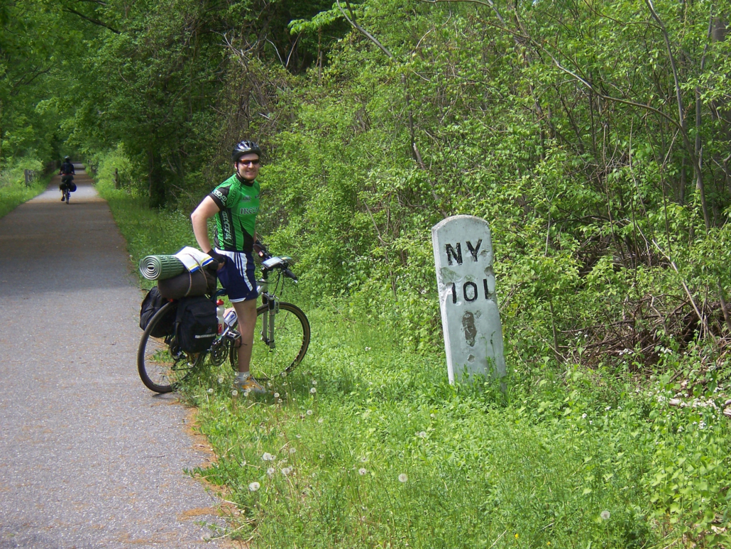
The Harlem Valley Rail Trail is one of the most beautiful rail trails in New York State. It’s also one of the easiest to get to since begins in a Metro-North train station parking lot. The Harlem Valley Rail Trail also has lots of amenities along it’s route including farmers markets, restaurants and swimming holes. It’s the perfect getaway for a day ride. And it also makes for a great destination for two of the tours we offer at Gotham Bicycle Tours: our Hudson Valley Bike Tour and our Harlem Valley Rail Ride Weekend. We also run private tours on this trail, because it is so nice!
The Harlem Valley Rail Trail can trace its history back to 1852, when the New York and Harlem Railroad was constructed as far north as Chatham, New York. The New York and Harlem was one of America’s oldest railroads, which was eventually absorbed into the New York Central, and ultimately into Metro-North Railroad as the Harlem Line. However, by the time Metro-North Railroad acquired the line, commuter rail service only went as far north as Dover Plains, with the rest of the line being abandoned.
Fortunately in the late 1990’s, Metro-North undertook an extension of the Harlem Line to Wassaic, NY. As part of the extension, the Harlem Valley Rail Trail was built on top of the abandoned rail alignment north of Wassaic. With this project, the first “intermodal” train to bike hub was created in the New York Metro region.
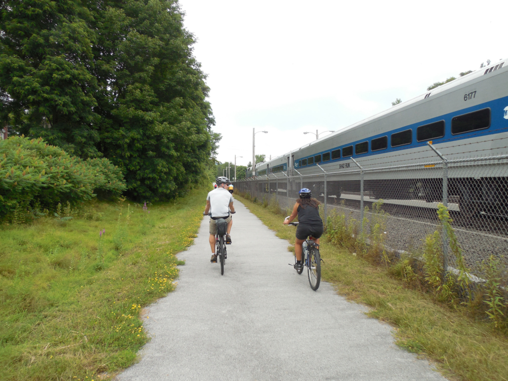
The trail goes right by the Wassaic Metro-North station.
The Harlem Valley Rail Trail is currently open as a 23 mile trail between Wassaic and Copake Falls. Full information and maps can be found at the Harlem Valley Rail Trail Association’s website at: http://hvrt.org/
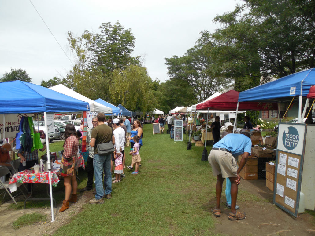
The amenities on this trail are some of the best around. There are always plenty of places to eat in Millerton, 11 miles north of the trail start in Wassaic. On Saturdays you can even grab lunch at a great farmers market that has all kinds of wonderful food from all of the farms you just rode past on your bike.
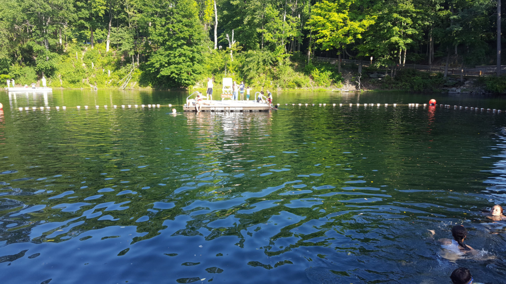
As you push north, you’ll pass Taconic State Park in Copake Falls which has camping, a waterfall hike…and a great lifeguarded swimming hole in an old quarry that is super refreshing on a hot summer day.
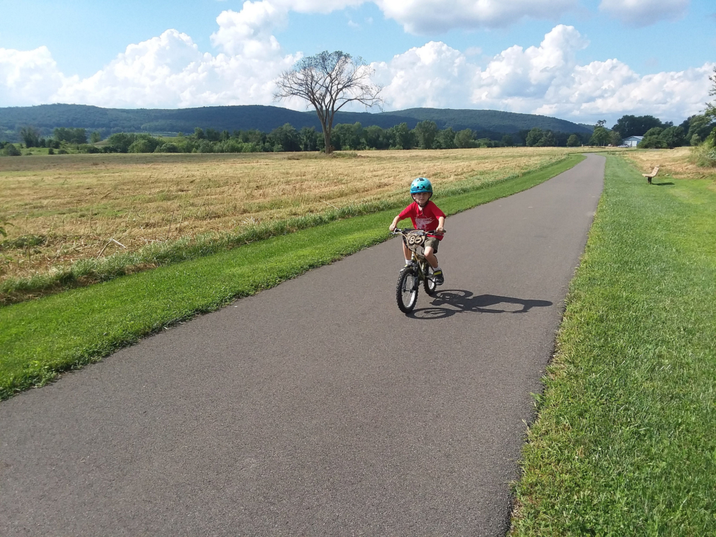
Just north of the park is one of the most scenic segments of the trail, where you ride through a lush valley. The first time we rode through this spot with our 6-year old son, he asked us “is this God’s world?” because it looked like the pictures he had seen of Heaven!
A favorite pastime for many cyclists is to do a big ride that ends at a craft brewery destination. There’s nothing better than enjoying a beer at the end of a big ride! But getting back on that bike after drinking that beer can be tough going…or even dangerous if you’ve had a few too many. Unless the brewery you’ve ridden to is next to a train station, or you’ve made plans to have someone pick you up, riding those final miles after your brewery ride can be a challenge.
That’s why we came up with our Captain Lawrence Bicycle Tour. Captain Lawrence is a locally famous brewery…you can find their beers in many stores and restaurants throughout the tri-state region. And to ride to Captain Lawrence is relatively easy….its about a half-mile away from a great rail-trail. But because rail-trails are in the locations where trains used to be….unfortunately there’s no easy way to get home with your bike if you don’t want to do any more riding. And that’s the situation we were hoping to remedy with our bike tour.
Captain Lawrence is a great brewery to experience, and given its proximity to New York City, it should be easy ride for anyone from the city to do…and now it is! Check out our ride details on our website! With lunch, rail-fare and a ride back to the train included…it’s an unbeatable value for an all-inclusive day trip from the city!