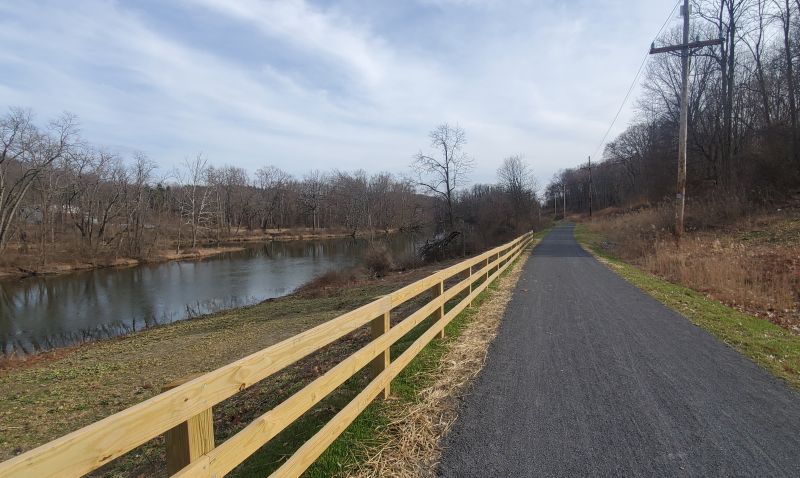
The Empire State Trail is New York’s newest “bike path”. It is described as a 750-mile facility that will span the state in three distinct segments: the Hudson Valley Greenway Trail, the Erie Canalway Trail and the Champlain Valley Trail.
When the Empire State Trail was officially opened to much fanfare in January of 2021, we were very curious to get a sense of what this trial system would be like. A quick overview of the official website let’s you know right away that the Empire State Trail system is not 100% off road. Instead it is an amalgam of separate trailways that have been linked together using on-road segments and a unified system of signage. Conditions vary with each segment: sometimes you are riding on pavement, sometimes you are riding on dirt. Some on-road sections are quiet country roads, others are busy white-knuckle urban arterials. But for the most part, for the first 100 miles north of New York City, you are mostly off-road, riding on an excellent system of paved and unpaved bike paths between the Big Apple and Kingston. North of Kingston, it’s back-and-forth between trails and roads until you reach Albany where the three branches of the Empire State Trail system meet. West of Albany it’s the Erie Canalway Trail (which we will not cover here, since it’s its own topic). North of Albany, it’s the Champlain Valley Trail, which is primarily on-road, although there are some nice off-road segments.
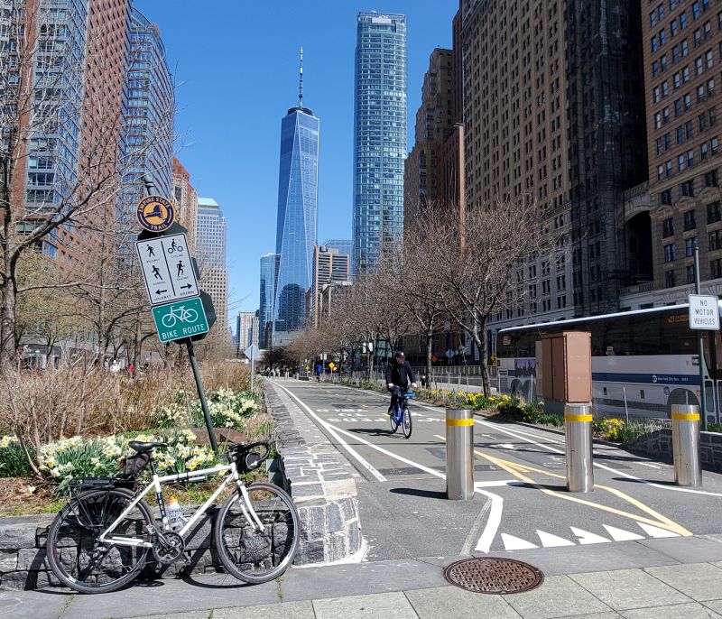
The southern terminus of the Empire State trail in Battery Park City.
At the beginning of 2021, as we began to ramp up our weekend day rides on the lower 100 miles of the Empire State Trail, as well as our multi-day vacation tours between New York City and Saratoga Springs, we did our due diligence and rode the entire route from New York City to Whitehall, near the Vermont border. The reason we stopped in Whitehall is because north of there, the Empire State trail is all on-road, following New York State Bike Route 9, so we didn’t bother. Click here for more information about New York State bike routes.
New York City and Westchester County
Undoubtedly many riders will want to either start or end the tour in Manhattan where the Empire State Trail begins (or ends) in Battery Park City. For New Yorkers, this is just the same old Hudson River Park bike path that you’ve known for years. It’s a straight shot on this path from lower Manhattan to Upper Manhattan, where the pathway ends at Dyckman Street and you are dumped out onto a congested roadway, left to fend for yourself!
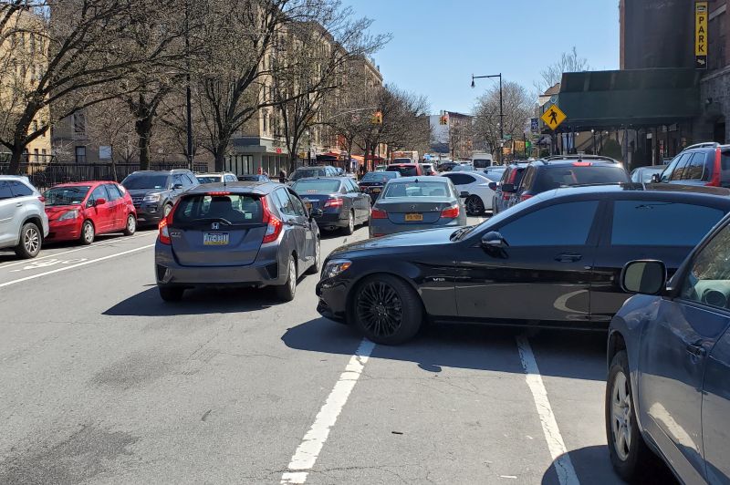
After about an hour of riding along the waterfront, you get to contend with a “sea of cars” double parked in bike lanes. Following the route to the next bike path is challenging.
This might be a good time to bring up what the Empire State Trail really is. As I mentioned before, it’s an amalgam of trails, connected by roads, with a unified signage system. But each trail segment is owned by a different agency, and it’s not clear who is putting up the signs (or maintaining them after they fall down, get vandalized, etc.). So we highly recommend you download the maps off of the official Empire State Trail website so that you know where you are going and you don’t have to depend on signs (many of which were missing at key turns throughout our ride). Better yet, do a tour with us and we’ll just give you GPS and vehicle support and you don’t have to think about where you are going!
OK – back to the ride. It’s a tricky slog through northern Manhattan and the Bronx, which is all on road, with inconsistent signage and busy traffic. But once you get to Van Cortlandt Park, you’ll experience the bliss of one of New York City’s newest bike paths, the Putnam Greenway. You’ll feel the hustle and bustle of city life melt away as you head north along a wooded corridor that becomes the South County Trailway in Westchester County. Keep going and it becomes the North County Trailway. Then, when you cross into Putnam County….it becomes the Putnam Trailway. You’ve been on the same path, but already it’s got four different names! But now you are 50 miles away from the city line, and the ride just keeps getting better and better.
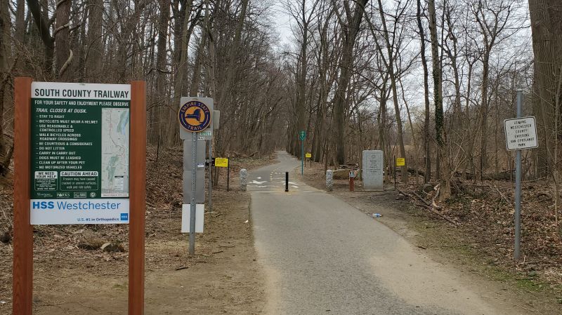
A smattering of signs in the middle of the woods lets you know you are changing jurisdictions between NYC and Westchester County. It’s literally written in stone on a granite marker!
Putnam and Dutchess Counties
The Putnam Trailway dumps you out rather unceremoniously access the street from Miggins Screw Products, which is next to a rail yard used by Metro-North Railroad. Now what? You’ll need to get over to the next segment of trail which is the Maybrook Trailway. This next segment is fantastic, but you’ll need to ride a little through the Village of Brewster to make this connection. There are supposed to be signs showing you the way, but it’s not always clear, Better use a map. Or just take one of our tours which start right here at the Brewster train station, which make them easy to get to from the city.
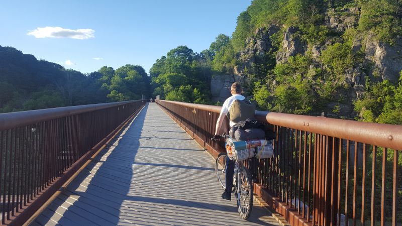
But when you get the the Maybrook Trailway, you won’t believe how nice it is. This trail is brand new, having been constructed by Metro-North Railroad in 2020. We have a separate blog page about it. The key takeaway about the Maybrook is that it is beautiful and quiet. There are also no services, restrooms, benches or picnic tables along its entire 25 mile length. So don’t drink too much gatorade – you’ll either run out without a place to buy more, or you’ll have to run to a restroom that isn’t there.
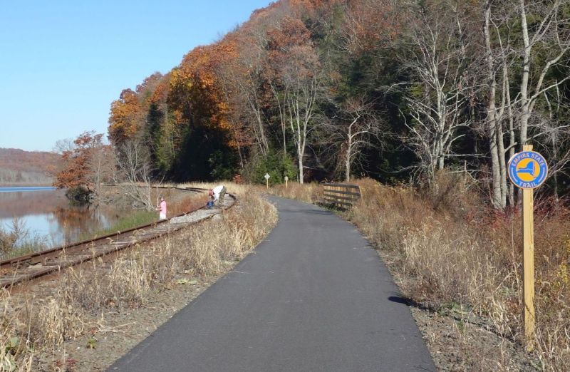
The Maybrook Trailway in Putnam County is quiet and remote. It’s one of the best sections of the Empire State Trail that is still relatively close to NYC.
But once you reach Hopewell Junction, the trail changes again. Now you are on the William R. Steinhaus Dutchess Rail Trail. This trail is run by the Dutchess County Parks Department and has plenty of benches, picnic tables and restrooms to use. It is also one of the widest segments of trail, which is great given the high level of usage this trail receives from local residents.
The Walkway Over the Hudson
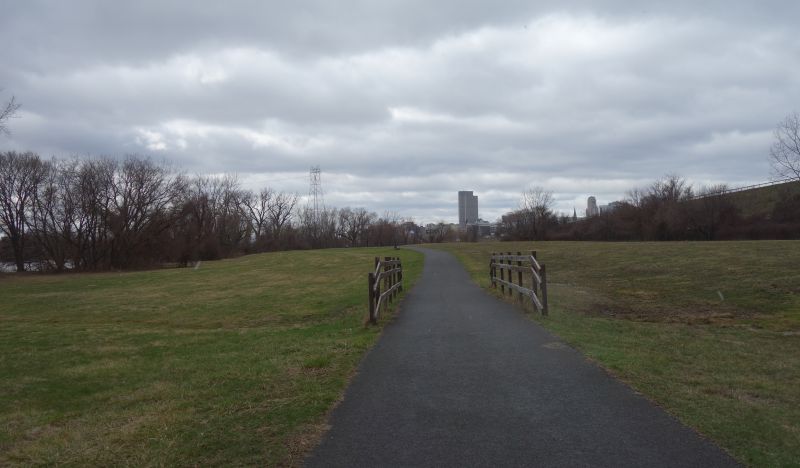
The Dutchess Rail Trail ends in Poughkeepsie, a city that is halfway between New York and Albany and the county seat of Dutchess County. Poughkeepsie has a lot of great dining choices if you are hanging around. And why not? Poughkeepsie is also where the Empire State Trail crosses the Hudson River on the magnificent Walkway Over the Hudson. This railroad trestle was used for 85 years before burning in 1974 and subsequently being abandoned. But through the hard work and advocacy of local volunteers, it is now the showpiece of the Empire State Trail in the Mid-Hudson Valley and the endpoint of our Empire State Trail day tours which allow you to take the train back to NYC via the Poughkeepsie train station.
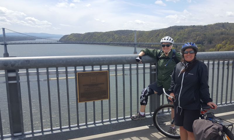
It’s hard to capture the magnificent view you will experience on the Walkway Over the Hudson.
Ulster County
Riding west over the Walkway Over the Hudson, you enter Ulster County on the Hudson Valley Rail Trail. This is another great real trail featuring restrooms and other amenities along its length. It ends just outside the Village of New Paltz, which is a college town in the shadow of the Shawgunk Ridge, a beautiful formation of cliffs that are popular with rock climbers. Here the Empire State Trail is an off-road path following along Route 299 until you get to the interchange with the New York State Thruway. After that, you have to ride on local streets for a few miles to get to the next off-road segment, the unpaved Wallkill Valley Rail Trail.
You’re going to want a hybrid bike for the Walkill Valley Rail Trail. If you are riding a road bike, you’ll still be OK, but the bumpiness of the trail will get to you. You don’t want that because this trail is absolutely beautiful and you’ll want to enjoy every minute of it, especially the part where you cross over the Wallkill Valley on the humongous Rosendale Trestle. Take it all in as you pass enormous abandoned kilns along the trail that once processed cement. Much of the cement that built New York City was made here.
Take in another great view as you head across the Rosendale Trestle. Joppenbergh Mountain looms in the distance with its abandoned cement kilns.
The Wallkill Valley Rail trail goes to Kingston, the county seat of Ulster County….but not quite. It dumps you out on Route 32 just south of the city. This road is also designated as New York State Bike Route 32, but it’s busy and has a rumble strip. Fortunately, once you are inside the city limits there are great on-road bike lanes that you can use to get to the next segment of off-road path: the Kingston Greenline. This is where the railroad once snaked down to the river from the uplands above. Cruise on down to the waterfront, which was partially destroyed by urban renewal projects from decades ago. But what remains is still nice. There’s a trolley museum, and you can ride along the tracks straight to the waterfront. There’s also a beach where you can swim in the Hudson River. Go ahead, we dare you to jump in.
The Kingston Greenline continues along the waterfront, becoming the Hudson River Brickyard Trail, which offers a window into Kingston’s industrial past. After this it’s back on the road again for a while. You’ll have to conquer a steep hill and then cross the Hudson again using the Kingston-Rhinecliff Bridge. As I mentioned before, the Empire State Trail is an amalgam of various trails and roads, owned by different agencies. When you cross the Kingston-Rhinecliff Bridge you’ll get to experience the hospitality of the New York State Bridge Authority, which decided to parcel the bridge deck into a sidewalk for pedestrians only while giving the cyclists narrow shoulders to negotiate. It’s not clear why they did it this way.
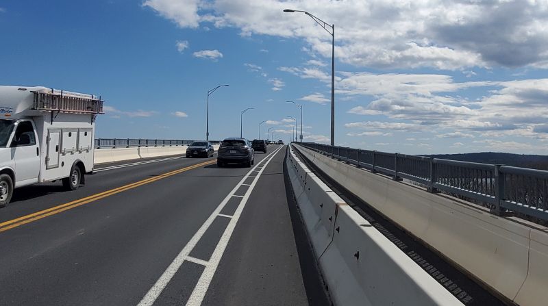
Ugh – why did the NYS Bridge Authority set it up this way with a separate sidewalk and bike lane? Why not make it a wider, barrier-separated shared use path like most other bridges in the region! Another, autonomous government agency implementing their own “solutions”.
Dutchess County (again) and Columbia County
Back on the east side of the Hudson, it’s all on-road riding again. But it sure is beautiful. From the bridge you head north on some lovely roads that take you past some of the grand estates that used to grace this valley. Ultimately you pass through Bard College (this another place where the signage breaks down so bring a map) and you are on a series of dirt roads and quiet paved roads until you get to Hudson, the county seat of Columbia County. Hudson has an interesting history and beautiful buildings. It also has an Amtrak station, making it a great spot to start or end a ride.
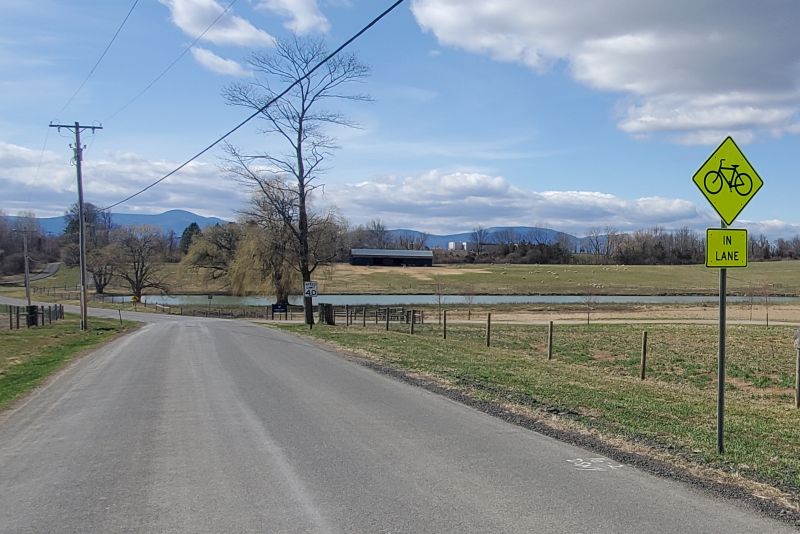
The Empire State Trail is on-road between the bridge and Hudson. But the roads are quiet, framed by farms and mountains.
Going north of Hudson, it’s back on the trail. It first starts out as on-street, barrier-separated bike lanes, but soon you are fully off-road on the Albany-Hudson Electric Trail. This trail was built on the route of a 37-mile-long trolley line that once connected Hudson and Albany together. The trolleys stopped running in 1929. Almost 100 years later, a great bike path was born!
The Albany-Hudson Electric Trail is, for the most part, continuous and paved with stone-dust and not asphalt. There are also some on-road sections you’ll need to pay attention to. Again, bring a map since the signage isn’t always clear.
The Albany-Hudson Electric Trail offers beautiful views of streams and waterfalls along its quiet, remote route.
Rensselaer and Albany Counties
The Albany-Hudson Electric Trail continues into Rensselaer County where it ends in the Town of Greenbush. From there you’ll have to ride on roads again to get down to the Hudson River in the City of Rensselaer near the Amtrak Station. You’ll cross the Hudson River again on a highway bridge with the dystopian backdrop of Empire State Plaza looming in the distance. Take a break and check it out. You can ride your bike around the plaza. You’ll never see anything quite like it.
Albany went crazy for urban renewal. In addition to destroying an entire neighborhood to build Empire State Plaza, they also built a highway along the riverfront, so that nobody could enjoy it except drivers in cars. Fortunately, the Mohawk Hudson Bike Hike Trail was squeezed in between the highway and the river as an afterthought. But this trail provides a blissful experience that almost feels as if it’s a secret kept from the rest of the world because it is hidden by a highway.
The Hudson River is to your left, I-787 is to your right and Empire State Plaza is dead-ahead. The Mohawk Hudson Bike Hike Trail feels like a secret path just for you as you approach the State Capitol.
But heading north that bliss is interrupted as you are dumped out onto local streets again. Keep an eye out for signs (or bring a map!) to navigate the roads through Watervliet and Cohoes. This is where the Erie Canalway Trail intersects with the other two legs of the Empire State Trail, near the confluence of the Hudson River and the Mohawk River (also known as the Erie Barge Canal). Cross over to Peebles Island State Park and the Champlain Valley Trail begins, heading north out of the Capital Region.
Saratoga and Washington Counties
The Champlain Valley Trail is a beautiful ride heading north of Albany. At first, it is an unpaved trail between the Village of Waterford and the Town of Halfmoon. But north of Halfmoon it is 19 miles of on-road riding on NYS Bike Route 9 to Schuylerville.
The best segments of the Empire State Trail north of Schuylerville are dirt roads and paths along the Champlain Canal.
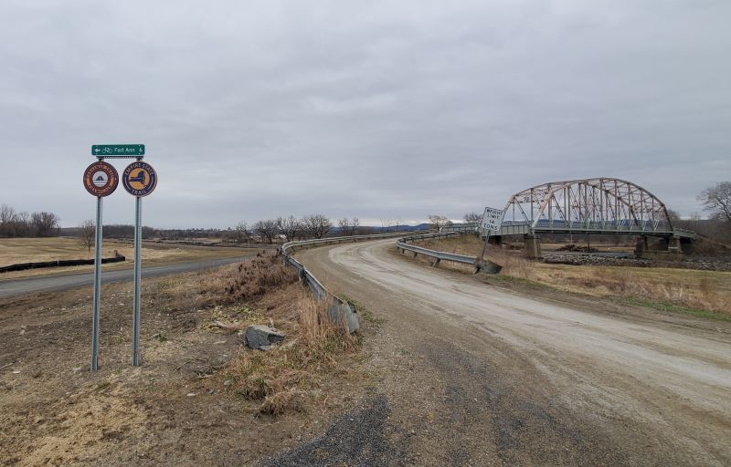
Once you are in Schuylerville its a pretty ride on unpaved pathways, dirt roads, paved roads and Bike Route 9 (again) until you get to Fort Edward, the county seat of Washington County. Then once again you get on quiet dirt roads and paths that follow the Champlain Canal to Fort Ann. North of Fort Ann, it’s back on paved roads until you are put back on Bike Route 9 just after you pass an ominous looking prison in the middle of a beautiful landscape. From here, the Empire State Trail just follows Bike Route 9 to the Canadian border – all on road. So we stopped in Whitehall which is the next town up. It is also the birthplace of the US Navy, which is an interesting story.
Speaking of interesting stories….
….the Empire State Trail is full of them. If you ride the trail as described above, you’ll be taken through many different communities – each with their own history and qualities. Some of these towns you might never pass through otherwise, and they are worth exploring. New York was nicknamed the Empire State for a reason. The places you will pass through helped build one of the largest economies in the world, and each place has a story. Come experience it all on the Empire State Trail!
