Riding the Sussex Branch Trail
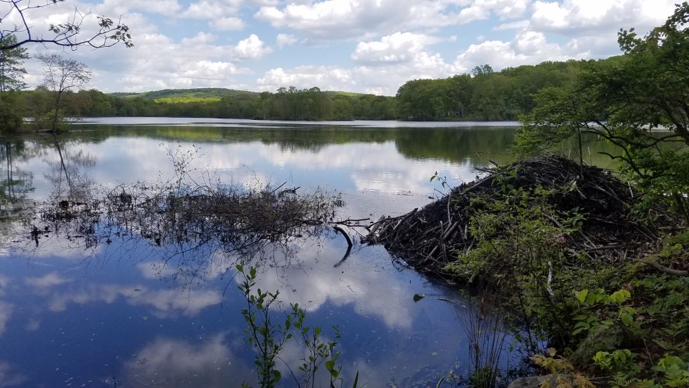
A beaver lodge on a reflective lake: one of many nature scenes on the Sussex Branch Trail
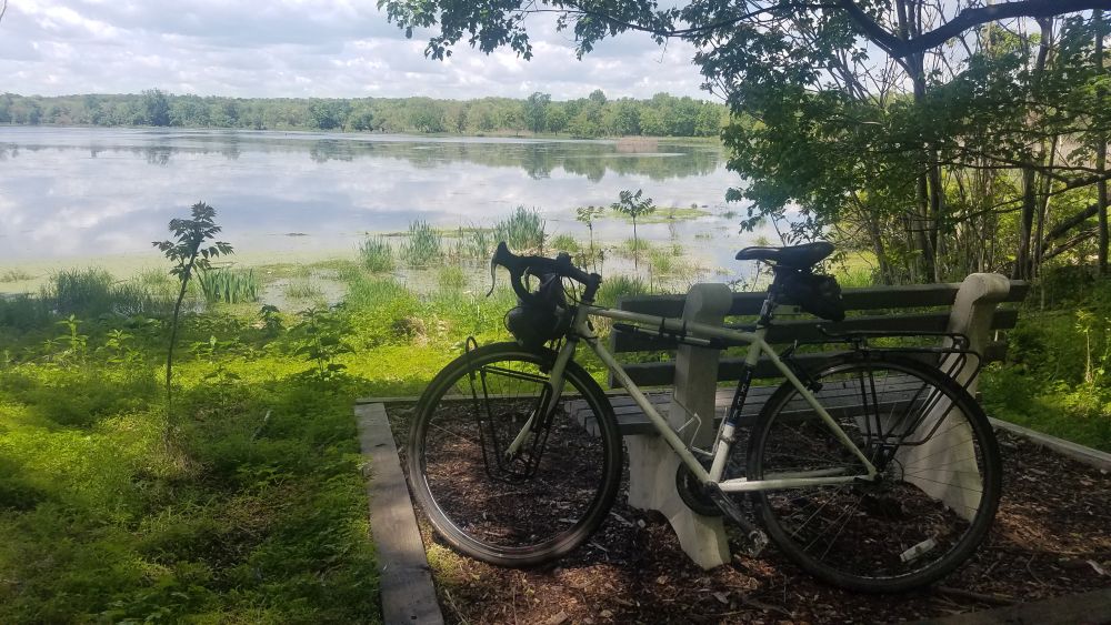
If you are looking to ride your bike on a rail trail that offers a great deal of solitude, check out the Sussex Branch Trail, which as the name suggests, is located in Sussex County, New Jersey. This trail is 18 miles long, unpaved, and goes through many quiet areas where you can easily spot wildlife. This trail is also a great feature of our New Jersey End-to-End bike tour.
While the Sussex Branch trail is generally flat, thanks to the fact that it was once the Sussex Branch line of the former Erie Lackawana Railroad, it has its “ups and downs” in terms of conditions and maintenance. The trail is not paved, and can have lots of puddles, mud and flooding if it has recently rained. In autumn, this trail is a spectacular tunnel of color, but that also means that there are leaves on the trail obscuring rocks. No matter when you go, make sure you show up with a mountain bike or a hybrid bike. Take your time and go slow. There’s no need for speed and it’s better to relax and enjoy the quiet solitude. The generally tough conditions of this trail help keep it quiet, and you may go long distances without seeing another cyclist.
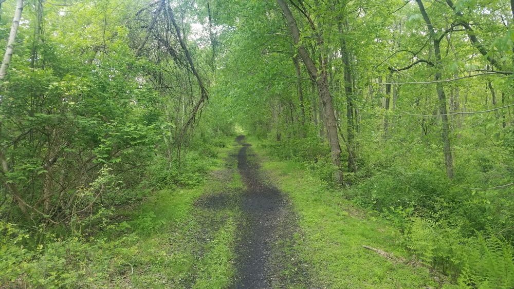
One of the smoother sections of trail.
The Sussex Branch trail generally runs north-south between the Borough of Branchville and Allamuchy Mountain State Park at the southern end of Byram Township, right at the border of Morris County and Mount Olive Township. Mount Olive has a train station that is located about a mile away from the trailhead in Allamuchy Mountain State Park, so the NJ Transit Morris and Essex Line train is your only option if you are seeking to access the Sussex Branch Trail by train with your bike Be advised that the train serves the Mount Olive station on weekdays only and you will have to switch trains in Dover if you are coming from NYC.
If you are driving, the clearest parking area is at the southern end in Allamuchy Mountain State Park. Just off Waterloo Road (County Road 604) is a sizable parking lot with a port-a-potty. This is also the closest parking area to Interstate 80. But there are also other parking areas available along the route, mostly just roadside pull-offs. Consult this map produced by the Sussex County tourism organization for parking locations and other info about accommodations, and things to do near the trail.
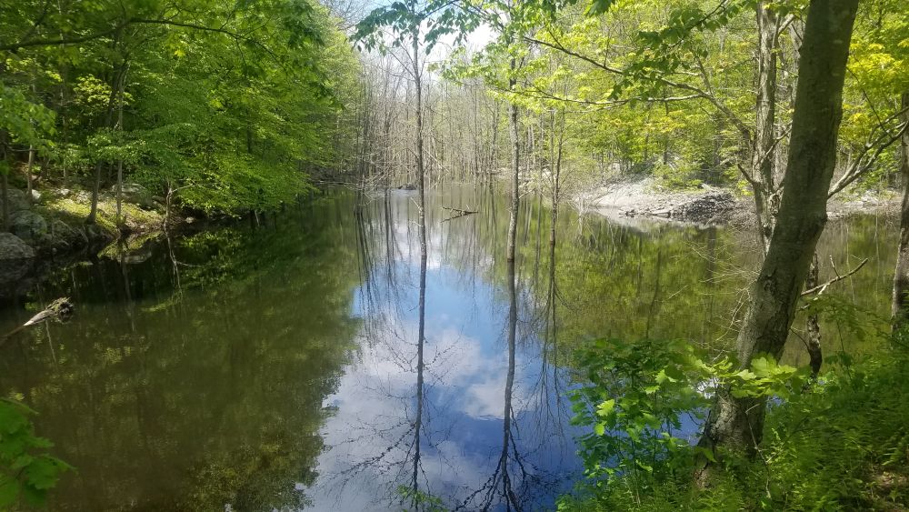
One of the many viewpoints of quiet lakes along the trail.
Starting at the south parking lot, you immediately get to travel north through Allamuchy Mountain State Park which has two beautiful lakes that you can stop and enjoy. Unfortunately, the first lake has you riding close to its dam and this area can severely flood under the wrong conditions. (We’re not kidding – check out this video!) Allamuchy State park used to have quarries and you can see the remnants of those as smaller ponds along the route. Eventually you will reach Cranberry Lake and you will get to ride along its shore. The trail enters a small commercial area here with a deli and then goes along Route 206, more or less through parking lots, and then as a dirt path on the side of the road. Eventually the road rises up above you and you are down lower, which means poor drainage after a rain. The good news is that Route 206 has wide shoulders here, so you can hop off and so some road riding if you want a break from the trail conditions.
You can see these quarry ponds adjacent to the trail in Allamuchy Mountain State Park
At Whitehall Hill Road, there is a gap in the trail, but instead of riding along Route 206, you can ride along the much quieter Whitehall Hill Road, which parallels Route 206. At the junction of Whitehall Hill Road, Whitehall Road and Morris and Sussex Turnpike look for a little dirt path off to the right. That is where the trail picks up again. This time you are higher up, above Route 206. No flooding here, but it is bumpy. Take your time and push through. You’ll be rewarded by going over an old stone bridge. Shortly after you’ll arrive in Andover, which has a few restaurants and bunch of antique shops.
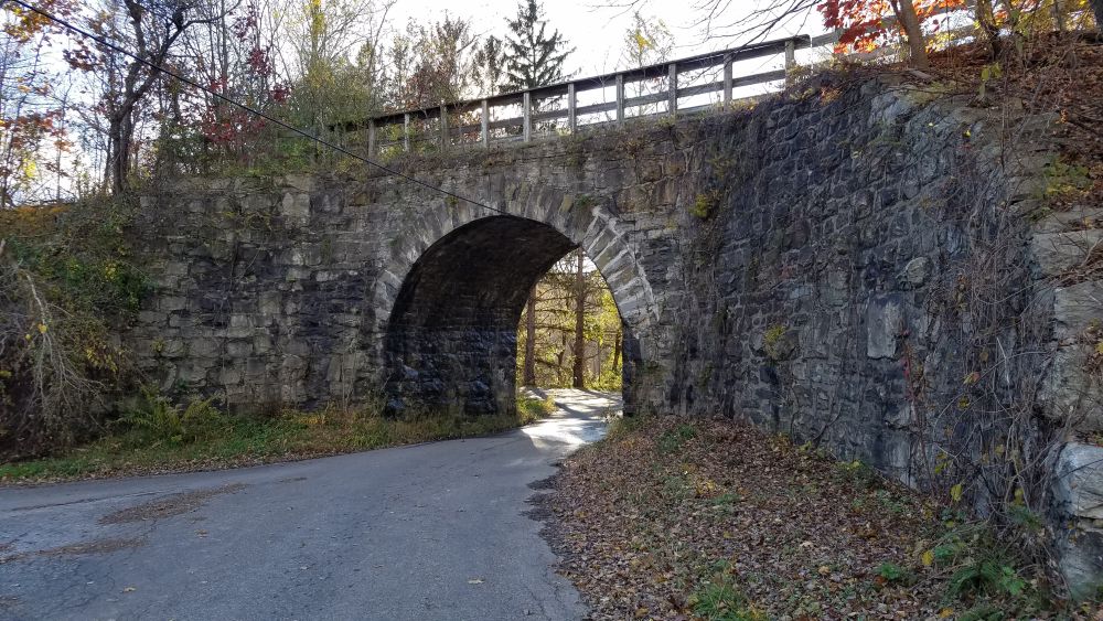
The trail goes over this stone bridge
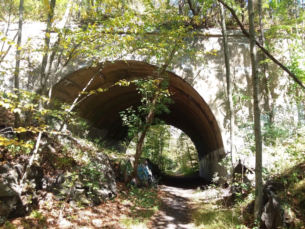
North of Andover, the trail gets very quiet again as you veer away from Route 206 and head back into the woods. You will skirt along the east side of Newtown (another opportunity to access stores and restaurants) and you will need to ride on Hicks Avenue for a short distance to cover a break in the trail. After that, it is very quiet as you bike through the woods next to several streams. One interesting site you will see is the crossing of the Paulinskill Valley Trail high above you. This is another rail trail that was built on a line of the former New York, Susquehanna and Western Railroad. It is an uncommon sight to see two rail trail bike paths cross each other like this!
The Paulinskill Valley Trail passes high above you.
Soon after this crossing you will approach Lafayette Township where the trail starts going along Route 15. Fortunately, you are far enough away from the road to not be distracted by a lot of car noise. Also, at this point you are biking along the Paulins Kill, a rushing stream whose flowing water adds to the sounds you will hear. But you are never far from Route 15 which has restaurants and stores along it, particularly if you need a restroom.
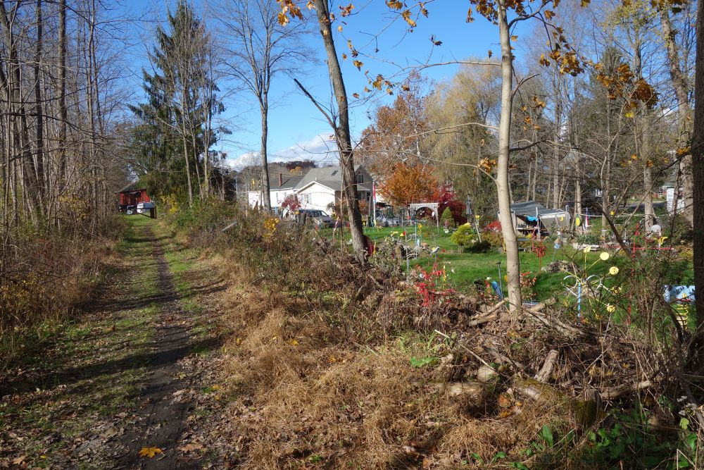
A quirky trail-side sculpture garden welcomes you to Lafayette Township
The bike path flows in the same direction as the streams you will pass, which in a few miles takes you to Branchville where the Sussex Branch Trail ends. The trail ends unceremoniously on Mill Street and then it’s just a quick bike ride to the borough’s historic business district where shops and restaurants are available.
This bucolic farm scene is not very far from services located along Route 15 and the end of the trail in Branchville.
