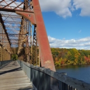
The growth of New York City into the place we all know today has always been linked to the ability to bring fresh water to an urban environment surrounded by salt water estuaries. In the early 19th century, this was a major problem as the city began to push north from its original settlement at the southern tip of Manhattan. At that time water was obtained from wells, many of which were contaminated. This lack of clean water was responsible for both yellow fever and cholera epidemics. Water was also needed for fire suppression. By 1833 it was time for the City to begin work on a new fresh water supply. Nine years later the project would be complete, connecting the Croton Reservoir to the growing city. Today, although the aqueduct is no longer in use, most of its infrastructure is still there. Much of the aqueduct is now a State park (or NYC Park), and the land above it is a fascinating trailway that you can ride your bike on with great views of the Hudson River. The Old Croton Aqueduct Trail (OCA) goes across the Highbridge – one of the nicest car-free bridges in our region. The OCA is also a great way to get to the new Mario M. Cuomo Bridge Bike Path.
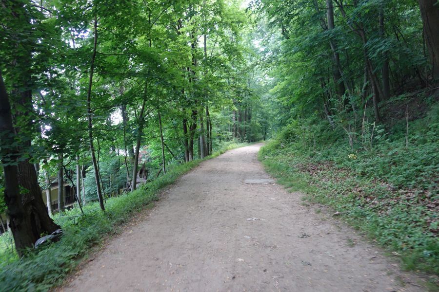
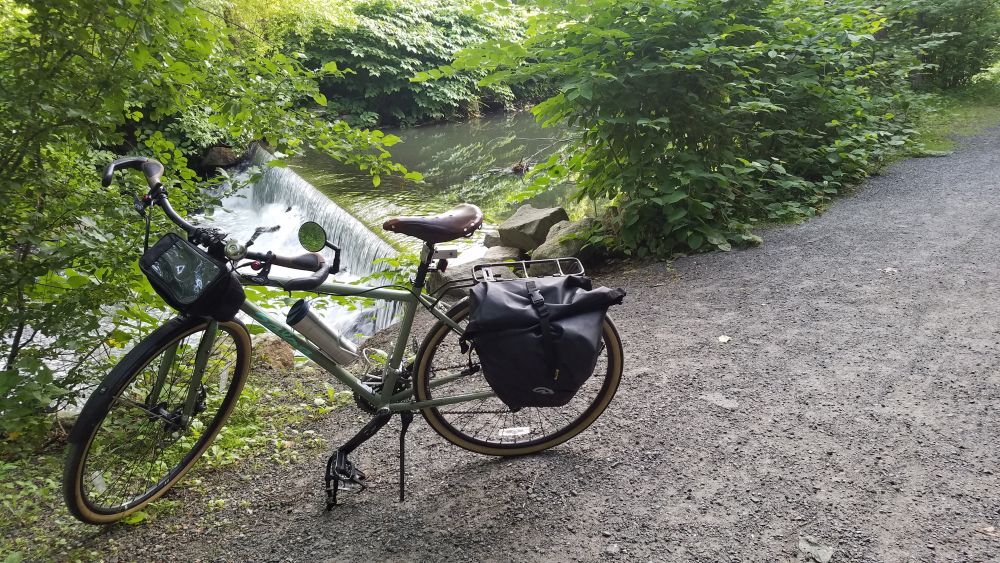
The OCA trail is unpaved for most of its length. This is one of the wider (and smoother) parts. You should ride this with a hybrid or mountain bike.
While the initial aqueduct was 41 miles long going between the Croton Reservoir in Westchester County and the Croton Distributing Reservoir (now the site of the New York Public Library on 5th Avenue and 42nd Street) the 26-mile portion in Westchester County is the part we will be discussing below. This is the most contiguous part of the trail that offers the best riding. While portions of the OCA trail in New York City are spectacular (like the Highbridge) the route isn’t contiguous or clear.
No matter which portion of the OCA Trail you want to ride, we highly recommend purchasing a map from the Friends of the Old Croton Aqueduct for $5. This map will show you the exact route, which can be confusing and hard to follow for the uninitiated. But once you’ve ridden it, you’ll see why it was worth the effort.
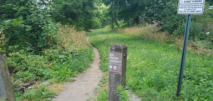
The OCA trail can be narrow at times and you will have to follow small signs to stay on the route. We definitely recommend buying a map for $5.
The Westchester portion of the OCA Trail is almost entirely unpaved. You will need to watch out for bumps, roots, rocks, mud and debris. Some portions are wider than others, and the route is almost entirely shaded. Peek through the trees and you’ll see great views of the Hudson River and the Palisades throughout most of your ride. You’ll also see many, many remnants of the aqueduct, like ventilation towers, weirs and more. But make no mistake, the trail can be rough. So do not attempt this trail with a road bike. Hybrid or mountain bikes are a must!
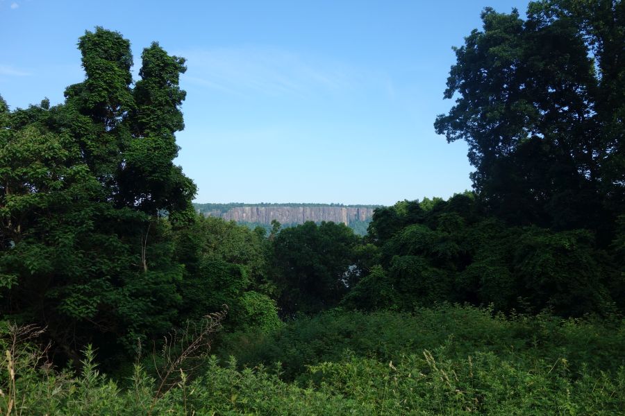
One of the many views you’ll get of the Hudson River or the Palisades while riding the OCA trail.
There are numerous access points to the OCA Trail from its many street crossings. The OCA once flowed through every riverfront village or town in Westchester between Yonkers and Croton-on-Hudson. This means that the trail offers direct access to downtown areas in Hastings-on-Hudson, Dobbs Ferry, Irvington, Tarrytown, Sleepy Hollow and Ossining and it is also very close to downtown Yonkers and downtown Croton-on-Hudson. All of these areas have Metro-North train stations, so you can easily do a ride that starts in one place and ends at another. And that also makes this trail easy to get to from the city.
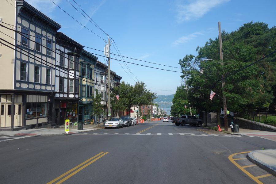
The OCA Trail goes directly through a number of downtown areas. So you are never far from services or train stations.
If you want to start your ride at the south end, a good place to start is at Glenwood Avenue, particularly if you are taking the train. This trail access point is very close to the Glenwood train station, but beware, you will have to go up a big hill to get to the trail.
Heading north the trail is continuous, but you will need to pay attention to your map or to signs (where available) to get you through tricky spots where the route gets confusing. In most downtown places the trail is shared with roadways or parking lots. Try your best to follow along. In some cases, it may even feel as if you are riding through somebody’s front or back yard. It’s OK – you are still on the trail.
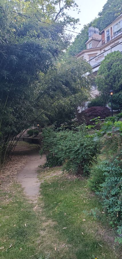
Hey, am I riding through someones yard? Yes you are…but it’s also the trail!
As you approach Tarrytown you will pass by some beautiful properties including Lyndhurst Castle. These were once Hudson River estates for the wealthy. Lyndhurst, in particular, offers tours. However, once you pass Lyndhurst, you will get to your first major interruption in the trail, since it is here that the aqueduct was obliterated by the construction of I-287 and the Tappan Zee Bridge. So you will have to ride along Route 9 for a while until you get to downtown Tarrytown where the OCA trail picks up again. This is a busy road, so it isn’t the greatest for cycling. But you could always ride on the sidewalk if you did not feel safe. It is here that you will also pass the entrance for the Mario M. Cuomo Bridge bike path.
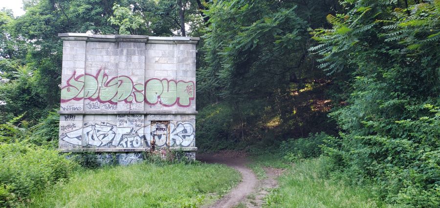
The OCA trail goes past many remnants of the aqueducts infrastructure, such as this weir building.
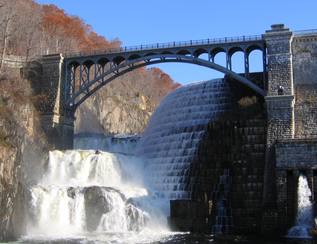
If you want to ride north of Tarrytown, the OCA trail offers some nice interrupted stretches. But there are also major gaps in the trail that you will need to get around. Once again, having a map will really help you figure this out. The biggest obstacles are Sleepy Hollow High School (which was built right over the aqueduct), a missing piece of trail in Scarborough, and passing through downtown Ossining, where you will need to use local streets (and stairs) to follow along the path. The last major interruption in the trail is where Route 9A was constructed across the aqueduct (another highway obliteration…). Here you will need to skirt around the fence of a training and conference center owned by GE, so again you will need to pay attention to signs (and your map). But the last couple of miles are spectacular, as you move away from the Hudson River into the Croton River gorge. The trail ends at the Croton Dam, which is a site to behold. You can bike across the top of the dam, or go down to the gorge below, which is a County park. If you are taking the train back, just reverse your course back a few miles and you can access the Croton-Harmon Metro-North station relatively easily.
The Bronx River Valley has been a corridor for transportation and industry throughout New York’s history. As the only fresh-water river in NYC it played an important role in industry, with many mills set up along its banks, the remnants of which can be seen in the many “waterfalls” you see along the river flowing over dams that date back to the 19th century. The Bronx River Valley has also been an important transportation corridor dating back to the 1840’s when the New York and Harlem Railroad was constructed (now the the Metro-North Harlem Line) and the construction of the Bronx River Parkway in 1907 as the first parkway to be constructed in the United States.
One of the innovations of parkway construction at the dawn of the automobile era was the preservation of lands along each side of the roadway as dedicated parkland. This parkland has allowed for the development of one of the region’s best bicycle paths. While not fully complete, you can ride 25 miles between the source of the Bronx River in Valhalla to and the mouth of the river at Claisson Point in the Bronx by using existing trail segments and roads that fill in the gaps. Eventually, both the City of New York, with the help of the Bronx River Alliance, and Westchester County are committed to constructing a trailway along the river’s entire length. But for now, you can ride the whole river mostly on bike paths, so long as you are OK with detours onto nearby streets.
One of the nicest attributes about the Bronx River Greenway is that it connects many downtown areas with restaurants, services, train stations and parking. So you are never far from services and this is an ideal ride to do one-way and take the train back, since the bike path follows the Metro-North Harlem Line closely. So whether you want to ride a little, or a lot, the Bronx River Greenway is a great choice for a day out on a bike that is close to home. During spring and autumn you can also combine your ride with Bicycle Sundays which involve the closure of the Bronx River Parkway for bikes and pedestrians between Yonkers and White Plains.
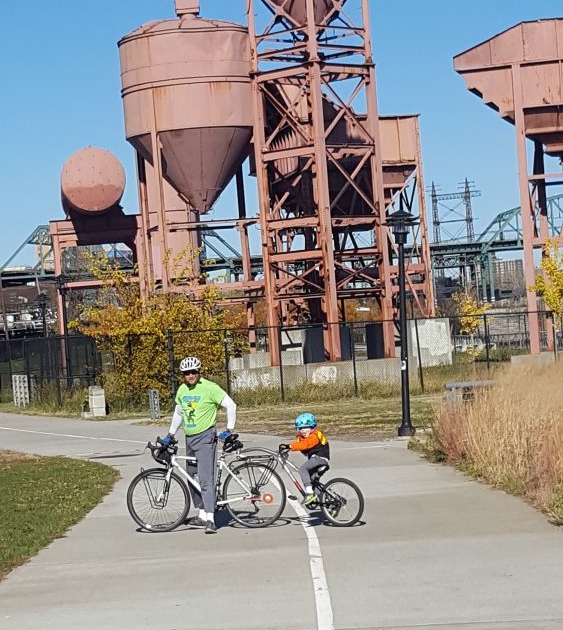
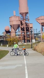
In the Bronx, the Greenway takes you though a series of smaller parks, such as Concrete Plant Park.
Let’s take a look at the route from south to north. For an overview of the route in both the Bronx and Westchester, click here. Use this map to guide you as you read, since your ride will take you through many different park areas and then on streets in between. But this map is not a recommended route. Please consult the various other maps we call your attention to later in this article. To start with, you may also want to check out the maps and cue sheets on this webpage.
Classon Point is at the south end. There is a dock here that gets regular NYC Ferry service which is a great way to arrive with your bike if you are coming from Brooklyn, Queens or Manhattan. Parking here is also relatively easy to find. From here you will ride through a series of parks with a little on-street riding in between each. Head directly out on a bike path which takes you through Soundview Park along the tidal flats of the mouth of the Bronx River. Then with a little knowledge of local streets from a map, you can get across the Bruckner Expressway to Concrete Plant Park. From here the route is well put together, with signage and a protected bike lane along the decommissioned Sheridan Expressway (now Sheridan Boulevard) which leads to Starlight Park.
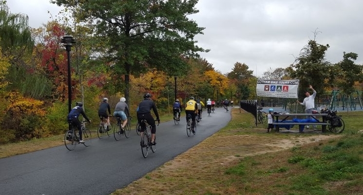
Cheering on riders in Starlight Park during the Tour de Bronx in October
North of here, the park land is interrupted as you go through the bustling West Farms neighborhood. This is a major transit hub for subways and buses, so it’s a good starting point if you want to take the subway to get to the ride. You can also try your luck with parking here since there is good highway access at this particular spot. Again a map is helpful getting you through the neighborhood streets. Watch out for cars!
The good news is that it’s only a half mile of on-street riding and then you are back on a nice bike path starting at 180th Street. At this point you are going to be on a path for a while as you go through Bronx Park, so relax and enjoy. If you are interested in an odd piece of New York history, take a very small detour to the East 180th Street subway station, which used to be a train terminal for the now-defunct New York, Boston and Westchester Railroad. Both the 2 and 5 trains stop here and the 5 continues on along the old NY,B &W route to Dyre Avenue.
The Bronx River Greenway in Shoelace Park is wide and straight.
Once you are on this bike path, everything is straightforward and well marked almost until you reach the northern border of NYC. There are also plenty of restrooms and water fountains (usually found at playgrounds) along the way. The only challenging section is where you need to cross Pelham Parkway. This is a busy street that is difficult to cross. So take your time and use the pedestrian signals. Or check out the neighborhood and get a snack or lunch while you are there.
After about 4.3 miles of riding on this path, you will reach Woodlawn Heights, which is where NYC ends and Westchester County begins. The bike path here continues north of 233 Street, but it is a dead-end bike path that goes to Muskrat Cove, a quiet little spot along the Bronx River in between the parkway and the railroad. So if you want to check it out, you’ll have to go back to 233 Street again. Be aware of homeless encampments if you go on this bike path. From 233 Street you are looking at 4 miles of on-road riding to get to the next trail segment. So you may want to take a break here and grab lunch while you figure out the best route for you to ride. The Woodlawn Heights neighborhood is famous for Irish restaurants. Or you can head up Bronx Boulevard and get great jerk chicken and BBQ from the Cookmaster who sets up shop most days in the summer on the sidewalk in front of a self-storage facility.
The ride to Muskrat Cove goes under the looming Nereid Avenue Bridge.
There is a lot of debate about the best on-road route to connect the Bronx and Westchester segments of this trail. On our map we use a jumble of streets in southeast Yonkers that takes you to Kimball Avenue, which is a relatively wide 2-lane road. It’s a mystery why the City of Yonkers doesn’t stripe this road with bike lanes. If you go this way, you will need to be careful riding past Cross County Shopping Center because there are a lot of cars here. But north of the mall you’ll ride through Sarah Lawrence College, which is a nice change. Right after Sarah Lawrence the bike path starts up again. Another route is offered on these cue sheets. You should decide the best route for you.
This 4 mile gap will probably be the least pleasant part of your ride, since there are no signs to guide you and you will be on streets with cars. Rest assured, Westchester County will eventually construct a bike path for this segment, but it has been hard to engineer using the available land. If you don’t want to ride this part, you can also ride Metro-North railroad with your bike between the Woodlawn Station and the Bronxville station. Trains run every 30 minutes on weekends and you can bring your bike on board for this 8 minute ride.

On Sundays during spring and autumn, the Bronx River Parkway is closed to cars.
Once you are in Bronxville, the final 11 miles of your ride are going to be pretty nice as you ride a bike path through the Bronx River Reservation. While there are few directional signs here, the bike path is (mostly) intuitive. The path also closely follows the Metro-North Harlem Line with direct access to several train stations which is perfect for getting to the trail and then back home again. There is also free parking at many of these stations on weekends if you want to drive to the trail. Westchester County Parks has also produced a nice map of this trail showing access points and parking.
Once you are north of Scarsdale Road in Yonkers, the bike path parallels the section of the Bronx River Parkway that is closed on Sundays in the spring and fall for “Bicycle Sundays”. So if you are doing your ride on a Sunday, you can choose to ride on the bike path or on the parkway itself. Either way, you’ll go directly through the center of a number of downtowns offering places to get lunch. Restrooms, however, are harder to find. Once you are north of Scarsdale Road, the path is continuous until the end.
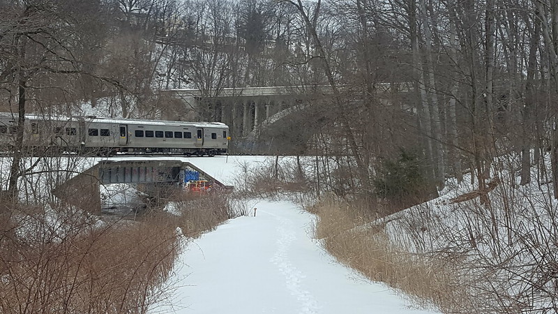
The section just south of White Plains is great for cross-country skiing when it snows.
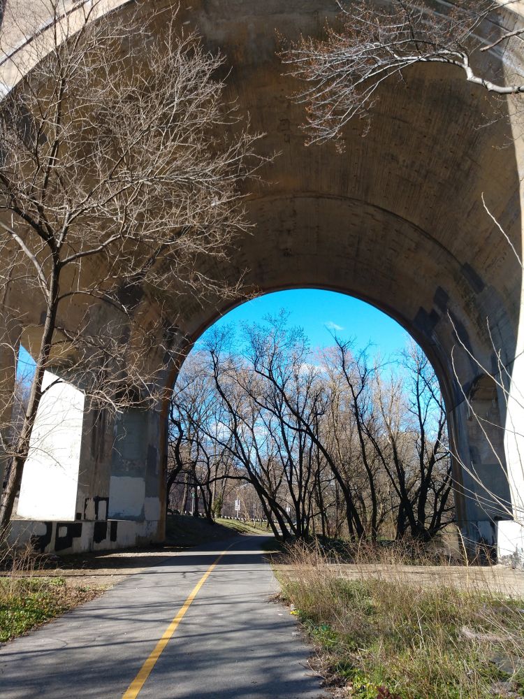
When you get to White Plains the bike path goes under two roadway bridges. Ring your bell if you have one as you approach the bridges because there are sometimes homeless people under them and you’ll want to give them a heads up. They won’t bother you. White Plains is a busy place, but if you are tempted to get off the trail and explore, be aware that the streets in White Plains are very inhospitable to bikes and, unless you like brutalist architecture, there aren’t a lot of places worth checking out unless you ride several blocks into the core of downtown. There is, however, a hot dog stand right next to the trail that is popular with local cyclists.
After the bridges and the hot dog stand, the bike path goes through a large parking lot associated with the Westchester County Center. They have restrooms here, but you’ll have to cross the parkway using a pedestrian signal to get to them. You can also park here, but you have to pay a fee.
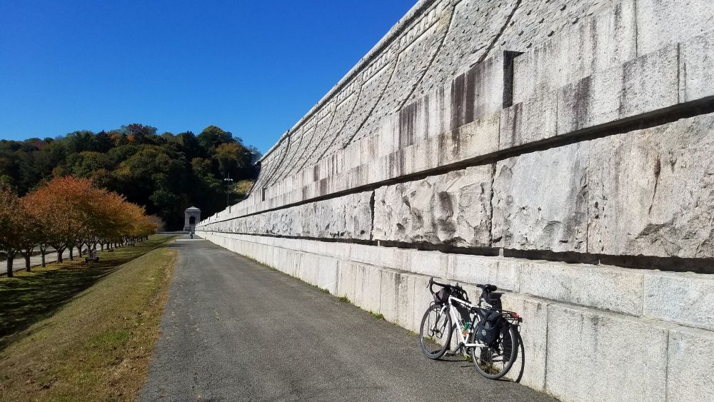
Kensico Dam Plaza is a bold visual finish to your ride.
The final 3 miles of the pathway between White Plains and Kensico Dam Plaza is a relaxing finish to the ride. There is plenty to explore at Kensico Dam, including a hike to the top of the dam. On weekends there are also a number of cultural festivals that are held here. From the dam you are a short bike ride to downtown Valhalla which has several nice restaurants which are perfect for the end of your ride. There is also a Metro-North station here if you want to get back to the city. Parking at Kensico Dam Plaza is free, so you could also start here and ride this bike path in the reverse order if you wanted to.
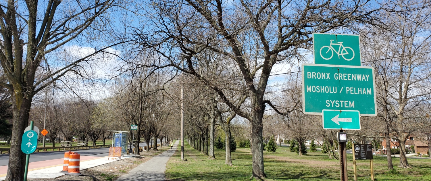
One of the best bicycle path networks in the New York Metro Region is located in the Bronx. While many counties and cities in our region have great bicycle paths, a common issue among many of them is connectivity. Perhaps they run a few miles and stop. Or perhaps one trail is unable to connect to another thanks to a missing piece. The Bronx is fortunate in this regard in that a number of bike paths connect together into a system that stretches almost entirely across the borough. As shown on the excerpt of the NYC Bike Map below, the Mosholu-Pelham Greenway System is the spine of a large network of trails that connects cyclists to attractions such as Orchard Beach, City Island, the Bronx Zoo, the New York Botanical Gardens as well as many local neighborhoods, great restaurants, employment sites, universities, swimming pools, golf courses (including mini-golf courses) and more.
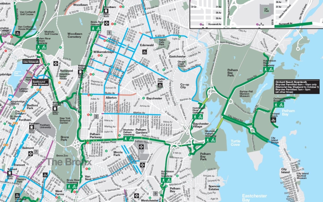
This trail of networks is the showpiece of the Tour de Bronx bike tour that is held every October. But it’s also a system that can be easily used by residents and visitors alike, with many access points, parking areas and transit connections. So it’s perfect place to go for a day-long outing. It also connects to other regional trail systems such as the North-South County Trailway in Westchester and the multi-state East Coast Greenway.
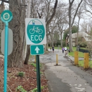
This trail system is part of the larger East Coast Greenway.
While this trail system generally runs east-west, there are a number of connections that will also take you north or south. The west end of this system is Van Cortlandt Park, which is home to many sports fields, a pool, a golf course, and the historic Van Cortlandt House Museum. It is in Van Cortlandt Park that this system connects to Westchester’s South County Trailway, which will take you more than 50 miles north up to Brewster in Putnam County. Trailside parking is available at the Van Cortlandt Golf Course and you can also easily get to the park by subway. Leaving Van Cortlandt Park, the bike path system goes along Mosholu Parkway where it connects with the New York Botanical Gardens. There is bike parking at the garden entrance here.
Moving east, the Mosholu/Pelham system merges into the Bronx River Greenway, a longer north-south route that generally follows the length of the Bronx River between Kensico Dam in Valhalla to Soundview where the Bronx River empties into the East River. It is here that you can access the Bronx Zoo or a number of Metro-North train stations. There is also on-street parking on most of the side streets here.
The Bronx River Greenway is a (mostly completed) bike path between Kensico Dam and the East River
At Pelham Parkway, the Mosholu/Pelham system breaks away from the Bronx River and heads east again as a bike path within the large median of Pelham Parkway. A quick side trip to the south brings you to the Morris Park neighborhood, with many great Italian restaurants. If you just want to stop for a quick lunch there are many options including the famous Emilio’s pizza which has a one-of-a-kind recipe for chicken vodka sauce slices. You could also park within this neighborhood or take the subway here with your bike.
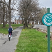
Ride through Pelham Bay Park, next to an equestrian trail and a historic mansion.
As the bike network crosses highway interchanges for both the Hutchinson River Parkway and I-95, you will need to cross many exit and entrance ramps here, so be careful. Most of these are well marked with signs and crosswalks, but always watch out for speeding cars. You can also gain access to the Hutchinson River Greenway here, which is another great north-south route that follows the Hutchinson River Parkway.
Once you cross I-95 you are in Pelham Bay Park, which is New York City’s largest park. This park includes Orchard Beach, Split Rock Golf Course, the Bartow-Pell Mansion Historic Site, Turtle Cove batting cages and mini-golf, and a stable for horseback riding. All of these attractions are right on the bike path which takes you as far east as City Island or north to the Village of Pelham Manor, where the trail dumps you out on a residential street that continues as part of the East Coast Greenway. City Island also features a number of great restaurants and it is a very interesting community to visit. Riding your bike to City Island also lets you not have to think about traffic or parking. Isn’t that great?
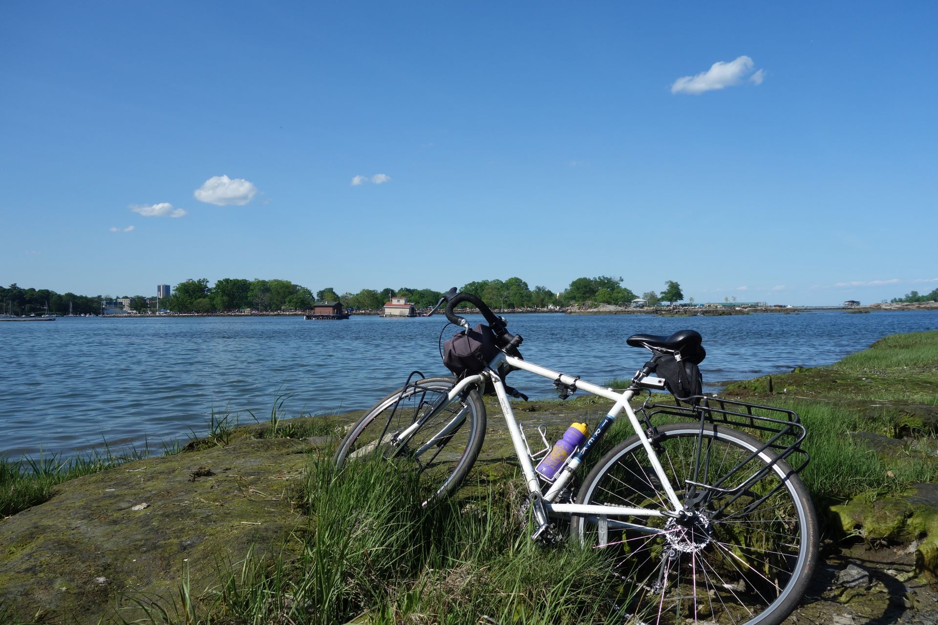
Relax by the water on City Island or at Orchard Beach
Now that it’s April, many cyclists are dusting off their bikes and heading out for their first ride of the season. And off-road bicycle paths are often the first places cyclists look to for those early season warm-up rides. The good news is that there are a lot of exciting bike path improvement projects heading to our region for 2019. Check out our updates below. And if you know of any other bike path improvement projects in the pipeline for this year, email us and we’ll update this posting again with the new information.
Don’t forget that there are great websites out there that catalog all the bike paths and bike routes in our region. These websites are great resources if you are looking to ride someplace new. Here are a few to check out:
https://www.facebook.com/njbikemap/
OK, on to the updates:
North County Trailway – Westchester County
The North County Trailway is one of three trailway segments that was constructed on the abandoned Putnam Division of the New York Central Railroad. Because the North County Trailway was also one of the first segments to be constructed on this rail line, some portions of the trail are now more than 20 years old and are in disrepair. However, the entire length of this trailway segment, between the Putnam County line and Old Saw Mill River Road in Tarrytown, will be resurfaced and repaired during 2019. If you ride the trail this year, be prepared for trail closures to occur anywhere along the trail. It may be worth checking the Westchester County Department of Parks, Recreation and Conservation Facebook page to see if they have information about trail closures before you head out for your ride. This trail is the prominent feature of our Hudson Valley Craft Brewery Bike Tour. If you do our tour, we can give you advance information of trail closures and we can shuttle you around them if they are impassible.
Harlem Valley Rail Trail – Dutchess and Columbia Counties
If you’ve ever taken the Metro-North Harlem Line train all the way to the end, you’ll notice that the Harlem Valley Rail Trail begins where the train tracks end. That’s because this rail trail was constructed atop the railroad abandonment, which constitutes all of the rail right-of-way north of the Wassaic station. This is one of the region’s most beautiful rail trails and it is a highlight of both our Hudson Valley Bike Tour and the Harlem Valley Rail Ride and Festival.
Over the years, it has been a challenge to construct a rail trail on top of the entire former rail line. An 8-mile segment has always been missing in between the Village of Millerton and Under Mountain Road in the Town of Ancram, which has necessitated that riders go on hilly (but beautiful) back roads to ride the whole trail.
However, construction has begun on this missing piece of trail and it is expected to be complete by October 2020. This will be a major undertaking requiring 4,100 feet of elevated boardwalks and the rehabilitation of six bridges. But when it is completed, it will surely be an amazing bike path. Read the whole story here.
Ocean Parkway Shared Use Path Extension – Long Island
If you are familiar with Jones Beach State Park, you might know about the Ocean Parkway Coastal Greenway, which is a great bike path that follows Ocean Parkway. Later this year construction will begin to extend this bike path for an additional 10 miles between its current terminus at Tobay Beach and Captree State Park. This bike path will greatly increase the amount of shoreline that is accessible by bikes in both Nassau and Suffolk Counties. The bike path is expected to be completed by the summer of 2020.
Verrazzano Bridge Summer Streets – Brooklyn and Staten Island
Have you ever done Summer Streets in Manhattan? It’s great. For three Saturdays every August, the City shuts down Park Avenue just for bikes.
It appears that support may be building to do the same thing on the Verrazanno Narrows Bridge. https://www.bikesbk.org/verrazzano-summer-streets/
The lack of a bike path or sidewalk on the Verrazanno Narrows Bridge has long been an issue for people looking to bike between the two heavily populated boroughs. The MTA has attempted to address this by providing bicycle racks on the S53 and S93 buses, but there is still a push to allow cyclists to simply ride across the bridge. This may be accomplished this summer if the Verrazzano Bridge Summer Streets intiative moves forward.
George Washington Bridge
A large number of cyclists (3700 per weekend day) routinely cross the George Washington Bridge, which was built in 1931 with narrow 7-foot wide sidewalks. The Port Authority of New York and New Jersey is currently undertaking a construction project to “Restore the George” which is anticipated to be completed in 2025. Because construction may impact the ability for cyclists to access the bridge sidewalks, the Port Authority recommends cyclists sign up for text or email alerts about sidewalk closures. Find out more at: https://www.panynj.gov/bridges-tunnels/gwb-pedestian-bicycle-info.html
However, it is important to note that the Port Authority’s “Restoring the George” project will not do much to improve bicycle mobility across this bridge, since the project is more or less only considering “replacement in-kind” of the existing sidewalks. To advocate for better improvements, all non-motorized users of the George Washington Bridge are strongly encouraged to go to https://completegeorge.org/ to learn more about how you can advocate for a better plan.
Mario Cuomo (Tappan Zee) Bridge
And finally, as this blog reported back in October of 2018, the long-awaited “shared use path” on the new Mario Cuomo Bridge is set to arrive later this year. This will be a major, major improvement for cyclists and pedestrians in the Hudson Valley. Check it out!
Getting between the various NYC Boroughs can be enormously frustrating if you are traveling by bicycle, thanks to bridges that were only designed for cars. While most of the bridges owned and maintained by NYC DOT have now been retrofitted with bike lanes or sidewalks, MTA-controlled bridges are another story.
Unfortunately for cyclists, MTA bridges are the only link for people traveling between Queens and the Bronx, or between Brooklyn and Staten Island. Ever since the sidewalks were removed from the Bronx-Whitestone bridge in 1943, cyclists have been out of luck, forced to detour to the Triborough Bridge. The Verrazano-Narrows Bridge never even had a sidewalk in the first place, meaning that you could never ride a bike between Brooklyn and Staten Island (except for the one day a year when they do the 5-boro bike tour). You’d have to ride into Manhattan first, then take the ferry with your bike.
Forcing cyclists to take such long detours is beyond ridiculous in today’s world, where cycling is more popular than ever. Thankfully, the MTA has finally understood this and has implemented a bike rack program for local buses that go across both the Bronx-Whitestone Bridge and Verrazano-Narrows Bridge, to help cyclists use bridges that should have been open to them in the first place.
Unlike virtually every other public bus system in America, New York City Transit has never had bicycle racks on any of their buses. This new policy changes this – finally! – at least for 4 bus routes, 3 of which cross bridges. You can read all about the new bike rack service here: http://www.mta.info/press-release/nyc-transit/mta-running-bus-routes-new-bike-racks-summer
And if you are unsure of how to use a bus bike rack, there is a dull instructional video you can link to from the MTA’s press release. Or, for a more entertaining tutorial, click here!
If you are looking to get away from the hustle and crowds of NYC…but not leave the city, riding your bike to Randalls Island is a great way to spend an afternoon. It’s an easy, pleasant ride from Manhattan, Queens or the Bronx. And it’s also a good spot to take children to since there are plenty of car-free bike paths, and plenty of things to check out!
If you are coming from Manhattan, the best way to get there is to ride to East 102nd Street. Go down 102nd Street until it ends at the East River. Ride onto the sidewalk on the north side of the street, then make a left along the FDR drive an you will soon see a ramp going up to a pedestrian bridge. Take that to the island.
From Queens, you will need to ride to Hoyt Avenue North and 27th Street where the RFK Triborough Bridge sidewalk begins. Unfortunately, you’ll have to deal with a lot of stairs crossing over to Randalls Island, so be prepared!
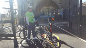
But the nicest way – by far – to get to Randalls Island is from the Bronx, where the new Randalls Island Connector gets you to the island. Access the connector from 132nd Street between Walnut Avenue and Willow Avenue. That’s the way we did it. We made a great day ride using the Bronx River Greenway to go from the northern end of NYC to Randalls Island. The pictures below tell the story!
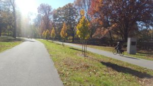
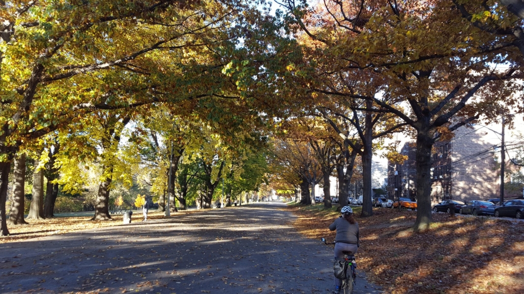
We started the ride by going down the Bronx River Pathway with its beautiful autumn colors!
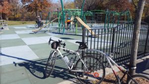
There were plenty of playgrounds along the way for our son to stop and play.
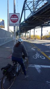
A nice “bikes only” protected bike lane leads to Concrete Plant Park
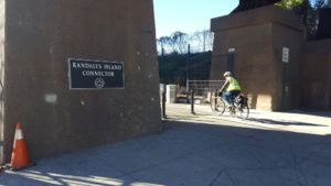
Here’s the entrance to the Randalls Island Connector.
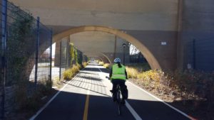
The connector bike path goes below the Amtrak tracks…and then crosses the Oak Point Rail line.
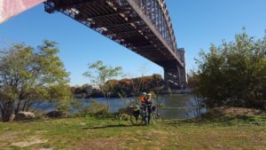
A nice view of the Hell Gate Bridge. Rail fans will love it!
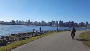
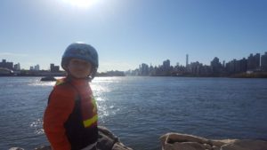
Bike paths within Randalls Island give an excellent view of the Manhattan skyline!
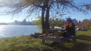
A great spot for lunch!
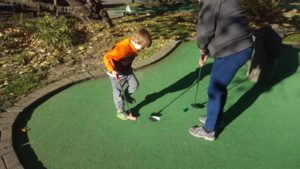
End the day with miniature golf!
Randalls Island has something for everyone! Check it out! Not only can you do miniature golf, but there are batting cages, nature walks…and concession stands where you can buy lunch. You can really make a nice day of it on Randalls Island.