The Best GPS for the Empire State Trail
Having clear and descriptive GPS will help you get the most out of your Empire State Trail bike tour. We see cyclists all of the time standing next to the road where the trail suddenly ends, staring at their phones….lost. This is because the Empire State Trail is owned and maintained by over 40 different agencies or organizations, each with their own maintenance priorities. Signs go missing all of the time. Google maps won’t alert you to a trail closure or detour. Accommodations are rarely next to the trail. What’s the best route? What about all of the nice downtowns, historic sites or waterfalls that the Empire State Trail bypasses because the “route doesn’t go that way” or because the local residents didn’t want bikes coming through their town? Do you want to miss that stuff?
The best, most complete information
Our GPS is a masterwork of constant research. We are out on these trails, over and over, throughout the season. We test every cue and take photos of every sign. Every picnic table, convenience store, restroom, train station, historic sign, urgent care facility and hospital is shown on our GPS. We also show information about hazardous conditions or detours, because we are out all the time on these trails, checking for this. We combine the GPS with daily overview maps that will help you plan each day. There is absolutely nobody else doing this! If you want complete information, come to us. Period.

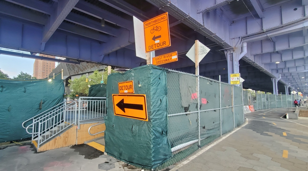
Are you kidding me? Another ridiculous detour? Welcome to Manhattan. Our GPS is constantly updated to respond to trail closures and detours
Our GPS is included with all Trip Planning packages.
If you have already planned out your tour on the Empire State Trail, but you would like to use our GPS, we can set you up with a GPS-Only Package for $150 per segment (Hudson Valley, Erie Canal or Champlain Valley) of the Empire State Trail or $250 for two segments (such as Buffalo to NYC). Contact us to get started.
— “Thanks for your help. The Ride with GPS program was great! It really helped with the navigation and information about the trail. It was worth every penny.” – Tom S., Iowa
