Riding the Union Transportation Trail

UTT Trail

The Union Transportation trail is a flat rail trail that goes through wide farming areas.

If you are looking to get away for a ride that is rural and beautiful, yet isn’t super far from the NYC or Philadelphia metro areas, you can’t beat the Union Transportation Trail, or UTT for short. This is a 9-mile long rail trail that can easily be combined with quiet back roads to make a nice loop.  In fact, we prominently feature this trail on our Tour des Vins de New Jersey

The UTT trail is a gravel/stonedust surface and is generally flat for its entire length. While it is ideal for hybrid bikes and mountain bikes, some road bikers may find the surface to be too loose to ride comfortably. But this trail is best enjoyed at a relaxed pace since there are so many scenic vistas to enjoy. 

UTT trail crossing

A typical road crossing on the UTT trail.

The UTT trail generally travels across Upper Freehold Township, located in the western panhandle of Monmouth County. It’s not really practical to take public transit here, although you could potentially ride to this trail from either the Trenton or Hamilton NJ Transit rail stations if you like riding longer distances. The trail is currently being extended further south into the New Egypt hamlet of Plumsted Township, which will take trail users directly to the shops and services located there. So once this extension is developed, it will be a nice 20 mile ride if you park at the north end of the trail at Herbert Road and ride the 10 miles to New Egypt, take a break and ride back. If you want to ride a longer distance, you can’t go wrong with signing up for the Tour des Vins de New Jersey which is a 35-mile ride which also explores the Assunpink Wildlife Management Area as well as two wineries.  We have been partnering with Cream Ridge Winery for many years on our rides, and they are only a short distance off of the trail. 

Cream Ridge Winery

Make sure you stop at Cream Ridge winery. It’s close to the trail, about halfway.

When you are on the trail, there really aren’t any services or restrooms, except near the south end in new Egypt, so plan accordingly.  Also, on hot summer days, be aware that you are very exposed on this trail because you are going through a lot of flat farming areas.  So sunscreen and plenty of water are a must for summer rides!  Also keep in mind that horses also use this trail, so you will encounter piles of horse manure as you ride.  If you are riding and you see someone on a horse, please stop and let the horse pass!

Check out the official webpage for the trail here

North County Trailway Bridge

Riding the South and North County Trailway

North County Trailway Bridge in Autumn

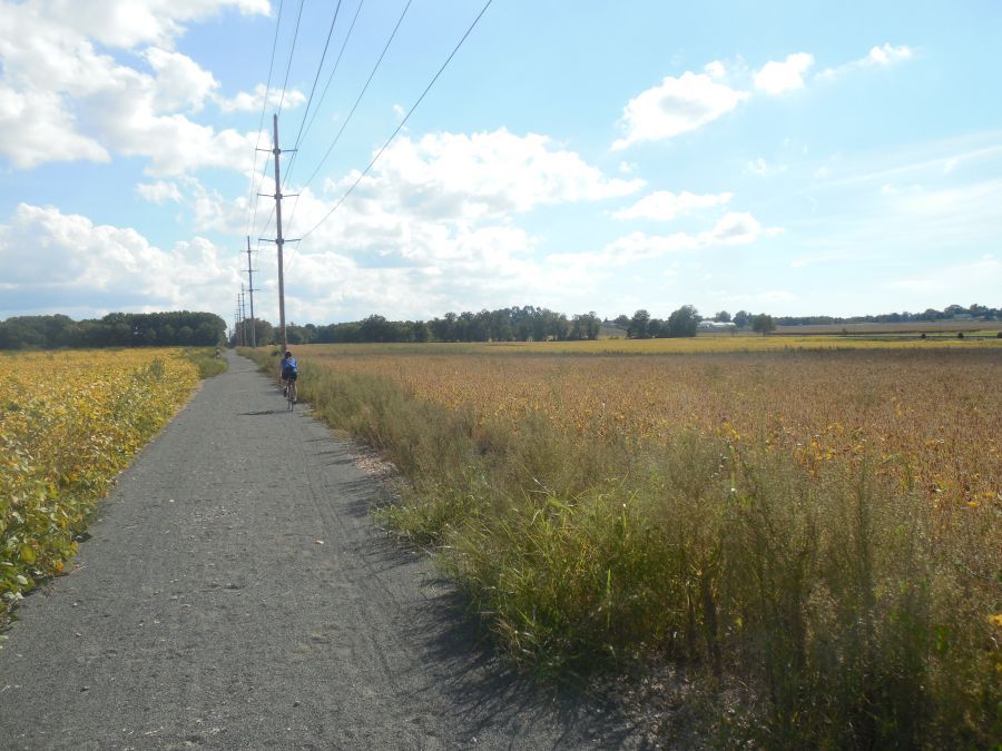
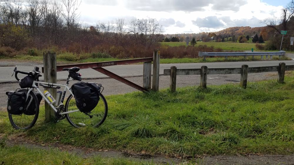
If there is one bike path that most closely resembles a trunk-line, main artery for bikes in the Hudson Valley region, it is the South and North County Trailway in Westchester County.  This trail, which runs continuously from Bronx/Yonkers border for almost 50 miles to the Village of Brewster in Putnam County, is the centerpiece of Westchester’s trail network and one of the most popular parks in this part of the region. It also features prominently in our Hudson Valley Craft Brewery Bike Tour, which is our most popular tour. 

Although this trailway is typically viewed as one long bike path, it is technically made up of four separate trailways with different names (and different maps). The South County Trailway runs between Van Cortlandt Park at the Bronx/Yonkers border to Old Saw Mill River Road, which is the border between the Towns of Greenburgh and Mount Pleasant.  North of Old Saw Mill River Road, the path is the North County Trailway until you get to the border between Putnam and Westchester Counties where the path becomes the Putnam Trailway. The southernmost segment of the trail, which goes through Van Cortlandt Park in the Bronx, is named the Putnam Greenway

Putnam Greenway

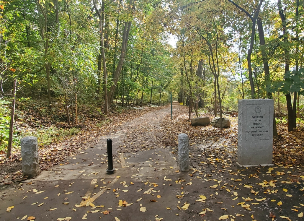
A stone marker lets you know you are crossing into New York City on the Putnam Greenway.

Although the name changes four times, and you need four different maps for it, the trailway is basically the same throughout. This was once a train line, known as the Putnam Division of the New York Central Railroad.  It was first constructed as the New York City & Northern Railroad in 1881 when mining operations were abundant in Putnam County. Passenger service continued until 1958, but it was never as successful as the Harlem or Hudson lines (both of which continue as Metro-North train lines today) probably because riders needed to transfer in the Bronx to continue their trips to Manhattan. After passenger service ended, freight service continued until 1982 at which point the right-of-way was transferred to the New York State Department of Transportation. Then Westchester County and Putnam County both constructed trailways on the alignment as county parks. The New York City portion of the right-of-way remained a dirt path until it was finally paved in 2020.  

Historic trailway sign

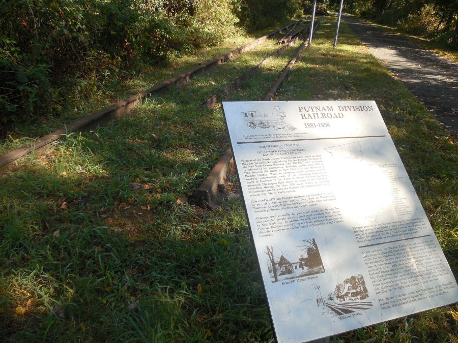
Historic panels along the trailway tell you about long lost train stations.

This trailway corridor has been constructed piece-meal over several decades. The first segments were constructed by Westchester County in the 1990’s. The last piece was opened in 2017. What this now means is that there are sections that are relatively new, and in great shape….and there area also old sections that are in very rough shape.  The conditions can change dramatically as you ride.  The good news is that some of the older sections are now being reconstructed and are better than ever. The bad news is that this construction will take many years to reach all of the spots that need it, so some of the segments will stay rough and bumpy for a while longer.  You’ll also have to deal with interruptions in the trail due to construction.

North County Trailway Construction

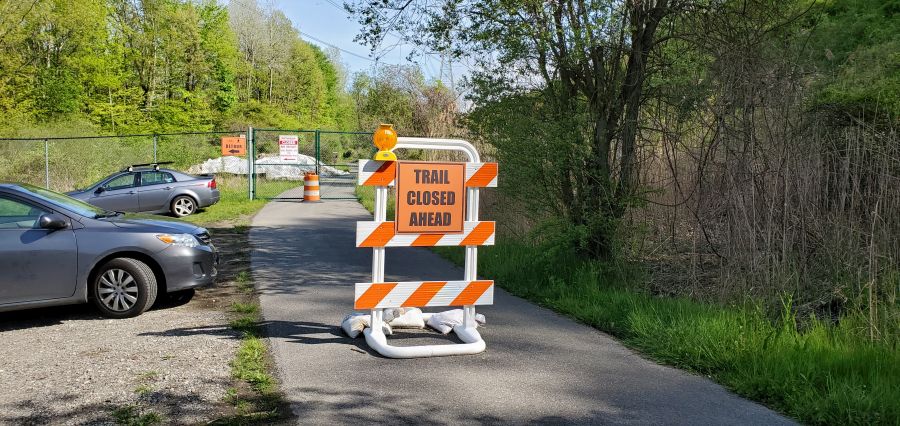
Uh oh…a surprise construction closure means you get to make a detour. At least this part of trail will be brand new the next time you come back.

If you are looking to ride the trail, the good news is that there are many parking lots along the path. Parking lots are shown on the various maps for the trail. Biking to the trailway from somewhere else can be hit-or-miss, depending on where you are. Many of the roads that cross the trail are busy and have no shoulders on them, since this trail goes right through the heart of car-oriented suburbia. The only nearby public transit options are at the south end (the #1 subway at Van Cortlandt Park) or the north end (the Brewster Metro-North station). So transit works well if you want to do a 50+ mile ride. If not, you’ll probably end up riding “out and back” from wherever you parked your car. The only way to do a shorter distance as a one-way ride using transit is to do our Hudson Valley Craft Brewery Bike Tour, where we shuttle you back to the train after riding 35 miles. 

When riding this trail, you will also need to carefully think about services, since there are long stretches with no restrooms, stores or restaurants. So you may need to pack a lunch or at least plan where you may want to buy it as well as think about bathroom breaks. This trail is busy, and often times there is little room on each side of the path, so sneaking into the woods to pee isn’t always an option. (Again, another advantage of our bike tour…we tell you where the restrooms are and we arrange a picnic lunch for you.)

Saw Mill River rest stop

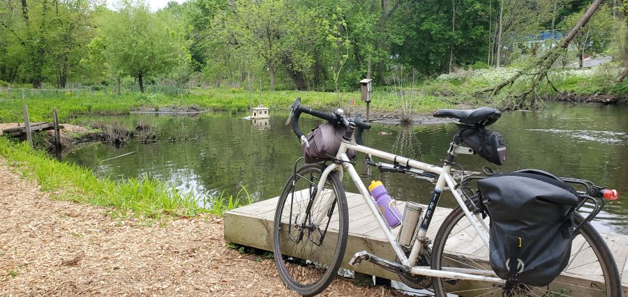
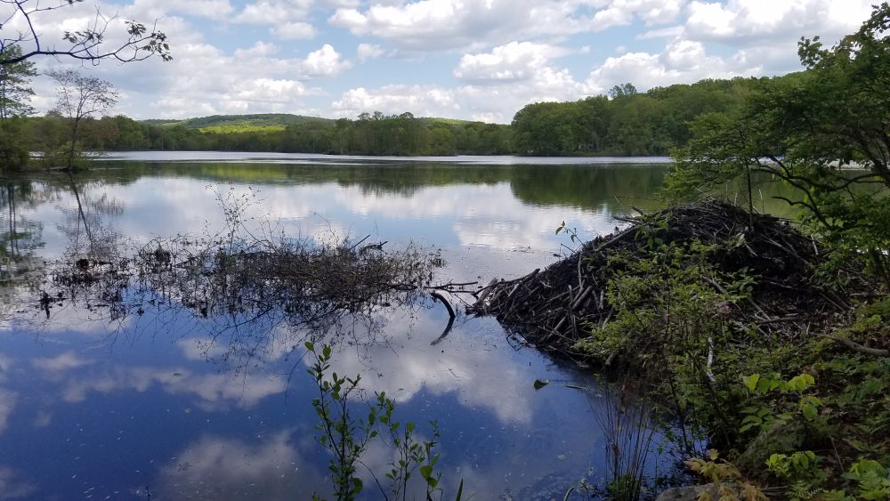
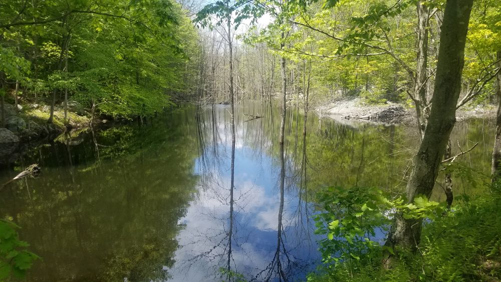
A beautiful spot to take a break along the Saw Mill River and observe wildlife.

This trailway also has an interesting relationship with the towns it goes through. Most of the South County Trailway is along the Saw Mill River, often squeezed between the river itself and the Saw Mill Parkway. So these were industrial areas, not downtown areas. Most of the factories are now gone, having left decades of pollution in the muck of the Saw Mill River next to empty brownfield sites, some of which have been redeveloped. One site was redeveloped with a shopping center with a variety of restaurants and a Starbucks. So that makes a good break stop, although you will have to get across the Saw Mill Parkway at a traffic signal.

South County Trailway shopping center

A shopping center is located on the other side of the parkway from the trail. Cross at the light to get there.

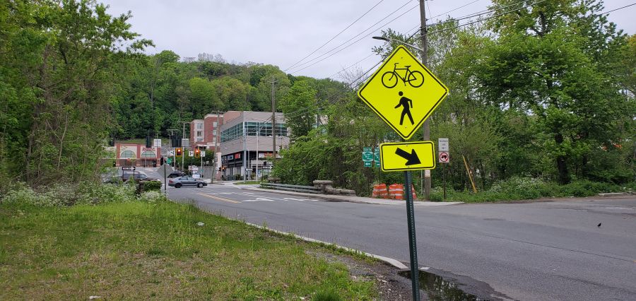
While the South County Trailway goes directly through the downtowns of two villages (Ardsley and Elmsford) the immediate areas surrounding the trailway are still industrial and you’ll need to ride around (on busy roads with no shoulders) to find that Dunkin Donuts with the bathroom or that pizza shop for lunch.  Ardsley is particularly tricky since the only access point to the Village is through a school bus depot and it’s a tangle of roads to get to the main part of town. 

South County Trailway picnic tables

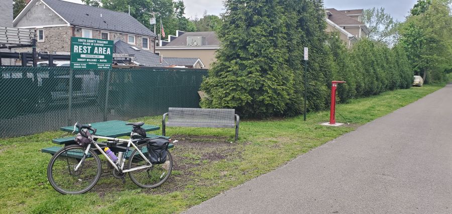
The Village of Elmsford welcomes you with this picnic area and bike repair station. There is no restroom here.

The North County Trailway does a little better in terms of taking you through downtown areas with restrooms and lunch places. The old Briarcliff Manor train station was converted into a library, and it is a great stop for a bathroom break (but there are no stores). Further up the line, Millwood has convenience stores, a deli and a supermarket. But perhaps the easiest towns for services are Yorktown Heights and Mahopac since the trail goes right through the center of those places. Yorktown Heights is one of the few places left where an old train station building remains. The local chamber of commerce has also placed maps of the town along the trail to help you find nearby services while also telling you about Yorktown’s other attractions. While there are many choices here, it helps to know where to go since the town is mostly a cluster of suburban shopping centers, many of which have substantial vacancies. Finding a restroom here is also tricky.  Mahopac also has a lot of choices as well as another library right along the trail (another great restroom stop). Food choices in both towns are good, particularly if you like pizza. You get pizza that’s the real deal in these towns, although no pizza shops are directly along the trail. 

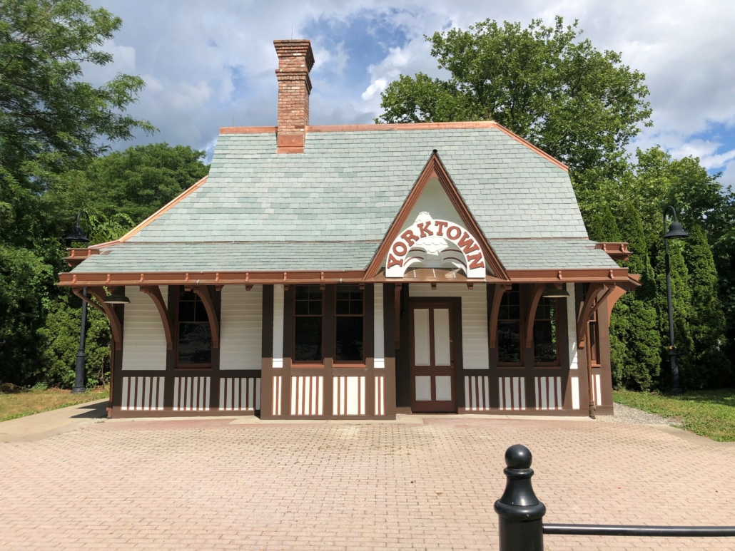
The historic Yorktown train station is currently being restored to its former glory…but it will not have a restroom for you to use.

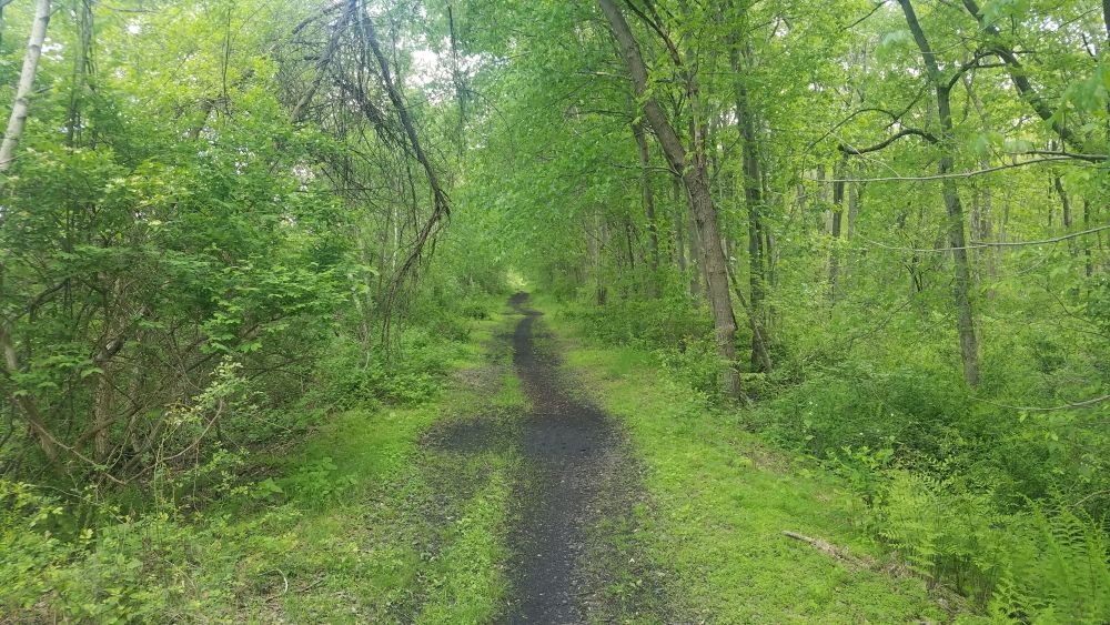
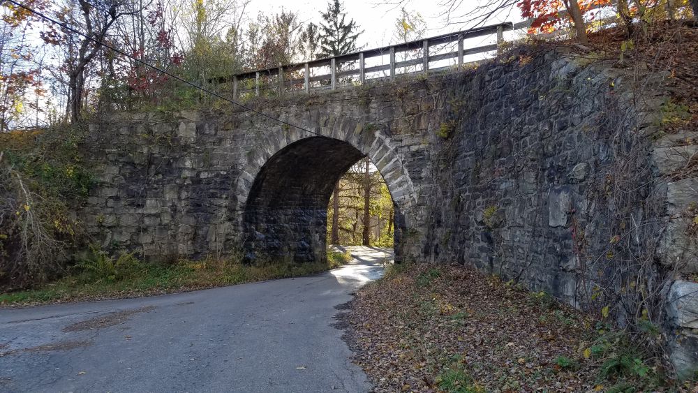
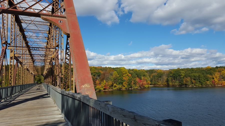
From Mahopac and north you are on the Putnam Trailway. Although the entire corridor is a relatively flat rail trail, the Putnam Trailway has some of the steeper grades. But you will be rewarded by going through some very densely wooded areas with tall trees that burst into color in the fall.  You will also get to experience a number of tall bridges as well as a causeway that goes across a reservoir. North of Mahopac you’ll go through Carmel, more or less through the center of town, but not always super close to businesses. And again, there are no restrooms along the trail.

West Branch Reservoir crossing

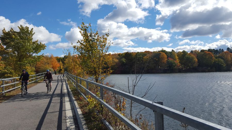
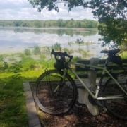
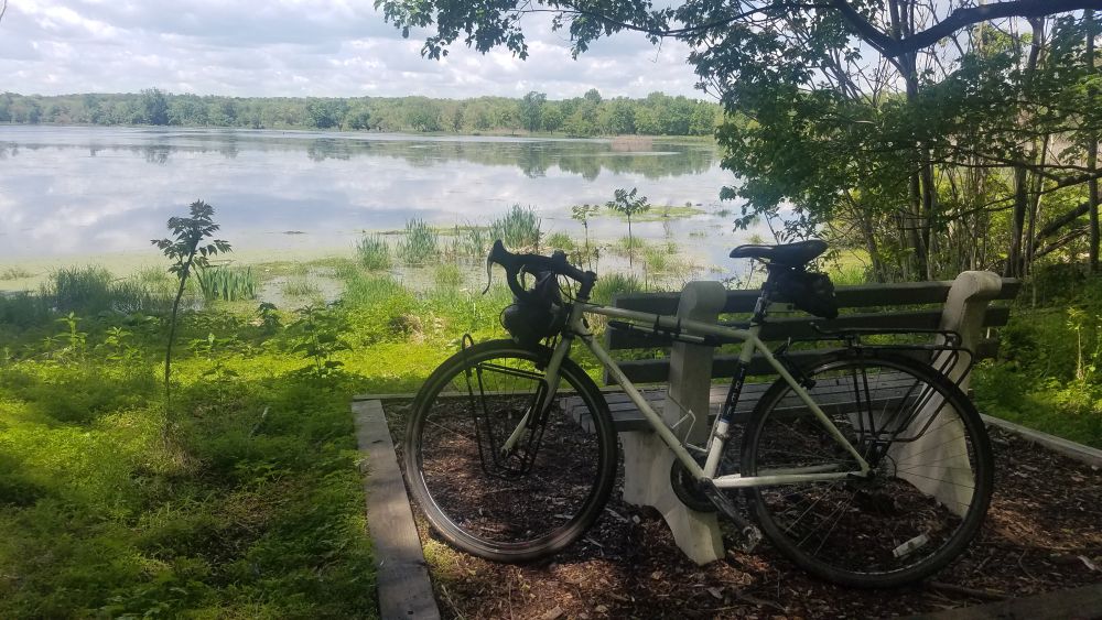
The crossing of the West Branch reservoir is another highlight of this great bike path.

The trailway ends unceremoniously in the Village of Brewster across from Miggins Screw Products and the entrance to the Metro-North rail yard for the Harlem Line. To get to downtown Brewster (and the train station) you will have to ride over a steep hill and then on a busy road to reach the center of the village. There are a number of restaurants and stores here. The Brewster train station also has a restroom, but it is often out of order, so don’t count on it. 

End of Putnam Trailway

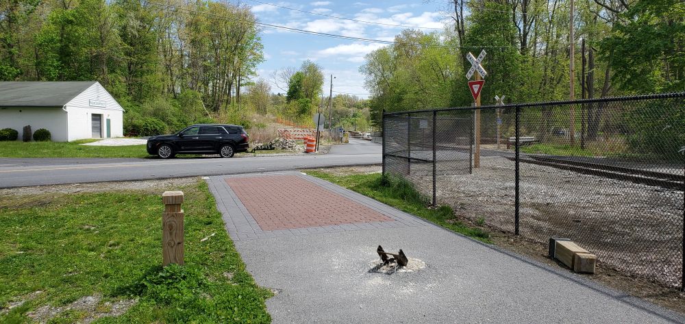
The trail ends unceremoniously across from Miggins Screw Products, next to the Metro-North rail yard.

Sussex Branch Trail Lake

Riding the Sussex Branch Trail

Beaver lodge along Sussex Branch Trail

A beaver lodge on a reflective lake: one of many nature scenes on the Sussex Branch Trail

If you are looking to ride your bike on a rail trail that offers a great deal of solitude, check out the Sussex Branch Trail, which as the name suggests, is located in Sussex County, New Jersey. This trail is 18 miles long, unpaved, and goes through many quiet areas where you can easily spot wildlife. This trail is also a great feature of our New Jersey End-to-End bike tour. 

While the Sussex Branch trail is generally flat, thanks to the fact that it was once the Sussex Branch line of the former Erie Lackawana Railroad, it has its “ups and downs” in terms of conditions and maintenance. The trail is not paved, and can have lots of puddles, mud and flooding if it has recently rained. In autumn, this trail is a spectacular tunnel of color, but that also means that there are leaves on the trail obscuring rocks. No matter when you go, make sure you show up with a mountain bike or a hybrid bike. Take your time and go slow. There’s no need for speed and it’s better to relax and enjoy the quiet solitude. The generally tough conditions of this trail help keep it quiet, and you may go long distances without seeing another cyclist. 

Sussex Branch Trail conditions

One of the smoother sections of trail.

The Sussex Branch trail generally runs north-south between the Borough of Branchville and Allamuchy Mountain State Park at the southern end of Byram Township, right at the border of Morris County and Mount Olive Township. Mount Olive has a train station that is located about a mile away from the trailhead in Allamuchy Mountain State Park, so the NJ Transit Morris and Essex Line train is your only option if you are seeking to access the Sussex Branch Trail by train with your bike  Be advised that the train serves the Mount Olive station on weekdays only and you will have to switch trains in Dover if you are coming from NYC. 

If you are driving, the clearest parking area is at the southern end in Allamuchy Mountain State Park.  Just off Waterloo Road (County Road 604) is a sizable parking lot with a port-a-potty. This is also the closest parking area to Interstate 80. But there are also other parking areas available along the route, mostly just roadside pull-offs.  Consult this map produced by the Sussex County tourism organization for parking locations and other info about accommodations, and things to do near the trail. 

Sussex Branch Trail Lake

One of the many viewpoints of quiet lakes along the trail.

Starting at the south parking lot, you immediately get to travel north through Allamuchy Mountain State Park which has two beautiful lakes that you can stop and enjoy. Unfortunately, the first lake has you riding close to its dam and this area can severely flood under the wrong conditions. (We’re not kidding – check out this video!)  Allamuchy State park used to have quarries and you can see the remnants of those as smaller ponds along the route.  Eventually you will reach Cranberry Lake and you will get to ride along its shore.  The trail enters a small commercial area here with a deli and then goes along Route 206, more or less through parking lots, and then as a dirt path on the side of the road. Eventually the road rises up above you and you are down lower, which means poor drainage after a rain.  The good news is that Route 206 has wide shoulders here, so you can hop off and so some road riding if you want a break from the trail conditions. 

Quarry pond

You can see these quarry ponds adjacent to the trail in Allamuchy Mountain State Park

At Whitehall Hill Road, there is a gap in the trail, but instead of riding along Route 206, you can ride along the much quieter Whitehall Hill Road, which parallels Route 206. At the junction of Whitehall Hill Road, Whitehall Road and Morris and Sussex Turnpike look for a little dirt path off to the right.  That is where the trail picks up again. This time you are higher up, above Route 206.  No flooding here, but it is bumpy. Take your time and push through. You’ll be rewarded by going over an old stone bridge. Shortly after you’ll arrive in Andover, which has a few restaurants and bunch of antique shops. 

Old stone bridge

The trail goes over this stone bridge

North of Andover, the trail gets very quiet again as you veer away from Route 206 and head back into the woods. You will skirt along the east side of Newtown (another opportunity to access stores and restaurants) and you will need to ride on Hicks Avenue for a short distance to cover a break in the trail.  After that, it is very quiet as you bike through the woods next to several streams. One interesting site you will see is the crossing of the Paulinskill Valley Trail high above you.  This is another rail trail that was built on a line of the former New York, Susquehanna and Western Railroad.  It is an uncommon sight to see two rail trail bike paths cross each other like this!

Paulinskill Valley Trail

The Paulinskill Valley Trail passes high above you.

Soon after this crossing you will approach Lafayette Township where the trail starts going along Route 15. Fortunately, you are far enough away from the road to not be distracted by a lot of car noise. Also, at this point you are biking along the Paulins Kill, a rushing stream whose flowing water adds to the sounds you will hear. But you are never far from Route 15 which has restaurants and stores along it, particularly if you need a restroom. 

sculpture garden

A quirky trail-side sculpture garden welcomes you to Lafayette Township

The bike path flows in the same direction as the streams you will pass, which in a few miles takes you to Branchville where the Sussex Branch Trail ends.  The trail ends unceremoniously on Mill Street and then it’s just a quick bike ride to the borough’s historic business district where shops and restaurants are available.

Sussex Branch Trail farm scene

This bucolic farm scene is not very far from services located along Route 15 and the end of the trail in Branchville.